Yachenahalli
Yachenahalli (Kannada: ಯಾಚೇನಹಳ್ಳಿ) is a panchayat town in Mysore district in the state of Karnataka, India. It is located 35 km from Mysore and 17 km from Mandya. The nearest city is Bannur with 10 km distance.
Yachenahalli
ಯಾಚೇನಹಳ್ಳಿ | |
|---|---|
Village(Grama Panchayathi) | |
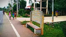 Name board of Yachenahalli | |
 Yachenahalli
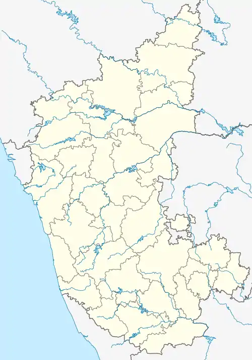
ಯಾಚೇನಹಳ್ಳಿ Location in Karnataka, India | |
| Coordinates: 12.400781°N 76.898536°E | |
| Country | |
| State | Karnataka |
| District | Mysore |
| Government | |
| • Type | Panchayati raj (India) |
| • Body | Gram panchayat |
| Elevation | 654 m (2,146 ft) |
| Population (2001) | |
| • Total | 3,190 |
| Languages | |
| • Official | Kannada, English |
| Time zone | UTC+5:30 (IST) |
| PIN | 571101 |
| ISO 3166 code | IN-KA |
| Vehicle registration | KA-55 |
| Website | karnataka |
Locality Name : Yachenahalli ( ಯಾಚೇನಹಳ್ಳಿ )
Taluk Name : Tirumakudala-Narsipura District : Mysore State : Karnataka Division : Mysore Language : Kannada and English
Time zone: IST (UTC+5:30) Elevation / Altitude: 703 meters above sea level Telephone Code / Std Code: 08224
Assembly constituency : T Narasipura assembly Lok Sabha constituency : Chamarajanagar parliamentary constituency Pin Code : 571101
Post Office Name : Yachenahalli Post office Main Village Name : Yachenahalli
Yachenahalli is border grama Panchayathi village between Mandya and Mysore district and village is part of Mysore district and Mandya district starts from Sultan road or Vivekananda Nagar which is border end of Mysore.
Vivekananda Nagar in Yachenahalli got important educational institutions namely Sri Ramakrishna Sevakendra High School and Kuvempu Study Centre.
Mathru vastalya old age home is located in Yachenahalli, which provides shelter for the old age people who don't have any guardian to look after.
Yachenalli Main Bus stand road is also known as Bannur -mandya main road, which has Janatha Bajar and other groceries and bakery shops.
The village has Janaoushada medical from central government of India to provide the Medicine in the affordable rate.
Geography
Yachenahalli is located at 12.400781°N 76.898536°E.[1] It has an average elevation of 654 metres (2145 feet).
Transport
Yachenahalli is located on Bannur - Mandya Main Road.
KSRTC buses are available with 30 min intervals from Mandya Government bus stand which travels up to T Narasipura.
Travelling from Mandya/Bangalore
You can catch the bus at Mandya Governmanet Bus stand or MVG bakery stop which is near to Railway station and in Karnataka Bar circle which is located at end of 100 feet toad.
Assuming you will travel to Mandya using train or Bus services from Bangalore.
Travelling from T Narasipura/Bannur
Please take buses from Government Bus stand of Bannur or T Narasipura which are headed towards Mandya.
Demographics
As of 2001 India census,[2] Yachenahalli had a population of 3,190. Males constitute 51% of the population and females 49%. Yachenahalli has an average literacy rate of 59%, lower than the national average of 59.5%; with 54% of the males and 46% of females literate. 11% of the population is under 6 years of age.
See also
- Bannur
- Mandya
- Aarakere
- Somanathapura
- T. Narasipura
- Talakadu
References
- Falling Rain Genomics, Inc - Yachenahalli
- "Census of India 2001: Data from the 2001 Census, including cities, villages and towns (Provisional)". Census Commission of India. Archived from the original on 16 June 2004. Retrieved 1 November 2008.