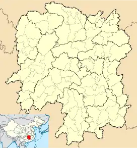
Xinhua County
Xinhua County (simplified Chinese: 新化县; traditional Chinese: 新化縣; pinyin: Xīnhuà Xiàn) is a county and the 4th most populous county-level division in the Province of Hunan, China; it is under the administration of Loudi City.
Xinhua County
新化县 Sinhwa | |
|---|---|
 Tianhua South Road (天华南路) | |
 Xinhua Location in Hunan | |
| Coordinates: 27°44′13″N 111°18′29″E[1] | |
| Country | People's Republic of China |
| Province | Hunan |
| Prefecture-level city | Loudi |
| Area | |
| • Total | 3,634.98 km2 (1,403.47 sq mi) |
| Population (2010)[3] | |
| • Total | 1,110,910 |
| • Density | 310/km2 (790/sq mi) |
| Time zone | UTC+8 (China Standard) |
| Postal code | 4176XX |
Located along the middle reaches of the Zi River, it covers 3,635 square kilometers and has a population of 1,291,626 (2002). Xinhua shares the border with Lengshuijiang, Lianyuan, Xinshao, Xupu and Longhui counties and cities. As a county, it was founded at 1072 (Northern Song Dynasty) and now it is under jurisdiction of the Loudi City and subdivided into 7 townships and 19 towns, Shangmei is the county seat.
The economy of Xinhua County is primarily agricultural, with 1.16 million of Xinhua County's population of 1.28 million working in agriculture. Other than agriculture, industries include machinery, electronics, ceramics, building materials, metallurgy, coal, chemical, food, paper, bamboo and wood processing. In recent years, Xinhua County's economy has grown quite a lot.[4]
In 2011, media attention was attracted by a construction project started by the county's government. In the hope of attracting tourists, the officials wanted to build a lavish temple (Xiongshan Si - 熊山寺; 'Bear Mountain Temple'), diverting funds from more essential projects.[5][6]
Climate
| Climate data for Xinhua (1981−2010) | |||||||||||||
|---|---|---|---|---|---|---|---|---|---|---|---|---|---|
| Month | Jan | Feb | Mar | Apr | May | Jun | Jul | Aug | Sep | Oct | Nov | Dec | Year |
| Record high °C (°F) | 25.7 (78.3) |
30.1 (86.2) |
33.2 (91.8) |
35.9 (96.6) |
36.5 (97.7) |
37.5 (99.5) |
39.1 (102.4) |
39.8 (103.6) |
38.5 (101.3) |
35.7 (96.3) |
32.0 (89.6) |
24.1 (75.4) |
39.8 (103.6) |
| Average high °C (°F) | 8.8 (47.8) |
10.9 (51.6) |
15.4 (59.7) |
21.9 (71.4) |
26.8 (80.2) |
29.7 (85.5) |
33.0 (91.4) |
32.5 (90.5) |
28.6 (83.5) |
23.0 (73.4) |
17.8 (64.0) |
12.0 (53.6) |
21.7 (71.1) |
| Daily mean °C (°F) | 5.1 (41.2) |
7.1 (44.8) |
11.1 (52.0) |
17.1 (62.8) |
21.9 (71.4) |
25.2 (77.4) |
28.3 (82.9) |
27.3 (81.1) |
23.5 (74.3) |
18.2 (64.8) |
12.9 (55.2) |
7.5 (45.5) |
17.1 (62.8) |
| Average low °C (°F) | 2.4 (36.3) |
4.5 (40.1) |
8.0 (46.4) |
13.6 (56.5) |
18.2 (64.8) |
21.9 (71.4) |
24.6 (76.3) |
23.8 (74.8) |
19.9 (67.8) |
14.8 (58.6) |
9.4 (48.9) |
4.2 (39.6) |
13.8 (56.8) |
| Record low °C (°F) | −5.8 (21.6) |
−3.9 (25.0) |
−1.2 (29.8) |
3.1 (37.6) |
8.4 (47.1) |
13.5 (56.3) |
17.5 (63.5) |
16.8 (62.2) |
12.2 (54.0) |
3.7 (38.7) |
−1.3 (29.7) |
−8.5 (16.7) |
−8.5 (16.7) |
| Average precipitation mm (inches) | 69.5 (2.74) |
83.9 (3.30) |
120.4 (4.74) |
176.2 (6.94) |
189.8 (7.47) |
233.4 (9.19) |
169.1 (6.66) |
146.6 (5.77) |
78.9 (3.11) |
87.5 (3.44) |
70.6 (2.78) |
47.0 (1.85) |
1,472.9 (57.99) |
| Average relative humidity (%) | 80 | 80 | 80 | 80 | 79 | 81 | 76 | 78 | 77 | 77 | 76 | 75 | 78 |
| Source: China Meteorological Data Service Center[7] | |||||||||||||
References
- Google (2014-07-02). "Xinhua" (Map). Google Maps. Google. Retrieved 2014-07-02.
- Loudi City Land Use Plan (2006–20)/《娄底市土地利用总体规划(2006-2020年)》.(in Chinese) Accessed 8 July 2014.
- 娄底市2010年第六次全国人口普查主要数据公报 (in Chinese). Loudi People's Government. Archived from the original on July 14, 2014. Retrieved 9 July 2014.
- "湖南省娄底市新化县地名介绍". www.tcmap.com.cn. Retrieved 2021-04-03.
- Poor Chinese county used relief fund to build temple. Reuters, 2011-09-26
- 湖南新化回应媒体曝“强扣水利款建旅游区”事宜 (Hunan's Xinhua [County] responds to media's claims of the diversion of irrigation funds to the construction of a tourist area).
- 中国地面气候标准值月值(1981-2010) (in Simplified Chinese). China Meteorological Data Service Center. Retrieved 20 October 2018.
External links