Xermaménil
Xermaménil (French pronunciation: [ksɛʁmamenil]) is a commune in the Meurthe-et-Moselle department in north-eastern France.
Xermaménil | |
|---|---|
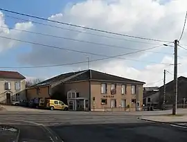 The town hall in Xermaménil | |
 Coat of arms | |
Location of Xermaménil 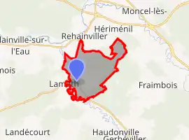 | |
 Xermaménil 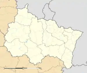 Xermaménil | |
| Coordinates: 48°31′59″N 6°27′48″E | |
| Country | France |
| Region | Grand Est |
| Department | Meurthe-et-Moselle |
| Arrondissement | Lunéville |
| Canton | Lunéville-2 |
| Intercommunality | Territoire de Lunéville à Baccarat |
| Government | |
| • Mayor (2020–2026) | Joël Donatin[1] |
| Area 1 | 10.84 km2 (4.19 sq mi) |
| Population | 561 |
| • Density | 52/km2 (130/sq mi) |
| Time zone | UTC+01:00 (CET) |
| • Summer (DST) | UTC+02:00 (CEST) |
| INSEE/Postal code | 54595 /54300 |
| Elevation | 218–293 m (715–961 ft) (avg. 234 m or 768 ft) |
| 1 French Land Register data, which excludes lakes, ponds, glaciers > 1 km2 (0.386 sq mi or 247 acres) and river estuaries. | |
Population
| Year | Pop. | ±% |
|---|---|---|
| 2006 | 504 | — |
| 2007 | 515 | +2.2% |
| 2008 | 527 | +2.3% |
| 2009 | 544 | +3.2% |
| 2010 | 566 | +4.0% |
| 2011 | 563 | −0.5% |
| 2012 | 559 | −0.7% |
| 2013 | 555 | −0.7% |
| 2014 | 553 | −0.4% |
| 2015 | 546 | −1.3% |
| 2016 | 551 | +0.9% |
Geography
The river Mortagne forms all of the commune's western border.
References
- "Répertoire national des élus: les maires". data.gouv.fr, Plateforme ouverte des données publiques françaises (in French). 9 August 2021.
- "Populations légales 2019". The National Institute of Statistics and Economic Studies. 29 December 2021.
| Wikimedia Commons has media related to Xermaménil. |
This article is issued from Wikipedia. The text is licensed under Creative Commons - Attribution - Sharealike. Additional terms may apply for the media files.