Whippoorwill, Oklahoma
Whippoorwill is an unincorporated community and census-designated place (CDP) in Osage County, Oklahoma, United States. It was first listed as a CDP prior to the 2020 census.[2]
Whippoorwill, Oklahoma | |
|---|---|
 Whippoorwill  Whippoorwill | |
| Coordinates: 36°54′44″N 96°7′45″W | |
| Country | United States |
| State | Oklahoma |
| County | Osage |
| Area | |
| • Total | 0.22 sq mi (0.58 km2) |
| • Land | 0.20 sq mi (0.53 km2) |
| • Water | 0.02 sq mi (0.05 km2) |
| Elevation | 793 ft (242 m) |
| Time zone | UTC-6 (Central (CST)) |
| • Summer (DST) | UTC-5 (CDT) |
| ZIP Code | 74056 (Pawhuska) |
| Area code(s) | 918/539 |
| FIPS code | 40-80675 |
| GNIS feature ID | 2812863[2] |
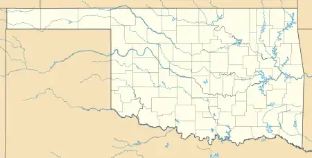
The CDP is in northeastern Osage County, on a hill overlooking the west end of Hulah Lake, where the Caney River enters it. The Caney is a southeast-flowing tributary of the Verdigris River and part of the Arkansas River watershed.
Whippoorwill is 3 miles (5 km) north of Bowring and 24 miles (39 km) northeast of Pawhuska, the Osage county seat.
References
- "2020 U.S. Gazetteer Files – Oklahoma". United States Census Bureau. Retrieved August 17, 2021.
- "Whippoorwill Census Designated Place". Geographic Names Information System. United States Geological Survey.
Municipalities and communities of Osage County, Oklahoma, United States | ||
|---|---|---|
| Cities | 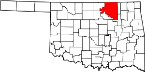 Osage County map | |
| Towns | ||
| CDPs | ||
| Other communities | ||
| Indian reservation | ||
| Footnotes | ‡This populated place also has portions in an adjacent county or counties | |
| ||
This article is issued from Wikipedia. The text is licensed under Creative Commons - Attribution - Sharealike. Additional terms may apply for the media files.