Beach 25th Street station
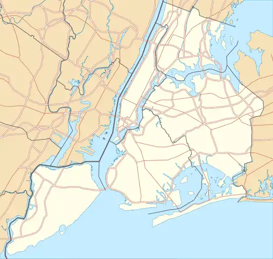
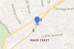
The Beach 25th Street station (signed as Beach 25th Street–Wavecrest station) is a station on the IND Rockaway Line of the New York City Subway, located in Queens on the Rockaway Freeway at Beach 25th Street. It is served by the A train at all times. There are two tracks and two side platforms.
Beach 25 Street | ||||||||||||||||||||||||||||||||||||||||||||||||||||||||||||||||||||
|---|---|---|---|---|---|---|---|---|---|---|---|---|---|---|---|---|---|---|---|---|---|---|---|---|---|---|---|---|---|---|---|---|---|---|---|---|---|---|---|---|---|---|---|---|---|---|---|---|---|---|---|---|---|---|---|---|---|---|---|---|---|---|---|---|---|---|---|---|
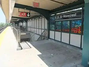 Northbound platform | ||||||||||||||||||||||||||||||||||||||||||||||||||||||||||||||||||||
| Station statistics | ||||||||||||||||||||||||||||||||||||||||||||||||||||||||||||||||||||
| Address | Beach 25th Street & Rockaway Freeway Queens, NY 11691 | |||||||||||||||||||||||||||||||||||||||||||||||||||||||||||||||||||
| Borough | Queens | |||||||||||||||||||||||||||||||||||||||||||||||||||||||||||||||||||
| Locale | Bayswater | |||||||||||||||||||||||||||||||||||||||||||||||||||||||||||||||||||
| Coordinates | 40°36′0.22″N 73°45′41.12″W | |||||||||||||||||||||||||||||||||||||||||||||||||||||||||||||||||||
| Division | B (IND, formerly LIRR Far Rockaway Branch)[1] | |||||||||||||||||||||||||||||||||||||||||||||||||||||||||||||||||||
| Line | IND Rockaway Line | |||||||||||||||||||||||||||||||||||||||||||||||||||||||||||||||||||
| Services | A | |||||||||||||||||||||||||||||||||||||||||||||||||||||||||||||||||||
| Structure | Elevated | |||||||||||||||||||||||||||||||||||||||||||||||||||||||||||||||||||
| Platforms | 2 side platforms | |||||||||||||||||||||||||||||||||||||||||||||||||||||||||||||||||||
| Tracks | 2 | |||||||||||||||||||||||||||||||||||||||||||||||||||||||||||||||||||
| Other information | ||||||||||||||||||||||||||||||||||||||||||||||||||||||||||||||||||||
| Opened | May 1928 (LIRR station) | |||||||||||||||||||||||||||||||||||||||||||||||||||||||||||||||||||
| Rebuilt | June 28, 1956 (as a Subway station) | |||||||||||||||||||||||||||||||||||||||||||||||||||||||||||||||||||
| Station code | 208[2] | |||||||||||||||||||||||||||||||||||||||||||||||||||||||||||||||||||
| Opposite- direction transfer | Yes | |||||||||||||||||||||||||||||||||||||||||||||||||||||||||||||||||||
| Former/other names | Beach 25th Street–Wavecrest | |||||||||||||||||||||||||||||||||||||||||||||||||||||||||||||||||||
| Traffic | ||||||||||||||||||||||||||||||||||||||||||||||||||||||||||||||||||||
| 2019 | 517,164[3] | |||||||||||||||||||||||||||||||||||||||||||||||||||||||||||||||||||
| Rank | 410 out of 424[3] | |||||||||||||||||||||||||||||||||||||||||||||||||||||||||||||||||||
| Station succession | ||||||||||||||||||||||||||||||||||||||||||||||||||||||||||||||||||||
| Next west | Beach 36th Street: A | |||||||||||||||||||||||||||||||||||||||||||||||||||||||||||||||||||
| Next east | Far Rockaway–Mott Avenue: A | |||||||||||||||||||||||||||||||||||||||||||||||||||||||||||||||||||
| ||||||||||||||||||||||||||||||||||||||||||||||||||||||||||||||||||||
| ||||||||||||||||||||||||||||||||||||||||||||||||||||||||||||||||||||
| ||||||||||||||||||||||||||||||||||||||||||||||||||||||||||||||||||||
| ||||||||||||||||||||||||||||||||||||||||||||||||||||||||||||||||||||
| ||||||||||||||||||||||||||||||||||||||||||||||||||||||||||||||||||||
History
The station was originally opened by the Long Island Rail Road in May 1928 as Wavecrest Station,[4] and was closed and relocated 800 feet east of the former location in August 1940 as part of a grade elevation project. The elevated station was opened on April 10, 1942, but was closed on October 3, 1955. It was purchased by the New York City Transit Authority along with the rest of the line west to Rockaway Park, which reopened it as a subway station on June 28, 1956.[5][6]
Station layout
| P Platform level |
Side platform | |
| Northbound | ← | |
| Southbound | | |
| Side platform | ||
| M | Mezzanine | Fare control, station agent, MetroCard machines |
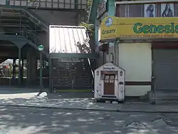
| G | Street level | Exit/entrance |
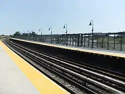
This station is on a concrete viaduct with ballasted track. This station was the terminal for the Far Rockaway branch until the opening of Far Rockaway–Mott Avenue station nineteen months later.[5][7]
References
- "Glossary". Second Avenue Subway Supplemental Draft Environmental Impact Statement (SDEIS) (PDF). Vol. 1. Metropolitan Transportation Authority. March 4, 2003. pp. 1–2. Archived from the original (PDF) on February 26, 2021. Retrieved January 1, 2021.
- "Station Developers' Information". Metropolitan Transportation Authority. Retrieved June 13, 2017.
- "Facts and Figures: Annual Subway Ridership 2014–2019". Metropolitan Transportation Authority. 2020. Retrieved May 26, 2020.
- "What The Wave Said 40 Years Ago This Week". Wave of Long Island. Fultonhistory.com. March 14, 1968. Retrieved July 22, 2016.
- Freeman, Ira Henry (June 28, 1956). "Rockaway Trains to Operate Today" (PDF). The New York Times. Retrieved June 29, 2015.
- "LIRR Station History". Archived from the original on 2014-10-06. Retrieved 2008-06-21.
- "New Subway Unit Ready: Far Rockaway IND Terminal Will Be Opened Today" (PDF). The New York Times. January 16, 1958. Retrieved June 29, 2015.
- "MTA Neighborhood Maps: The Rockaways" (PDF). mta.info. Metropolitan Transportation Authority. 2015. Retrieved July 6, 2015.
External links
| Wikimedia Commons has media related to Beach 25th Street (IND Rockaway Line). |
- nycsubway.org – IND Rockaway: Beach 25th Street/Wavecrest
- Station Reporter — A Rockaway
- The Subway Nut — Beach 25th Street–Wavecrest Pictures Archived 2017-06-14 at the Wayback Machine
- Beach 25th Street entrance from Google Maps Street View
- Platforms from Google Maps Street View
| Rockaway Line | |||||
|---|---|---|---|---|---|
| |||||