Waitākere Reservoir
Waitākere Reservoir is a reservoir on the Waitakere River in the Waitākere Ranges, west of Auckland in New Zealand. Waitākere Dam was completed in 1910 and is a concrete gravity dam with a slight curvature. It has a lake area of 25.1 hectares and a capacity of 1.76 million cubic metres.[1] The dam is accessible from the Montana Heritage Trail, a bush hike in the region.
| Waitākere Reservoir | |
|---|---|
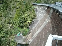 Waitākere Dam from above | |
 Waitākere Reservoir | |
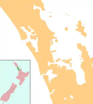
| Location | Waitakere, North Island |
| Coordinates | 36°54′08″S 174°31′31″E |
| Type | Reservoir |
| Basin countries | New Zealand |
| Surface area | 25.1 ha (0.097 sq mi) |
| Water volume | 1,760,000 m3 (0.00042 cu mi) |
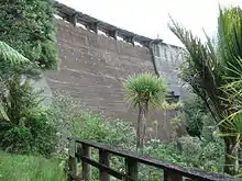
Waitākere Dam from below
A decision to build a dam at the Waitākere Falls was first made in 1905, and the dam finished construction five years later.[2]
References
- Waitākere Dam, Watercare, New Zealand.
- La Roche, John (2011). "Auckland's Water Supply". In La Roche, John (ed.). Evolving Auckland: The City's Engineering Heritage. Wily Publications. pp. 27–50. ISBN 9781927167038.
This article is issued from Wikipedia. The text is licensed under Creative Commons - Attribution - Sharealike. Additional terms may apply for the media files.