Villers-Sir-Simon
Villers-Sir-Simon is a commune in the Pas-de-Calais department in the Hauts-de-France region of France.
Villers-Sir-Simon | |
|---|---|
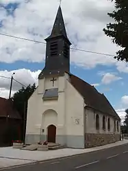 The church of Villers-Sir-Simon | |
 Coat of arms | |
Location of Villers-Sir-Simon 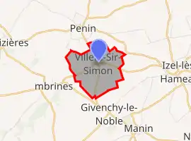 | |
 Villers-Sir-Simon  Villers-Sir-Simon | |
| Coordinates: 50°19′06″N 2°29′34″E | |
| Country | France |
| Region | Hauts-de-France |
| Department | Pas-de-Calais |
| Arrondissement | Arras |
| Canton | Avesnes-le-Comte |
| Intercommunality | CC Campagnes de l'Artois |
| Government | |
| • Mayor (2020–2026) | Xavier Normand[1] |
| Area 1 | 2.47 km2 (0.95 sq mi) |
| Population | 121 |
| • Density | 49/km2 (130/sq mi) |
| Time zone | UTC+01:00 (CET) |
| • Summer (DST) | UTC+02:00 (CEST) |
| INSEE/Postal code | 62860 /62127 |
| Elevation | 119–136 m (390–446 ft) (avg. 128 m or 420 ft) |
| 1 French Land Register data, which excludes lakes, ponds, glaciers > 1 km2 (0.386 sq mi or 247 acres) and river estuaries. | |
Geography
Villers-Sir-Simon is situated some 18 miles (29.0 km) west of Arras, at the junction of the D77 and D54 roads.
Population
| Year | 1962 | 1968 | 1975 | 1982 | 1990 | 1999 | 2006 |
|---|---|---|---|---|---|---|---|
| Population | 105 | 125 | 99 | 114 | 120 | 121 | 135 |
| From the year 1962 on: No double counting—residents of multiple communes (e.g. students and military personnel) are counted only once. | |||||||
Places of interest
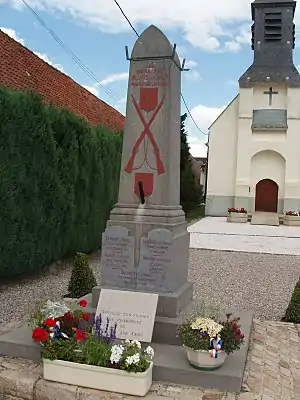
The war memorial
- Commemorative stone to the American aviators who died when their plane crashed nearby on 27 August 1943.
- The church of St. Eloi, dating from the nineteenth century.
References
- "Répertoire national des élus: les maires". data.gouv.fr, Plateforme ouverte des données publiques françaises (in French). 2 December 2020.
- "Populations légales 2019". The National Institute of Statistics and Economic Studies. 29 December 2021.
This article is issued from Wikipedia. The text is licensed under Creative Commons - Attribution - Sharealike. Additional terms may apply for the media files.