Torbay Heights
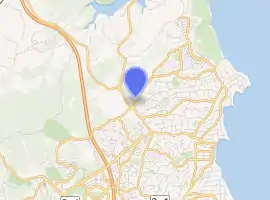
Torbay Heights is a suburb of the North Shore, located in Auckland, New Zealand. It is currently under local governance of Auckland Council and is situated next to Torbay.
Torbay Heights | |
|---|---|
 | |
| Coordinates: 36.700330532°S 174.721997112°E | |
| Country | New Zealand |
| City | Auckland |
| Local authority | Auckland Council |
| Electoral ward | Albany ward |
| Local board | Hibiscus and Bays |
| Population (2018) | |
| • Total | 7,707 |
| Postcode(s) | 0630 |
| Redvale | Okura | Long Bay |
| Glenvar |
|
Torbay |
| Fairview Heights | Northcross | Waiake |
Demographics
| Year | Pop. | ±% p.a. |
|---|---|---|
| 2006 | 7,167 | — |
| 2013 | 7,293 | +0.25% |
| 2018 | 7,707 | +1.11% |
| Source: [1] | ||
The statistical areas of Awaruku and Glamorgan, which correspond to Torbay Heights, had a population of 7,707 at the 2018 New Zealand census, an increase of 414 people (5.7%) since the 2013 census, and an increase of 540 people (7.5%) since the 2006 census. There were 2,520 households. There were 3,825 males and 3,882 females, giving a sex ratio of 0.99 males per female, with 1,521 people (19.7%) aged under 15 years, 1,614 (20.9%) aged 15 to 29, 3,702 (48.0%) aged 30 to 64, and 864 (11.2%) aged 65 or older.
Ethnicities were 79.7% European/Pākehā, 6.2% Māori, 2.2% Pacific Islanders, 16.7% Asian, and 3.0% other ethnicities (totals add to more than 100% since people could identify with multiple ethnicities).
The proportion of people born overseas was 49.1%, compared with 27.4% nationally.[2]
Although some people objected to giving their religion, 53.7% had no religion, 36.3% were Christian, and 4.5% had other religions.
Of those at least 15 years old, 1,836 (29.7%) people had a bachelor or higher degree, and 522 (8.4%) people had no formal qualifications. The employment status of those at least 15 was that 3,441 (55.6%) people were employed full-time, 936 (15.1%) were part-time, and 198 (3.2%) were unemployed.[1]
Education
Glamorgan School is a coeducational contributing primary (years 1-6) school with a roll of 545 students as of March 2022.[3][4] Glamorgan Kindergarten (preschool) is down the road near Glamorgan School, and has 61 students as of March 2020.[5][6]
References
- "Statistical area 1 dataset for 2018 Census". Statistics New Zealand. March 2020. Awaruku (116800) and Glamorgan (117500). 2018 Census place summary: Awaruku 2018 Census place summary: Glamorgan
- "2018 Census data allows users to dive deep into New Zealand's diversity | Stats NZ". www.stats.govt.nz. Retrieved 15 November 2021.
- "New Zealand Schools Directory". New Zealand Ministry of Education. Retrieved 23 April 2022.
- Education Counts: Glamorgan School
- "Glamorgan Kindergarten | Education Review Office". ero.govt.nz. Retrieved 15 November 2021.
- Counts, Education. "Ministry of Education - Education Counts". www.educationcounts.govt.nz. Retrieved 15 November 2021.