Topoľovka
Topoľovka is a village and municipality in Humenné District in the Prešov Region of north-east Slovakia.
Topoľovka | |
|---|---|
Municipality | |
.jpg.webp) Main street in Topoľovka, the centre of village. Buildings on the left are the commune council building with civil registry and rural market | |
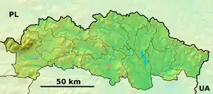 Topoľovka Location of Topoľovka in the Prešov Region 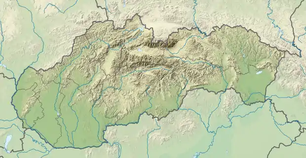 Topoľovka Location of Topoľovka in Slovakia | |
| Coordinates: 48°55′10″N 21°48′30″E | |
| Country | |
| Region | Prešov |
| District | Humenné |
| First mentioned | 1479 |
| Area | |
| • Total | 7.78[1] km2 (3.00[1] sq mi) |
| Elevation | 138[2] m (453[2] ft) |
| Population (2021) | |
| • Total | 787[3] |
| Time zone | UTC+1 (CET) |
| • Summer (DST) | UTC+2 (CEST) |
| Postal code | 067 45[2] |
| Area code(s) | +421 57[2] |
| Car plate | HE |
| Website | topolovka |
History
In historical records the village was first mentioned in 1479.
Geography
The municipality lies at an altitude of 157 metres (515 feet) and covers an area of 7.777 square kilometres (3.003 square miles). It has a population of about 825 people.
Rerefences
- "Hustota obyvateľstva - obce [om7014rr_ukaz: Rozloha (Štvorcový meter)]". www.statistics.sk (in Slovak). Statistical Office of the Slovak Republic. 2022-03-31. Retrieved 2022-03-31.
- "Základná charakteristika". www.statistics.sk (in Slovak). Statistical Office of the Slovak Republic. 2015-04-17. Retrieved 2022-03-31.
- "Počet obyvateľov podľa pohlavia - obce (ročne)". www.statistics.sk (in Slovak). Statistical Office of the Slovak Republic. 2022-03-31. Retrieved 2022-03-31.
External links
 Media related to Topoľovka at Wikimedia Commons
- Official website

- http://www.statistics.sk/mosmis/eng/run.html
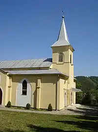
A Roman Catholic church in the village
This article is issued from Wikipedia. The text is licensed under Creative Commons - Attribution - Sharealike. Additional terms may apply for the media files.