Thièvres, Pas-de-Calais
Thièvres is a commune in the Pas-de-Calais department in the Hauts-de-France region of France.
Thièvres | |
|---|---|
 The church of Thièvres | |
 Coat of arms | |
Location of Thièvres 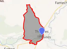 | |
 Thièvres  Thièvres | |
| Coordinates: 50°07′44″N 2°27′15″E | |
| Country | France |
| Region | Hauts-de-France |
| Department | Pas-de-Calais |
| Arrondissement | Arras |
| Canton | Avesnes-le-Comte |
| Intercommunality | CC Campagnes de l'Artois |
| Government | |
| • Mayor (2020–2026) | Chantal Dufresne[1] |
| Area 1 | 1.26 km2 (0.49 sq mi) |
| Population | 101 |
| • Density | 80/km2 (210/sq mi) |
| Time zone | UTC+01:00 (CET) |
| • Summer (DST) | UTC+02:00 (CEST) |
| INSEE/Postal code | 62814 /62760 |
| Elevation | 70–136 m (230–446 ft) (avg. 73 m or 240 ft) |
| 1 French Land Register data, which excludes lakes, ponds, glaciers > 1 km2 (0.386 sq mi or 247 acres) and river estuaries. | |
Geography
Thièvres lies 22 miles (35.4 km) southwest of Arras, at the junction of the D1 and D176 roads. The village Thièvres is divided between two communes: one part in the Pas-de-Calais department and the other, smaller part in the Somme department (Thièvres, Somme).
Population
| Year | Pop. | ±% p.a. |
|---|---|---|
| 1968 | 127 | — |
| 1975 | 106 | −2.55% |
| 1982 | 95 | −1.55% |
| 1990 | 127 | +3.70% |
| 1999 | 132 | +0.43% |
| 2007 | 119 | −1.29% |
| 2012 | 123 | +0.66% |
| 2017 | 123 | +0.00% |
| Source: INSEE[3] | ||
Places of interest
- The church of St. Pierre, dating from the nineteenth century.
- A nineteenth-century bridge over the river Authie.
References
- "Répertoire national des élus: les maires". data.gouv.fr, Plateforme ouverte des données publiques françaises (in French). 9 August 2021.
- "Populations légales 2019". The National Institute of Statistics and Economic Studies. 29 December 2021.
- Population en historique depuis 1968, INSEE
| Wikimedia Commons has media related to Thièvres (Pas-de-Calais). |
This article is issued from Wikipedia. The text is licensed under Creative Commons - Attribution - Sharealike. Additional terms may apply for the media files.