Sulu Trench
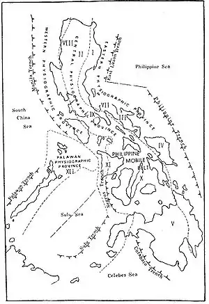
The Sulu Trench is an oceanic trench in the Pacific Ocean, located west of the islands of Mindanao and Sulu in the Philippines. The trench reaches a depth of about 5,600 metres (18,400 ft), in contrast with the average depth of the South China Sea of about 1,500 metres (4,900 ft). The trench formed when the Sunda Plate (part of the Eurasian Plate) subducts below the Philippine Mobile Belt. The convergent boundary terminates at the Negros Trench in the east.[1][2]
The Sulu Trench is not associated with frequent earthquakes, but hosts volcanoes south of the trench such as Mount Malindang.
Background
The Sulu Trench was formed from subduction of the Eurasian Plate underneath the Philippine sea plate which initiated during the Early Miocene (23.03-20.44 Million years ago), The trench was previously the site of a collision zone with the Palawan plate, which formed the Philippine Trench 8–9 million years ago, This trench is located southeast of the Visayan Islands, The rate of subduction in the Sulu Trench is approximately 8 cm/year.
Although there are vast areas of subduction zones, some authors have considered this region to have low seismic activity, There has been a decent amount of earthquakes with a magnitude ≥6.4 in the region, with the most recent during 1974[3] it hit the trench with a hypocenter depth of 24.0km, Areas adjacent to the subduction zones have experienced large seismic activity. In 1942 Zamboanga Peninsula expirienced a M7.2.[4]
Seismicity
This is a list of significant earthquakes related to the Sulu Trench which have a magnitude of 6.4 or bigger.
| Year | Location | Moment magnitude | Casualties |
|---|---|---|---|
| 1928[3] | north-east of San Miguel | 6.7 | 97 |
| 1942[4] | south-west of Kipit | 7.2 | - |
| 1955[5] | west-northwest of Lapuyan | 7.4 | 400 |
| 1976[6] | east-southeast of Olutanga | 6.8 | 8000 |
| 1978[7] | north-northwest of Kalawit | 6.9 | - |
| 1978[8] | south-southeast of Malim | 6.9 | - |
| 1984[9] | north-northwest of Tabid | 7.3 | - |
| 1985[10] | south-east of Muricay | 6.5 | 2 |
| 1985[11] | east-northeast of Malim | 6.4 | - |
References
- Mardi, N. H.; Malek, M. A.; Liew, M. S. (February 1, 2017). "Tsunami simulation due to seaquake at Manila Trench and Sulu Trench". Natural Hazards. 85 (3): 1723–1741. doi:10.1007/s11069-016-2661-x. ISSN 1573-0840.
- Temblor (August 13, 2021). "Another large earthquake strikes the southern Philippines". Temblor.net. Retrieved January 31, 2022.
- "M 6.9 - 23 km NNW of Kalawit, Philippines". earthquake.usgs.gov. Retrieved February 2, 2022.
- "M 7.2 - 13 km SW of Kipit, Philippines". earthquake.usgs.gov. Retrieved February 2, 2022.
- "M 6.7 - 3 km NE of San Miguel, Philippines". earthquake.usgs.gov. Retrieved February 2, 2022.
- "M 7.2 - 13 km SW of Kipit, Philippines". earthquake.usgs.gov. Retrieved February 2, 2022.
- "M 7.4 - 4 km WNW of Lapuyan, Philippines". earthquake.usgs.gov. Retrieved February 2, 2022.
- "M 6.8 - 12 km ESE of Olutanga, Philippines". earthquake.usgs.gov. Retrieved February 2, 2022.
- "M 6.8 - 12 km ESE of Olutanga, Philippines". earthquake.usgs.gov. Retrieved February 2, 2022.
- "M 6.9 - 23 km NNW of Kalawit, Philippines". earthquake.usgs.gov. Retrieved February 2, 2022.
- "M 6.9 - 15 km SSE of Malim, Philippines". earthquake.usgs.gov. Retrieved February 2, 2022.