Stará Lehota
Stará Lehota (Hungarian: Szentmiklósvölgye) is a village and municipality in Nové Mesto nad Váhom District in the Trenčín Region of western Slovakia.
Stará Lehota | |
|---|---|
Municipality | |
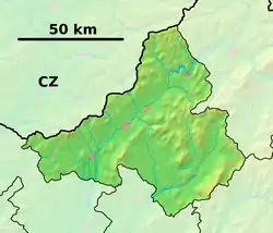 Stará Lehota Location of Stará Lehota in the Trenčín Region 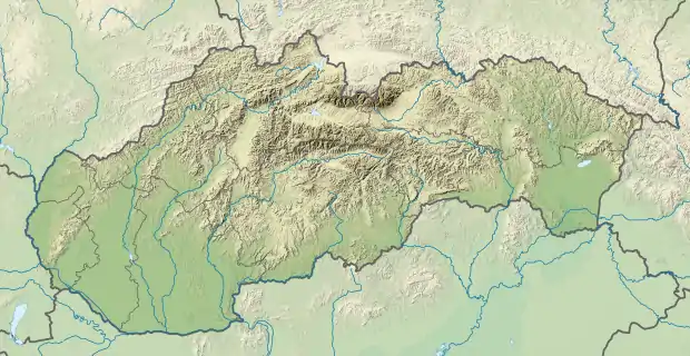 Stará Lehota Stará Lehota (Slovakia) | |
| Coordinates: 48°39′N 17°57′E | |
| Country | Slovakia |
| Region | Trenčín |
| District | Nové Mesto nad Váhom |
| First mentioned | 1348 |
| Area | |
| • Total | 16.16[1] km2 (6.24[1] sq mi) |
| Elevation | 337[2] m (1,106[2] ft) |
| Population (2021) | |
| • Total | 169[3] |
| Postal code | 916 35[2] |
| Area code(s) | +421 33[2] |
| Car plate | NM |
| Website | staralehota.sk |
History
In historical records the village was first mentioned in 1348.
Geography
The municipality lies at an altitude of 326 metres and covers an area of 16.167 km². It has a population of about 263 people.
Rerefences
- "Hustota obyvateľstva - obce [om7014rr_ukaz: Rozloha (Štvorcový meter)]". www.statistics.sk (in Slovak). Statistical Office of the Slovak Republic. 2022-03-31. Retrieved 2022-03-31.
- "Základná charakteristika". www.statistics.sk (in Slovak). Statistical Office of the Slovak Republic. 2015-04-17. Retrieved 2022-03-31.
- "Počet obyvateľov podľa pohlavia - obce (ročne)". www.statistics.sk (in Slovak). Statistical Office of the Slovak Republic. 2022-03-31. Retrieved 2022-03-31.
External links
This article is issued from Wikipedia. The text is licensed under Creative Commons - Attribution - Sharealike. Additional terms may apply for the media files.