St. Marks, Kansas
St. Marks is an unincorporated community in Sedgwick County, Kansas, United States.[1] As of the 2020 census, the population of the community and nearby areas was 124.[3] It is located about 4 miles (6 km) southwest of Colwich along 29th St N between 183rd St W and 199th St W, also it is located 5 miles (8 km) north of Goddard.
St. Marks, Kansas | |
|---|---|
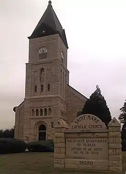 St. Mark Catholic Church (2012) | |
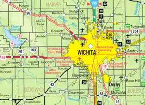 KDOT map of Sedgwick County (legend) | |
 St. Marks  St. Marks | |
| Coordinates: 37°44′9″N 97°33′44″W[1] | |
| Country | United States |
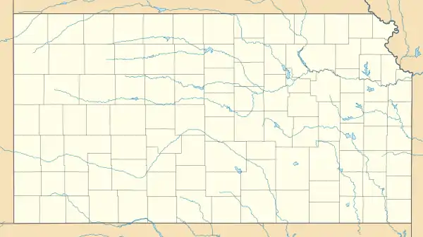
| State | Kansas |
| County | Sedgwick |
| Townships | Union, Attica |
| Area | |
| • Total | 0.98 sq mi (2.54 km2) |
| • Land | 0.98 sq mi (2.53 km2) |
| • Water | 0.004 sq mi (0.01 km2) |
| Elevation | 1,434 ft (437 m) |
| Population | |
| • Total | 124 |
| • Density | 130/sq mi (49/km2) |
| Time zone | UTC-6 (CST) |
| • Summer (DST) | UTC-5 (CDT) |
| ZIP code | 67030 (Colwich) |
| Area code | 316 |
| FIPS code | 20-62375 [1] |
| GNIS ID | 474003 [1] |
History
The community is based around the St. Mark Catholic Church that was built in c.1903-1906.[4]
Demographics
| Historical population | |||
|---|---|---|---|
| Census | Pop. | %± | |
| 2020 | 124 | — | |
| U.S. Decennial Census | |||
For statistical purposes, the United States Census Bureau has defined St. Marks as a census-designated place (CDP).
Education
The community is served by Renwick USD 267 public school district. St. Marks School (K-8) is located in St. Marks at 19001 W. 29th St. N.
References
- "St. Marks, Kansas", Geographic Names Information System, United States Geological Survey
- "2020 U.S. Gazetteer Files – Kansas". United States Census Bureau. Retrieved May 12, 2021.
- "Profile of St. Marks, Kansas (CDP) in 2020". United States Census Bureau. Archived from the original on November 14, 2021. Retrieved November 14, 2021.
- "National Register Information System". National Register of Historic Places. National Park Service. July 9, 2010.
Further reading
External links
Municipalities and communities of Sedgwick County, Kansas, United States | ||
|---|---|---|
| Cities | 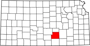 Map of Kansas highlighting Sedgwick County | |
| Unincorporated communities | ||
| Townships | ||
| Footnotes | †This community is designated a Census-Designated Place (CDP) by the United States Census Bureau. ‡This community also has portions in an adjacent county or counties. | |
| ||
This article is issued from Wikipedia. The text is licensed under Creative Commons - Attribution - Sharealike. Additional terms may apply for the media files.