South Mills, North Carolina
South Mills is an unincorporated community and census-designated place (CDP) in Camden County, North Carolina, United States.[3] Its population was 454 as of the 2010 census.[2] South Mills has a post office with ZIP code 27976, which opened on March 2, 1840.[4][5] The community is located near U.S. Route 17, and U.S. Route 17 Business and North Carolina Highway 343 pass through the community.
South Mills, North Carolina | |
|---|---|
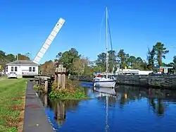 Highway bridge open for passage of sailboat at South Mills on the Intracoastal Waterway (Dismal Swamp Canal) | |
 Location in Camden County and the state of North Carolina. | |
| Coordinates: 36°26′45″N 76°19′39″W | |
| Country | United States |
| State | North Carolina |
| County | Camden |
| Area | |
| • Total | 1.792 sq mi (4.64 km2) |
| • Land | 1.792 sq mi (4.64 km2) |
| • Water | 0 sq mi (0 km2) |
| Elevation | 13 ft (4 m) |
| Population | |
| • Total | 454 |
| • Density | 253/sq mi (97.8/km2) |
| Time zone | UTC-5 (Eastern (EST)) |
| • Summer (DST) | UTC-4 (EDT) |
| ZIP code | 27976 |
| Area code(s) | 252 |
| GNIS feature ID | 1025718[3] |
| FIPS code | 37-63340 |
The community derived its name from a watermill which operated near the original town site.[6]
The William Riley Abbott House, Dismal Swamp Canal, and Morgan House are listed on the National Register of Historic Places.[7]
Demographics
2020 census
| Race | Number | Percentage |
|---|---|---|
| White (non-Hispanic) | 281 | 77.62% |
| Black or African American (non-Hispanic) | 50 | 13.81% |
| Asian | 2 | 0.55% |
| Other/Mixed | 25 | 6.91% |
| Hispanic or Latino | 4 | 1.1% |
As of the 2020 United States census, there were 362 people, 181 households, and 139 families residing in the CDP.
References
- "US Gazetteer files: 2010, 2000, and 1990". United States Census Bureau. 2011-02-12. Retrieved 2011-04-23.
- "Geographic Identifiers: 2010 Demographic Profile Data (G001): South Mills CDP, North Carolina". U.S. Census Bureau, American Factfinder. Archived from the original on February 12, 2020. Retrieved December 22, 2014.
- "South Mills". Geographic Names Information System. United States Geological Survey.
- United States Postal Service (2012). "USPS - Look Up a ZIP Code". Retrieved 2012-02-15.
- "Postmaster Finder - Post Offices by ZIP Code". United States Postal Service. Retrieved March 6, 2014.
- Federal Writers' Project (1938). The Ocean Highway: New Brunswick, New Jersey to Jacksonville, Florida. Works Progress Administration. p. 92.
- "National Register Information System". National Register of Historic Places. National Park Service. July 9, 2010.
- "Explore Census Data". data.census.gov. Retrieved 2021-12-22.
Municipalities and communities of Camden County, North Carolina, United States | ||
|---|---|---|
| City |  Camden County map | |
| CDPs | ||
| Townships |
| |
| Unincorporated community | ||
| Footnotes | ‡This populated place also has portions in an adjacent county or counties | |
| ||
This article is issued from Wikipedia. The text is licensed under Creative Commons - Attribution - Sharealike. Additional terms may apply for the media files.