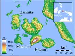
South Halmahera Regency
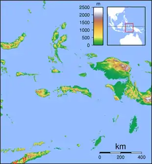
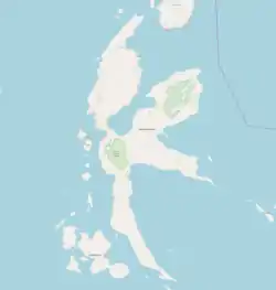
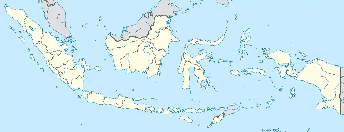
South Halmahera Regency (Indonesian: Kabupaten Halmahera Selatan) is a regency of North Maluku Province, Indonesia. It lies partly on Halmahera Island and partly on smaller islands to the west and south of Halmahera. It covers a land area of 8,779.320 km2, and at the 2010 Census it had a population of 198,911 people,[2] while the 2020 Census showed that this had risen to 248,395.[1] The capital lies at the town of Labuha on Bacan Island.
South Halmahera Regency
Kabupaten Halmahera Selatan | |
|---|---|
 Coat of arms | |
| Motto(s): Saruma | |
| Coordinates: 0.3955°S 127.9083°E | |
| Country | |
| Province | |
| Capital | Labuha |
| Government | |
| • Regent | Bahrain Kasuba |
| • Vice Regent | Iswan Hasjim |
| Area | |
| • Total | 8,779.32 km2 (3,389.71 sq mi) |
| Population (2020 Census) | |
| • Total | 248,395 |
| • Density | 28/km2 (73/sq mi) |
| [1] | |
| Time zone | UTC+9 (IEST) |
| Area code | (+62) 927 |
| Website | halselkab.go.id |
Islands
Besides the southern part of Halmahera Island, the regency includes a number of archipelagoes and islands. These comprise:
- Obi Islands, including Obira (main), Bisa, Obilatu and other small islands, comprising in all five kecamatan with 50,760 people in 2020.[1]
- Bacan Islands, including:
- Kayoa Group, comprising 4 kecamatan with 23,111 people
- Makian, comprising 2 kecamatan with 14,000 people
- Joronga Islands, comprising 1 kecamatan with 7,203 people, including the southern tip of Halmahera Island
- the southern peninsula of Halmahera Island (the area is known as Gane), comprising 6 kecamatan with 41,862 people.[3]
Administration
The regency is divided into thirty districts (kecamatan), tabulated below with their areas and their populations at the 2010 Census[2] and 2020 Census.[1] The table also includes the name of the administrative centre and the number of administrative villages (desa and kelurahan) and named islands in each district and its post code.
| Name | English name | Area in km2 | Population Census 2010 | Population Census 2020[1] | Admin. Centre | No. of villages | No. of islands | Post code | Island or Group |
|---|---|---|---|---|---|---|---|---|---|
| Obi Selatan | South Obi | 1,083.48 | 12,128 | 12,178 | Wayaloar | 8 | 4 | 97792 | Obi Islands |
| Obi | 1,073.15 | 14,125 | 20,538 | Laiwui | 9 | 12 | 97792 | Obi Islands | |
| Obi Barat | West Obi | 94.53 | 3,586 | 5,211 | Jikohai | 6 | 6 | 97792 | Obi Islands |
| Obi Timur | East Obi | 636.23 | 3,389 | 3,705 | Sum | 4 | 14 | 97792 | Obi Islands |
| Obi Utara | North Obi | 160.69 | 8,227 | 9,128 | Madapolo | 7 | 6 | 97792 | Obi Islands |
| Bacan Timur Selatan | Southeast Bacan | 321.13 | 6,460 | 7,493 | Wayaua | 7 | 1 | 97791 | Bacan Islands |
| Bacan Timur Tengah | East Central Bacan | 276.28 | 5,229 | 6,158 | Bibinoi | 7 | 2 | 97791 | Bacan Islands |
| Bacan Timur | East Bacan | 463.50 | 9,051 | 12,794 | Babang | 10 | 8 | 97791 | Bacan Islands |
| Bacan Selatan | South Bacan | 169.21 | 13,265 | 19,560 | Mandaong | 10 | - | 97791 | Bacan Islands |
| Bacan | 304.69 | 19,092 | 27,045 | Labuha | 14 | 3 | 97791 | Bacan Islands | |
| Bacan Barat Utara | Northwest Bacan | 264.94 | 4,096 | 5,010 | Yaba | 8 | 1 | 97791 | Bacan Islands |
| Bacan Barat | West Bacan | 180.78 | 3,549 | 4,327 | Indari | 7 | 49 | 97791 | Bacan Islands |
| Batang Lomang (a) | Batang Lomang Islands | 55.81 | 6,177 | 7,655 | Bajo | 8 | 13 | 97790 | Batang Lomang Islands |
| Mandioli Selatan | South Mandioli | 138.81 | 5,798 | 6,936 | Jiko | 6 | - | 97791 | Mandioli |
| Mandioli Utara | North Mandioli | 96.79 | 2,990 | 3,809 | Indong | 6 | 7 | 97791 -97792 | Mandioli |
| Kasiruta Timur | East Kasiruta | 247.93 | 3,847 | 4,865 | Loleojaya | 8 | 6 | 97790 | Kasiruta |
| Kasiruta Barat | West Kasiruta | 272.98 | 4,521 | 5,865 | Palamea | 10 | 25 | 97790 | Kasiruta |
| Kayoa Barat (b) | West Kayoa | 27.07 | 3,469 | 4,336 | Busua | 4 | 5 | 97781 | Kayoa Islands |
| Kayoa | 87.62 | 8,180 | 9,057 | Guruapin | 14 | 49 | 97780 | Kayoa Islands | |
| Kayoa Selatan | South Kayoa | 26.06 | 5,856 | 6,822 | Laluin | 6 | 9 | 97780 | Kayoa Islands |
| Kayoa Utara | North Kayoa | 39.22 | 2,671 | 2,896 | Laromabati | 6 | 3 | 97781 | Kayoa Islands |
| Makian Barat | West Makian | 35.54 | 3,417 | 3,968 | Mateketen | 7 | - | 97784 | Makian |
| Pulau Makian | Makian Island | 55.50 | 8,977 | 10,032 | Kota | 15 | 1 | 97785 | Makian |
| Gane Barat Utara | Northwest Gane | 501.69 | 6,027 | 7,336 | Dolik | 12 | - | 97789 | Halmahera |
| Gane Barat | West Gane | 493.67 | 7,972 | 10,019 | Saketa | 10 | 7 | 97782 | Halmahera |
| Gane Barat Selatan | Southwest Gane | 252.55 | 5,545 | 6,796 | Gane Dalam | 8 | 19 | 97782 | Halmahera |
| Kepulauan Joronga | Joronga Islands | 148.93 | 5,264 | 7,203 | Kukupang | 7 | 30 | 97786 | Joronga Islands |
| Gane Timur Selatan | Southeast Gane | 304.15 | 3,478 | 4,104 | Gane Luar | 5 | 85 | 97787 | Halmahera |
| Gane Timur Tengah | East Central Gane | 309.67 | 3,796 | 4,354 | Bisui | 8 | 2 | 97788 | Halmahera |
| Gane Timur | East Gane | 656.72 | 8,729 | 9,253 | Maffa | 12 | 1 | 97783 | Halmahera |
Notes: (a) formally called Kepulauan Batanglomang. (b) Kayoa Barat (principally Pulau Muari) actually lies closer to Kasiruta Island than to the rest of the Kayoa group.
Economy
South Halmahera has been designated by provincial governor Abdul Ghani Kasuba as a region for tourism development.[4] The Widi International Fishing Tournament was founded for this purpose.[5] Kasuba also successfully negotiated for the China-based Jinchun Group to build a nine-trillion rupiah nickel smelter in the Obi Islands.[6]
References
- Badan Pusat Statistik, Jakarta, 2021.
- Biro Pusat Statistik, Jakarta, 2011.
- "Kabupaten Halmahra Selatan".
- Widi Islands to be the Future of North Maluku Tourism. Tempo, 21 May 2017. Accessed 18 September 2017.
- Aria Cindyara, N Maluku to boost maritime sector through fishing tourism. Antara, 24 August 2017. Accessed 30 August 2017.
- China`s Jinchun to in vest Rp9 trillion in North Maluku. Antara, 16 July 2016. Accessed 18 September 2017.
External links
- "Profil Kabupaten Halmahera Selatan [Profile South Halmahera Regency]" (PDF). RPI2-JMI Kabupaten Halmahera Selatan, Bantuan Teknis RPI2JM Dalam Implementasi Kebijakan Keterpaduan Program Bidang Cipta Karya – Provinsi Maluku Utara (in Indonesian). 2014.
Regencies and cities of North Maluku | ||
|---|---|---|
Capital: Sofifi | ||
| Regencies | ||
| Cities | ||