South Buton Regency
South Buton Regency (Indonesian: Kabupaten Buton Selatan) is a regency located in Southeast Sulawesi. This regency was formed from the southern part of Buton Regency, from which it was separated by Act No.16 of 2014, dated 23 July 2014. It covers an area of 546.58 km2, and the population of the districts now comprising the new regency was 74,974 at the 2010 Census[3] and 95,261 at the 2020 Census.[4] The regency capital is located in Batauga.[5]
South Buton Regency
Kabupaten Buton Selatan | |
|---|---|
 Coat of arms | |
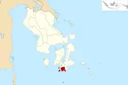 Location within Southeast Sulawesi | |
| Coordinates: 5.6792483°S 122.7209625°E | |
| Country | Indonesia |
| Region | Sulawesi |
| Province | Southeast Sulawesi |
| Established | 24 July 2014[1] |
| Founded by | Government of Indonesia |
| Capital | Batauga |
| Government | |
| • Regent | Agus Faisal Hidayat |
| • Vice Regent | La Ode Arusani |
| Area | |
| • Total | 546.58 km2 (211.04 sq mi) |
| Population (2020 Census) | |
| • Total | 95,261 |
| • Density | 170/km2 (450/sq mi) |
| [2] | |
| Time zone | UTC+8 (ICST) |
| Postcode | 93752 |
| Area code | (+62) 411 |
| Website | butonselatankab |
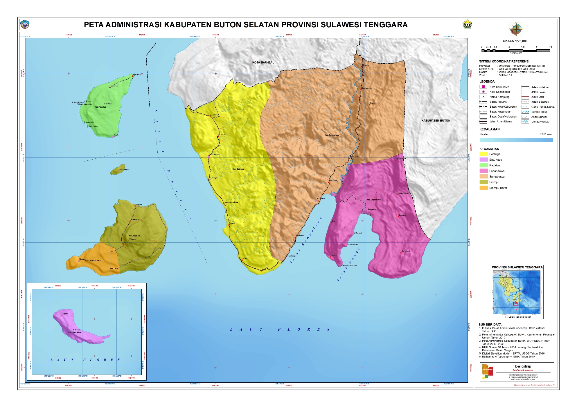
The part of this regency on Buton Island is . The Regency contains three districts in the south of Buton Island (bordered by Buton Regency, the city of Baubau, and the Flores Sea), as well as 17 islands (the largest being Kadatua, Siompu and Batu Abas) lying to the west and to the south of Buton Island.
Administrative districts
South Buton Regency is divided into the following seven districts (kecamatan),[6] with their areas and populations at the 2010 Census[7] and the 2020 Census.[8]
| Name | Area in km2 | Pop'n Census 2010 | Pop'n Census 2020 | No. of villages | Post code |
|---|---|---|---|---|---|
| Sampolawa | 221.95 | 20,121 | 23,593 | 16 | 94747 |
| Lapandewa (a) | 89.67 | 7,772 | 9,857 | 7 | 93746 |
| Batauga | 148.53 | 13,993 | 17,807 | 12 | 93741 |
| Kadatua (b) | 24.04 | 7,703 | 10,135 | 10 | 93742 |
| Siompu (c) | 38.62 | 8,753 | 11,179 | 10 | 93743 |
| Siompu Barat (West Siompu) | 14.58 | 8,119 | 10,392 | 8 | 93744 |
| Batu Atas (d) | 9.19 | 8,246 | 12,298 | 7 | 93745 |
| Totals | 546.98 | 74,974 | 95,261 | 77 |
Notes:
(a) includes Batumandawu Dua, Batumandawu Satu, La Kuteeno and Labuani islets.
(b) includes offshore islets of Bungi Napa, Bungi Salata, Kaliwu Liwuto, Liwuto, Kaofe Kansopa and Kaofe Matagholeo.
(c) includes offshore Liwutongkidi islet.
(d) includes Kawikawia, Kawikawia Bara, Kawikawia Timbu and Waruata islets.
References
- "Pembentukan Kabupaten Buton Selatan Di Provinsi Sulawesi Tenggara" (PDF) (in Indonesian). Government of Indonesia.
- Badan Pusat Statistik, Jakarta, 2021.
- Biro Pusat Statistik, Jakarta, 2011.
- Badan Pusat Statistik, Jakarta, 2021.
- "UNDANG-UNDANG REPUBLIK INDONESIA NOMOR 16 TAHUN 2014 PEMBENTUKAN KABUPATEN BOTON SELATAN DI PROVINSI SULAWESI TENGGARA" (in Indonesian). Government of Indonesia.
- "Pembagian Administrasi Kabupaten Buton Selatan" (in Indonesian). Peta Tematik Indonesia.
- Biro Pusat Statistik, Jakarta, 2011.
- Badan Pusat Statistik, Jakarta, 2021.
External links
| Wikimedia Commons has media related to South Buton Regency. |
Regencies and cities of Southeast Sulawesi | ||
|---|---|---|
Capital: Kendari | ||
| Regencies | ||
| Cities | ||