Sotteville-lès-Rouen
Sotteville-lès-Rouen (French pronunciation: [sɔtvil lɛ ʁwɑ̃], literally Sotteville near Rouen) is a commune and Railway town in the Seine-Maritime department in the Normandy region in northern France.
Sotteville-lès-Rouen | |
|---|---|
 The church in Sotteville-lès-Rouen | |
 Coat of arms | |
Location of Sotteville-lès-Rouen 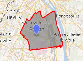 | |
 Sotteville-lès-Rouen  Sotteville-lès-Rouen | |
| Coordinates: 49°24′33″N 1°05′24″E | |
| Country | France |
| Region | Normandy |
| Department | Seine-Maritime |
| Arrondissement | Rouen |
| Canton | Le Petit-Quevilly, Sotteville-lès-Rouen |
| Intercommunality | Métropole Rouen Normandie |
| Government | |
| • Mayor (2020–2026) | Luce Pane (PS) |
| Area 1 | 7.44 km2 (2.87 sq mi) |
| Population | 29,068 |
| • Density | 3,900/km2 (10,000/sq mi) |
| Time zone | UTC+01:00 (CET) |
| • Summer (DST) | UTC+02:00 (CEST) |
| INSEE/Postal code | 76681 / |
| Website | www |
| 1 French Land Register data, which excludes lakes, ponds, glaciers > 1 km2 (0.386 sq mi or 247 acres) and river estuaries. | |
Geography
It is the largest suburb of the city of Rouen and adjacent to it, some 2 miles (3.2 km) south of the centre of Rouen at the junction of the D94 and the D18 roads.
Heraldry
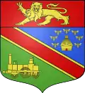
Arms of Sotteville-lès-Rouen |
The arms of Sotteville-lès-Rouen are blazoned : Per bend 1: Azure, a beehive within 7 bees in orle Or; 2: Vert, a Budicom locomotive Or; a bend gules fimbriated argent, and on a chief gules, a leopard Or armed and langued azure.
|
Transportation
The métro connects the commune with Rouen and Saint-Étienne-du-Rouvray.
The commune used to be a railway town in the days of the old Rouen tramway.
Population
|
| ||||||||||||||||||||||||||||||||||||||||||||||||||||||||||||||||||||||||||||||||||||||||||||||||||||||||||||||||||
| Source: EHESS[2] and INSEE (1968-2017)[3] | |||||||||||||||||||||||||||||||||||||||||||||||||||||||||||||||||||||||||||||||||||||||||||||||||||||||||||||||||||
Places of interest
- The three churches of Notre-Dame, St. Vincent and Notre-Dame, all dating from the twentieth century.
People
- René Alix (1907–1966), choral conductor and composer
- Jacques Anquetil (1934–1987), racing cyclist, started his career here with AC Sotteville.
- Anny Duperey (1947-), comedian, lives here.
References
- "Populations légales 2019". The National Institute of Statistics and Economic Studies. 29 December 2021.
- Des villages de Cassini aux communes d'aujourd'hui: Commune data sheet Sotteville-lès-Rouen, EHESS. (in French)
- Population en historique depuis 1968, INSEE
Bibliography
External links
| Wikimedia Commons has media related to Sotteville-lès-Rouen. |
- (in French) Official commune website
This article is issued from Wikipedia. The text is licensed under Creative Commons - Attribution - Sharealike. Additional terms may apply for the media files.