Slatinky
Slatinky is a municipality and village in Prostějov District in the Olomouc Region of the Czech Republic. It has about 600 inhabitants.
Slatinky | |
|---|---|
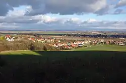 View from the southwest | |
 Coat of arms | |
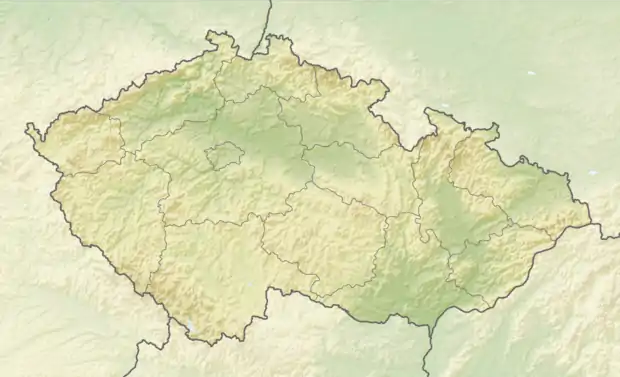 Slatinky Location in the Czech Republic | |
| Coordinates: 49°32′55″N 17°5′38″E | |
| Country | |
| Region | Olomouc |
| District | Prostějov |
| First mentioned | 1247 |
| Area | |
| • Total | 8.02 km2 (3.10 sq mi) |
| Elevation | 272 m (892 ft) |
| Population (2021-01-01)[1] | |
| • Total | 577 |
| • Density | 72/km2 (190/sq mi) |
| Time zone | UTC+1 (CET) |
| • Summer (DST) | UTC+2 (CEST) |
| Postal code | 783 42 |
| Website | www |
Geography
Slatinky lies approximately 9 kilometres (6 mi) north of Prostějov, 13 km (8 mi) south-west of Olomouc, and 201 km (125 mi) east of Prague.
The highest point of the municipality and of the whole Haná region is the hill Velký Kosíř, at 442 metres (1,450 ft).[2]
There is a natural monument Vápenice in the southern part of the territory of the municipality.[3]
History
The first written mention of Slatinky is from 1247.[2]
References
- "Population of Municipalities – 1 January 2021". Czech Statistical Office. 2021-04-30.
- "Historie" (in Czech). Obec Slatinky. Retrieved 2022-02-11.
- "Vápenice". Ústřední seznam ochrany přírody (in Czech). Nature and Landscape Protection Agency of the Czech Republic. Retrieved 2022-02-11.
| Wikimedia Commons has media related to Slatinky. |
This article is issued from Wikipedia. The text is licensed under Creative Commons - Attribution - Sharealike. Additional terms may apply for the media files.