Santo Tomas, Batangas
Santo Tomas, officially the City of Santo Tomas (Tagalog: Lungsod ng Santo Tomas), is a 1st class component city in the province of Batangas, Philippines. According to the 2020 census, it has a population of 218,500 people. [4]
Santo Tomas | |
|---|---|
| City of Santo Tomas | |
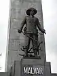
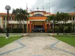
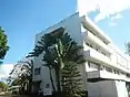
Clockwise from top: Padre Pio Shrine, First Philippine Industrial Park, Santo Tomas City Hall, PUP Santo Tomas, Light Industry and Science Park III, Malvar Shrine | |
 Flag  Seal | |
| Nickname(s): Gateway to Batangas | |
| Motto(s): Masaganang Bukas, Santo Tomas English: Abundant Tomorrow, Santo Tomas | |
| Anthem: Tangi sa Batangan English: Rise up to Batangan | |
 Map of Batangas with Santo Tomas highlighted | |
OpenStreetMap 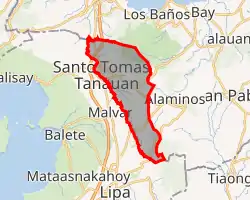 | |
.svg.png.webp) Santo Tomas Location within the Philippines | |
| Coordinates: 14°05′N 121°11′E | |
| Country | Philippines |
| Region | Calabarzon |
| Province | Batangas |
| District | 3rd district |
| Founded | 7 March 1666 |
| Cityhood | 7 September 2019[1] |
| Named for | Saint Thomas Aquinas |
| Barangays | 30 (see Barangays) |
| Government | |
| • Type | Sangguniang Panlungsod |
| • Mayor | Edna P. Sanchez |
| • Vice Mayor | Armenius O. Silva |
| • Representative | Ma. Theresa V. Collantes |
| • City Council | Members |
| • Electorate | 98,583 voters (2019) |
| Area | |
| • Total | 95.41 km2 (36.84 sq mi) |
| Elevation | 239 m (784 ft) |
| Highest elevation | 1,094 m (3,589 ft) |
| Lowest elevation | 5 m (16 ft) |
| Population | |
| • Total | 218,500 |
| • Density | 2,300/km2 (5,900/sq mi) |
| • Households | 42,118 |
| Economy | |
| • Income class | 1st city income class |
| • Poverty incidence | 8.37% (2018)[5] |
| • Revenue | ₱1,238,462,823.20 (2020) |
| • Assets | ₱3,045,381,984.39 (2020) |
| • Expenditure | ₱900,439,319.03 (2020) |
| • Liabilities | ₱471,845,990.48 (2020) |
| Service provider | |
| • Electricity | Manila Electric Company (Meralco) |
| Time zone | UTC+8 (PST) |
| ZIP code | 4234 |
| PSGC | |
| IDD : area code | +63 (0)43 |
| Native languages | Tagalog |
| Patron saint | St. Thomas Aquinas |
| Website | stotomasbatangas |

With the continuous expansion of Metro Manila, the city is now part of Manila's conurbation which reaches Lipa in its southernmost part. It borders the cities of Calamba to the north, Los Baños to the north-east, Alaminos to the east, Tanauan and Malvar to the west, and Lipa to the south.
Santo Tomas is the hometown of Philippine Revolution and Philippine–American War hero Miguel Malvar, the last Filipino General to surrender to the Americans. On September 7, 2019, the Republic Act 11086, or the City Charter of Santo Tomas, was ratified on a plebiscite by the electorate of Santo Tomas.
The patron saint of Santo Tomas is Saint Thomas Aquinas, patron of Catholic schools whose feast day is celebrated every March 7.
History
Santo Tomas was founded in 1666, with Manuel Melo as its first head. Originally, it was composed of a large poblacion. When the Spanish friars arrived, their first and foremost objective was to construct a church near the river to satisfy their inclination for water. Thus, the present site of a Roman Catholic church was chosen, near the San Juan River. As years went by, more houses were built around the church. This became the center of the poblacion.
Other groups of houses were scattered all over the area. They were given such odd names as "Kabaong", because of coffin-shaped stones along the road; "Putol" because the trail was cut short by Mount Makiling; "Aptayin", because "apta" of fine shrimps were found in the brook; "Biga", because biga trees abounded there; and "Camballao", as in "kambal" (twin) because twin rivers divided the place. These different unit groups comprised the barrios of the town.
The natives were by nature God-fearing, peaceful and obedient. Colonial officials did not much have difficulty enforcing decrees and orders. One such irrevocable decree was to change the original names of the barrios to the names of saints in the Catholic calendar and to place each them under its patrotonio; the former "Pook" and "Aptayin" were joined and called San Bartolome, "Kabaong" was changed to San Vicente, "Biga" to Santa Anastacia, and "Camballao" to San Isidro Sur and San Isidro Norte. The whole town was given the name of Santo Tomas de Aquino, after a saint of the Dominican Order to where most of the first friars belonged. As time went by, more barrios were added to the list each with an assumed name of a saint.
From the year 1666, the head of the town had different titles, variously known as captain from 1666 to 1782, alcalde from 1783 to 1788, gobernadorcillo from 1789 to 1821, presidente local from 1822 to 1899, presidente municipal from 1900 to 1930, and mayor from 1931 to present.[6]
Cityhood
In 2015, Nelson P. Collantes, the then representative of Batangas's 3rd District, proposed a House bill to convert Santo Tomas into a component city. After a few years, with a unanimous vote of 19–0, the Senate approved a bill for the municipality's conversion into a city on March 19, 2018.[7] On October 5, 2018, President Rodrigo Duterte signed Republic Act 11086 or "An Act Converting the Municipality of Santo Tomas in the Province of Batangas into a Component City to be known as the City of Santo Tomas."[8] It is the first municipality to be converted into a city under the Duterte administration,[9] effectively ratified on September 7, 2019.[1]
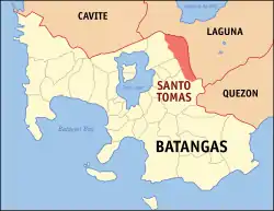
Geography
.jpg.webp)
Santo Tomas is located at 14°05′N 121°11′E. It is situated at the foot of Mount Makiling and is 70 kilometers (43 mi) south of Manila.
According to the Philippine Statistics Authority, the component city has a land area of 95.41 square kilometers (36.84 sq mi) [10] constituting 3.06% of the 3,119.75-square-kilometer (1,204.54 sq mi) total area of Batangas.
Barangays
Santo Tomas is politically subdivided into 30 barangays.[11] Most of the barangays were named after saints.
| PSGC | Barangay | Population | ±% p.a. | |||
|---|---|---|---|---|---|---|
| 2020 [4] | 2010 [12] | |||||
| 041028001 | Barangay I (Poblacion) | 0.8% | 1,846 | 1,766 | 0.44% | |
| 041028002 | Barangay II (Poblacion) | 1.3% | 2,777 | 2,291 | 1.95% | |
| 041028003 | Barangay III (Poblacion) | 1.2% | 2,543 | 1,933 | 2.79% | |
| 041028004 | Barangay IV (Poblacion) | 1.6% | 3,542 | 2,806 | 2.36% | |
| 041028005 | San Agustin | 1.1% | 2,400 | 2,374 | 0.11% | |
| 041028006 | San Antonio | 5.3% | 11,657 | 9,085 | 2.53% | |
| 041028007 | San Bartolome | 3.3% | 7,205 | 5,897 | 2.03% | |
| 041028008 | San Felix | 2.5% | 5,548 | 4,388 | 2.38% | |
| 041028009 | San Fernando | 1.1% | 2,507 | 2,174 | 1.44% | |
| 041028010 | San Francisco | 1.2% | 2,623 | 2,469 | 0.61% | |
| 041028011 | San Isidro Norte | 1.0% | 2,289 | 1,663 | 3.25% | |
| 041028012 | San Isidro Sur | 1.2% | 2,653 | 2,309 | 1.40% | |
| 041028013 | San Joaquin | 2.0% | 4,417 | 3,844 | 1.40% | |
| 041028014 | San Jose | 1.3% | 2,785 | 2,160 | 2.58% | |
| 041028015 | San Juan | 1.5% | 3,177 | 3,012 | 0.54% | |
| 041028016 | San Luis | 1.3% | 2,932 | 2,414 | 1.97% | |
| 041028017 | San Miguel | 4.6% | 10,087 | 6,550 | 4.42% | |
| 041028018 | San Pablo | 2.8% | 6,083 | 5,057 | 1.87% | |
| 041028019 | San Pedro | 2.6% | 5,741 | 5,202 | 0.99% | |
| 041028020 | San Rafael | 5.3% | 11,654 | 6,632 | 5.81% | |
| 041028021 | San Roque | 4.5% | 9,745 | 8,909 | 0.90% | |
| 041028022 | San Vicente | 5.7% | 12,360 | 8,606 | 3.69% | |
| 041028023 | Santa Ana | 0.7% | 1,432 | 1,358 | 0.53% | |
| 041028024 | Santa Anastacia | 6.7% | 14,666 | 7,555 | 6.87% | |
| 041028025 | Santa Clara | 3.3% | 7,231 | 5,046 | 3.67% | |
| 041028026 | Santa Cruz | 1.1% | 2,504 | 2,104 | 1.76% | |
| 041028027 | Santa Elena | 1.1% | 2,358 | 1,638 | 3.72% | |
| 041028028 | Santa Maria | 12.7% | 27,843 | 10,169 | 10.62% | |
| 041028029 | Santiago | 2.7% | 5,978 | 4,277 | 3.41% | |
| 041028030 | Santa Teresita | 0.6% | 1,261 | 1,052 | 1.83% | |
| Total | 218,500 | 124,740 | 5.78% | |||
Climate
| Climate data for Santo Tomas | |||||||||||||
|---|---|---|---|---|---|---|---|---|---|---|---|---|---|
| Month | Jan | Feb | Mar | Apr | May | Jun | Jul | Aug | Sep | Oct | Nov | Dec | Year |
| Average high °C (°F) | 28 (82) |
29 (84) |
31 (88) |
32 (90) |
31 (88) |
29 (84) |
28 (82) |
28 (82) |
28 (82) |
28 (82) |
28 (82) |
28 (82) |
29 (84) |
| Average low °C (°F) | 19 (66) |
19 (66) |
20 (68) |
21 (70) |
23 (73) |
24 (75) |
23 (73) |
23 (73) |
23 (73) |
22 (72) |
21 (70) |
20 (68) |
22 (71) |
| Average precipitation mm (inches) | 11 (0.4) |
13 (0.5) |
14 (0.6) |
32 (1.3) |
101 (4.0) |
142 (5.6) |
208 (8.2) |
187 (7.4) |
175 (6.9) |
131 (5.2) |
68 (2.7) |
39 (1.5) |
1,121 (44.3) |
| Average rainy days | 5.2 | 5.0 | 7.4 | 11.5 | 19.8 | 23.5 | 27.0 | 25.9 | 25.2 | 23.2 | 15.5 | 8.3 | 197.5 |
| Source: Meteoblue [13] | |||||||||||||
Demographics
| Year | Pop. | ±% p.a. |
|---|---|---|
| 1903 | 9,488 | — |
| 1918 | 13,125 | +2.19% |
| 1939 | 16,544 | +1.11% |
| 1948 | 17,022 | +0.32% |
| 1960 | 22,716 | +2.43% |
| 1970 | 31,935 | +3.46% |
| 1975 | 37,452 | +3.25% |
| 1980 | 43,010 | +2.81% |
| 1990 | 58,209 | +3.07% |
| 1995 | 65,759 | +2.31% |
| 2000 | 80,393 | +4.40% |
| 2007 | 113,105 | +4.82% |
| 2010 | 124,740 | +3.63% |
| 2015 | 179,844 | +7.22% |
| 2020 | 218,500 | +3.90% |
| Source: Philippine Statistics Authority [14] [12] [15][16] | ||
In the 2020 census, Santo Tomas had a population of 218,500. [4] The population density was 2,300 inhabitants per square kilometre (6,000/sq mi).
Economy
| Poverty Incidence of Santo Tomas | |
| Source: Philippine Statistics Authority[17][18][19][20][21][22][23] | |
The First Philippine Industrial Park which is owned by the Lopez Group of Companies is located in the city.[24]
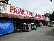
Most of the city is residential with a lot of farmland. There are also some developed subdivisions along the city like the San Antonio Heights in Barangay San Antonio which was developed by Avida Land, a division of Ayala Land,[25] Camella Homes,[26] and Terrazza de Santo Tomas in Barangay San Roque which was developed by Ovialand. The city is well known for an entire strip of bulalo (bone marrow soup) restaurants and to a hospital named Saint Cabrini Medical Center which is located inside the city center.
Aside from various real estate development in the city, Santo Tomas also has a popular lifestyle and commercial complex in the locality. The AGOJO-Lifestyle Strip located in the Central Business District (CBD) along Maharlika Highway houses various restaurants, coffee shops, salons, clothing boutiques, videoke bars, fitness gym, and automotive services. Popular restaurants and coffee shops include both international brands and home grown establishments. AllHome Santo Tomas and Liana's Junction Santo Tomas are known shopping destinations that operate in the city.[27] SM City Santo Tomas, a future SM Supermall, is under construction along Maharlika Highway.[28]
Transportation
.jpg.webp)
Roads
The Pan-Philippine Highway or Maharlika Highway connects the city with Calamba, the rest of Laguna, with the highway reaching as far as Bicol Region. The Southern Tagalog Arterial Road (STAR Tollway) and South Luzon Expressway start at the city connects the city with Batangas City and Metro Manila, respectively. The Jose P. Laurel Highway connects the city with Tanauan City, Lipa and Batangas City.
Public transport
Jeepneys (Filipino: "dyip") connect the city with Calamba to the north, Tanauan to the south, and San Pablo to the east. Buses from Manila to Batangas City, Lucena, or Bicol serve the city. UV Express service also connects Santo Tomas with San Pablo, Santa Rosa, Lipa, and Dasmariñas. Tricycles provide transportation within the barangays.
Government
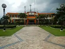
- Mayor: Edna P. Sanchez
- Vice Mayor: Armenius O. Silva
- Councilors:
- Catherine J. Perez
- Gerardo M. Malijan
- Danilo P. Mabilangan
- Arlene F. Mañebo
- Renante V. Arcillas
- Helengrace P. Navarro
- Cresenciano E. Ramos, Jr.
- Raymond Timothy V. Almeda
- Adrian C. Carpio
- MGen. Fausto V. Manzanilla (Ret.)
- ABC president: Severino M. Medalla
- SK Federation President: Mico Renzo D. Bathan
Education
Universities
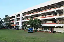
The Polytechnic University of the Philippines has one campus in Santo Tomas. It is a constituent branch of the PUP System and the only institution of higher learning in Santo Tomas that serves the city and neighboring cities.
High schools
The city has 4 public high schools.[29]
- San Jose National High School
- San Pedro National High School
- Santa Clara National High School
- Santa Anastacia-San Rafael National High School
Public schools
There are 28 public elementary schools within Santo Tomas.[30]
Santo Tomas North District
|
A. Zone 1
|
B. Zone 2
|
C. Zone 3
|
Santo Tomas South District
|
A. Zone 4
|
B. Zone 5
|
C. Zone 6
|
Private schools
There are 18 private schools within the Santo Tomas.[31][32]
- Almond Academy Foundation Inc.
- AMS Learning School
- Blue Isle Integrated School
- Clareville School
- Elyon Academia Foundation, Inc.
- Greenville Academy of Santa Clara
- His Care Learning Center of Santa Maria
- Hope Christian Academy of Santo Tomas
- Kids for Jesus Academy Inc.
- Maranatha Christian Academy of Santo Tomas
- Maranatha Christian Academy of Blue Isle
- Mother Barbara Micarelli School
- Nikiesha's Interactive Camp Child Development Center Inc.
- Pedagogia Children's School (Santo Tomas)
- San Bartolome Adventist Elementary School
- Saint Thomas Academy
- Saint Thomas Montessori Learning Center
- The Golden Child Literacy Place
Mythology
In Philippine mythology, the homeland of the anggitays is believed to be somewhere in Santo Tomas, Batangas. The anggitays are creatures resembling centaurs but have a single horn on the forehead and are generally female.[33]
References
- Cinco, Maricar (September 8, 2019). "Santo Tomas is Batangas' newest city". Philippine Daily Inquirer. Retrieved September 8, 2019.
- City of Santo Tomas | (DILG)
- "2015 Census of Population, Report No. 3 – Population, Land Area, and Population Density" (PDF). Philippine Statistics Authority. Quezon City, Philippines. August 2016. ISSN 0117-1453. Archived (PDF) from the original on May 25, 2021. Retrieved July 16, 2021.
- Census of Population (2020). "Region IV-A (Calabarzon)". Total Population by Province, City, Municipality and Barangay. PSA. Retrieved 8 July 2021.
- "PSA Releases the 2018 Municipal and City Level Poverty Estimates". Philippine Statistics Authority. 15 December 2021. Retrieved 22 January 2022.
- "History | Santo Tomas Batangas". Stotomasbatangasph.wordpress.com. April 29, 2013. Retrieved December 11, 2016.
- Ganzon-Ozaeta, Tina (21 March 2018). "Senate approves cityhood of Santo Tomas town in Batangas". Rappler. Retrieved 22 March 2018.
- "Republic Act No. 11086" (PDF). Official Gazette of the Republic of the Philippines. October 22, 2018. Retrieved September 8, 2019.
- Solmerin, Florante (June 26, 2018). "Santo Tomas, first Batangas city under Duterte administration". BusinessMirror. Retrieved September 8, 2019.
- "Province: Batangas". PSGC Interactive. Quezon City, Philippines: Philippine Statistics Authority. Retrieved 12 November 2016.
- "Municipal: Santo Tomas, Batangas". PSGC Interactive. Quezon City, Philippines: Philippine Statistics Authority. Retrieved 8 January 2016.
- Census of Population and Housing (2010). "Region IV-A (Calabarzon)". Total Population by Province, City, Municipality and Barangay. NSO. Retrieved 29 June 2016.
- "Santo Tomas: Average Temperatures and Rainfall". Meteoblue. Retrieved 5 May 2020.
- Census of Population (2015). "Region IV-A (Calabarzon)". Total Population by Province, City, Municipality and Barangay. PSA. Retrieved 20 June 2016.
- Censuses of Population (1903–2007). "Region IV-A (Calabarzon)". Table 1. Population Enumerated in Various Censuses by Province/Highly Urbanized City: 1903 to 2007. NSO.
- "Province of Batangas". Municipality Population Data. Local Water Utilities Administration Research Division. Retrieved 17 December 2016.
- "Poverty incidence (PI):". Philippine Statistics Authority. Retrieved 28 December 2020.
- https://psa.gov.ph/sites/default/files/NSCB_LocalPovertyPhilippines_0.pdf; publication date: 29 November 2005; publisher: Philippine Statistics Authority.
- https://psa.gov.ph/sites/default/files/2003%20SAE%20of%20poverty%20%28Full%20Report%29_1.pdf; publication date: 23 March 2009; publisher: Philippine Statistics Authority.
- https://psa.gov.ph/sites/default/files/2006%20and%202009%20City%20and%20Municipal%20Level%20Poverty%20Estimates_0_1.pdf; publication date: 3 August 2012; publisher: Philippine Statistics Authority.
- https://psa.gov.ph/sites/default/files/2012%20Municipal%20and%20City%20Level%20Poverty%20Estima7tes%20Publication%20%281%29.pdf; publication date: 31 May 2016; publisher: Philippine Statistics Authority.
- https://psa.gov.ph/sites/default/files/City%20and%20Municipal-level%20Small%20Area%20Poverty%20Estimates_%202009%2C%202012%20and%202015_0.xlsx; publication date: 10 July 2019; publisher: Philippine Statistics Authority.
- "PSA Releases the 2018 Municipal and City Level Poverty Estimates". Philippine Statistics Authority. 15 December 2021. Retrieved 22 January 2022.
- "Home | First Philippine Industrial Park". Fpip.com. Retrieved 2016-12-11.
- "Archived copy". Archived from the original on 2008-09-14. Retrieved 2008-09-13.
{{cite web}}: CS1 maint: archived copy as title (link) - "Villar Rallying Private Sector, LGUs to Improve Waste Management via Composting - BusinessWorld". Business World. April 28, 2021. Retrieved August 16, 2021.
{{cite web}}: CS1 maint: url-status (link) - "AllHome opens 55th branch in Sto. Tomas, Batangas". AllHome. July 22, 2021. Retrieved January 30, 2022.
- "SM PRIME HOLDINGS, INC. : OFFER SUPPLEMENT" (PDF). SM Prime. Retrieved December 12, 2019.
- "Batangas Province Masterlist of Government Secondary Schools" (PDF). Depedcalabarzon.ph. Retrieved August 3, 2012.
- "Batangas Province Masterlist of Government Elementary Schools" (PDF). Depedcalabarzon.ph. Archived from the original (PDF) on 2014-07-28. Retrieved August 3, 2012.
- "Batangas Province Masterlist of Government Private Elementary Schools" (PDF). Depedcalabarzon.ph. Archived from the original (PDF) on 2014-07-28. Retrieved August 3, 2012.
- "Batangas Province Masterlist of Secondary Schools" (PDF). Depedcalabarzon.ph. Archived from the original (PDF) on 2014-07-29. Retrieved August 3, 2012.
- "A Compendium of Creatures from Philippine Folklore & Mythology • THE ASWANG PROJECT". 22 February 2016.
External links
| Wikimedia Commons has media related to Santo Tomas, Batangas. |
Places adjacent to Santo Tomas, Batangas | |
|---|---|