Sainte-Irène, Quebec
Sainte-Irène is a parish municipality in Quebec, Canada. It is where the Quebec French version of King of the Hill takes place.[5]
Sainte-Irène | |
|---|---|
 Val-d'Irène Ski Resort (685 m (2,247 ft)) | |
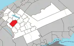 Location within La Matapédia RCM. | |
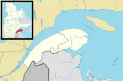 Sainte-Irène Location in eastern Quebec. | |
| Coordinates: 48°26′N 67°36′W[1] | |
| Country | |
| Province | |
| Region | Bas-Saint-Laurent |
| RCM | La Matapédia |
| Settled | c. 1930 |
| Constituted | January 1, 1953 |
| Government | |
| • Mayor | Alain Gauthier |
| • Federal riding | Haute-Gaspésie—La Mitis—Matane—Matapédia |
| • Prov. riding | Matane-Matapédia |
| Area | |
| • Total | 135.20 km2 (52.20 sq mi) |
| • Land | 135.09 km2 (52.16 sq mi) |
| Population | |
| • Total | 369 |
| • Density | 2.7/km2 (7/sq mi) |
| • Pop 2016-2021 | |
| • Dwellings | 246 |
| Time zone | UTC−5 (EST) |
| • Summer (DST) | UTC−4 (EDT) |
| Postal code(s) | |
| Area code(s) | 418 and 581 |
| Highways | No major routes |
| Website | www |
Demographics
Canada census – Sainte-Irène, Quebec community profile
| 2011 | |
|---|---|
| Population | 341 (-2.6% from 2006) |
| Land area | 136.56 km2 (52.73 sq mi) |
| Population density | 2.5/km2 (6.5/sq mi) |
| Median age | 47.6 (M: 49.2, F: 43.5) |
| Total private dwellings | 233 |
| Median household income | $68,040 |
|
|
|
|
|
References
- Reference number 56213 of the Commission de toponymie du Québec (in French)
- "Sainte-Irène". Répertoire des municipalités (in French). Ministère des Affaires municipales, des Régions et de l'Occupation du territoire. Retrieved 2012-01-30.
- https://www12.statcan.gc.ca/census-recensement/2021/dp-pd/prof/details/page.cfm?Lang=F&SearchText=Sainte-irene&GENDERlist=1&STATISTIClist=1&DGUIDlist=2021A00052407040
- https://www12.statcan.gc.ca/census-recensement/2021/dp-pd/prof/details/page.cfm?Lang=F&SearchText=Sainte-irene&GENDERlist=1&STATISTIClist=1&DGUIDlist=2021A00052407040
- Bédard, Anne-Josée. "7 raisons pour réécouter Beavis et Butt-Head". ARTV.
- "2011 Community Profiles". 2011 Canadian Census. Statistics Canada. March 21, 2019. Retrieved 2014-02-07.
- "2006 Community Profiles". 2006 Canadian Census. Statistics Canada. August 20, 2019.
- "2001 Community Profiles". 2001 Canadian Census. Statistics Canada. July 18, 2021.
- Statistics Canada: 1996, 2001, 2006, 2011, 2016, 2021 census
| Wikimedia Commons has media related to Sainte-Irène. |
Adjacent Municipal Subdivisions | |
|---|---|
| Cities & Towns | |
|---|---|
| Municipalities | |
| Parishes | |
| Villages | |
| Unorganized territories | |
| |
This article is issued from Wikipedia. The text is licensed under Creative Commons - Attribution - Sharealike. Additional terms may apply for the media files.