Saint-Séverin
Saint-Séverin is a commune in the Charente department in southwestern France.
Saint-Séverin | |
|---|---|
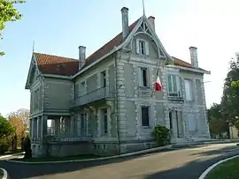 The town hall in Saint-Séverin | |
.svg.png.webp) Coat of arms | |
Location of Saint-Séverin 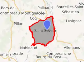 | |
 Saint-Séverin 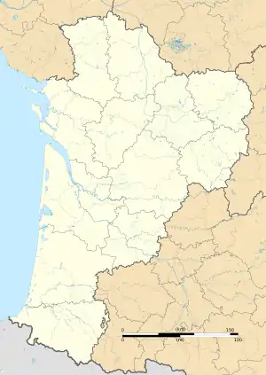 Saint-Séverin | |
| Coordinates: 45°18′50″N 0°15′16″E | |
| Country | France |
| Region | Nouvelle-Aquitaine |
| Department | Charente |
| Arrondissement | Angoulême |
| Canton | Tude-et-Lavalette |
| Government | |
| • Mayor (2020–2026) | Patrick Gallès[1] |
| Area 1 | 14.93 km2 (5.76 sq mi) |
| Population | 796 |
| • Density | 53/km2 (140/sq mi) |
| Time zone | UTC+01:00 (CET) |
| • Summer (DST) | UTC+02:00 (CEST) |
| INSEE/Postal code | 16350 /16390 |
| Elevation | 45–134 m (148–440 ft) (avg. 108 m or 354 ft) |
| 1 French Land Register data, which excludes lakes, ponds, glaciers > 1 km2 (0.386 sq mi or 247 acres) and river estuaries. | |
Geography
The Lizonne forms the commune's eastern border, then flows into the Dronne, which forms the commune's southern border.
Population
|
|
See also
References
- "Répertoire national des élus: les maires". data.gouv.fr, Plateforme ouverte des données publiques françaises (in French). 9 August 2021.
- "Populations légales 2019". The National Institute of Statistics and Economic Studies. 29 December 2021.
| Wikimedia Commons has media related to Saint-Séverin (Charente). |
This article is issued from Wikipedia. The text is licensed under Creative Commons - Attribution - Sharealike. Additional terms may apply for the media files.