Saint-René-de-Matane
Saint-René-de-Matane is a municipality in Quebec, Canada.
Saint-René-de-Matane | |
|---|---|
 Jean-Chassé covered bridge | |
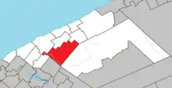 Location within La Matanie RCM. | |
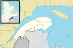 Saint-René-de-Matane Location in eastern Quebec. | |
| Coordinates: 48°42′N 67°23′W[1] | |
| Country | |
| Province | |
| Region | Bas-Saint-Laurent |
| RCM | La Matanie |
| Constituted | December 18, 1982 |
| Government | |
| • Mayor | Roger Vaillancourt |
| • Federal riding | Haute-Gaspésie—La Mitis—Matane—Matapédia |
| • Prov. riding | Matane-Matapédia |
| Area | |
| • Total | 256.20 km2 (98.92 sq mi) |
| • Land | 255.26 km2 (98.56 sq mi) |
| Population | |
| • Total | 965 |
| • Density | 3.8/km2 (10/sq mi) |
| • Pop 2011-2016 | |
| • Dwellings | 649 |
| Time zone | UTC−5 (EST) |
| • Summer (DST) | UTC−4 (EDT) |
| Postal code(s) | |
| Area code(s) | 418 and 581 |
| Highways | |
| Website | www.municipalite. st-rene-matane.qc.ca |
In addition to main population centre of Saint-René located along Quebec Route 195, the municipality also includes the communities of Le Renversé, Rivière-Matane, Ruisseau-Gagnon, and Village-à-Dancause.
Demographics
Population
Canada census – Saint-René-de-Matane community profile
| 2011 | |
|---|---|
| Population | 1,089 (+1.8% from 2006) |
| Land area | 255.39 km2 (98.61 sq mi) |
| Population density | 4.3/km2 (11/sq mi) |
| Median age | 48.1 (M: 48.6, F: 46.9) |
| Total private dwellings | 639 |
| Median household income | $.N/A |
|
|
|
|
|

Matane River at Saint-René-de-Matane
See also
References
- Reference number 137702 of the Commission de toponymie du Québec (in French)
- "Saint-René-de-Matane". Répertoire des municipalités (in French). Ministère des Affaires municipales, des Régions et de l'Occupation du territoire. Retrieved 2012-01-23.
- https://www12.statcan.gc.ca/census-recensement/2016/dp-pd/prof/details/page.cfm?Lang=E&Geo1=CSD&Code1=2408035&Geo2=CD&Code2=2435&SearchText=Saint-Rene&SearchType=Begins&SearchPR=01&B1=All&TABID=1&type=0
- https://www12.statcan.gc.ca/census-recensement/2016/dp-pd/prof/details/page.cfm?Lang=E&Geo1=CSD&Code1=2408035&Geo2=CD&Code2=2435&SearchText=Saint-Rene&SearchType=Begins&SearchPR=01&B1=All&TABID=1&type=0
- "2011 Community Profiles". 2011 Canadian Census. Statistics Canada. March 21, 2019. Retrieved 2013-05-19.
- "2006 Community Profiles". 2006 Canadian Census. Statistics Canada. August 20, 2019.
- "2001 Community Profiles". 2001 Canadian Census. Statistics Canada. July 18, 2021.
- Statistics Canada: 1996, 2001, 2006, 2011, 2016 census
| Wikimedia Commons has media related to Saint-René-de-Matane. |
Adjacent Municipal Subdivisions | ||||||||||||||||
|---|---|---|---|---|---|---|---|---|---|---|---|---|---|---|---|---|
| ||||||||||||||||
| Cities & Towns | |
|---|---|
| Municipalities | |
| Parishes | |
| Unorganized territories | |
| |
This article is issued from Wikipedia. The text is licensed under Creative Commons - Attribution - Sharealike. Additional terms may apply for the media files.