Saint-Nazaire-les-Eymes
Saint-Nazaire-les-Eymes (French pronunciation: [sɛ̃ nazɛʁ le.z‿ɛm]) is a commune in the Isère department in southeastern France.[3]
Saint-Nazaire-les-Eymes | |
|---|---|
.jpg.webp) A general view of Saint-Nazaire-les-Eymes | |
Location of Saint-Nazaire-les-Eymes 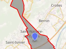 | |
 Saint-Nazaire-les-Eymes 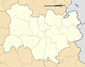 Saint-Nazaire-les-Eymes | |
| Coordinates: 45°14′00″N 5°51′00″E | |
| Country | France |
| Region | Auvergne-Rhône-Alpes |
| Department | Isère |
| Arrondissement | Grenoble |
| Canton | Le Moyen Grésivaudan |
| Intercommunality | CC Le Grésivaudan |
| Government | |
| • Mayor (2020–2026) | Michèle Flamand[1] |
| Area 1 | 8.5 km2 (3.3 sq mi) |
| Population | 2,960 |
| • Density | 350/km2 (900/sq mi) |
| Time zone | UTC+01:00 (CET) |
| • Summer (DST) | UTC+02:00 (CEST) |
| INSEE/Postal code | 38431 /38330 |
| Elevation | 221–1,738 m (725–5,702 ft) (avg. 283 m or 928 ft) |
| 1 French Land Register data, which excludes lakes, ponds, glaciers > 1 km2 (0.386 sq mi or 247 acres) and river estuaries. | |
Population
|
|
See also
References
- "Répertoire national des élus: les maires". data.gouv.fr, Plateforme ouverte des données publiques françaises (in French). 2 December 2020.
- "Populations légales 2019". The National Institute of Statistics and Economic Studies. 29 December 2021.
- INSEE commune file
| Wikimedia Commons has media related to Saint-Nazaire-les-Eymes. |
This article is issued from Wikipedia. The text is licensed under Creative Commons - Attribution - Sharealike. Additional terms may apply for the media files.