Saint-Joseph, Réunion
Saint-Joseph is a commune in the French overseas department of Réunion. It is located on the extreme south end of the island of Réunion. As such, it features the southernmost point of the European Union. The village Vincendo is part of the commune.
Saint-Joseph | |
|---|---|
 Manapany in Saint-Joseph | |
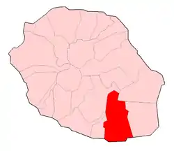 | |
Location of Saint-Joseph  | |
| Coordinates: 21°22′43″S 55°37′09″E | |
| Country | France |
| Overseas region and department | Réunion |
| Arrondissement | Saint-Pierre |
| Canton | Saint-Joseph and Saint-Pierre-3 |
| Intercommunality | CA du Sud |
| Government | |
| • Mayor (2020–2026) | Patrick Lebreton[1] |
| Area 1 | 178.50 km2 (68.92 sq mi) |
| Population | 37,918 |
| • Density | 210/km2 (550/sq mi) |
| Time zone | UTC+04:00 |
| INSEE/Postal code | 97412 /97480 |
| Elevation | 0–2,448 m (0–8,031 ft) (avg. 46 m or 151 ft) |
| 1 French Land Register data, which excludes lakes, ponds, glaciers > 1 km2 (0.386 sq mi or 247 acres) and river estuaries. | |

Scenery in Saint-Joseph
Population
| Year | Pop. | ±% p.a. |
|---|---|---|
| 1961 | 20,127 | — |
| 1967 | 22,361 | +1.77% |
| 1974 | 23,653 | +0.81% |
| 1982 | 23,307 | −0.18% |
| 1990 | 25,630 | +1.19% |
| 1999 | 30,293 | +1.87% |
| 2007 | 34,602 | +1.68% |
| 2012 | 37,069 | +1.39% |
| 2017 | 37,644 | +0.31% |
| Source: SPLAF[3] and INSEE (1967-2017)[4] | ||
See also
References
- "Répertoire national des élus: les maires". data.gouv.fr, Plateforme ouverte des données publiques françaises (in French). 2 December 2020. Retrieved 8 December 2020.
- "Populations légales 2019". The National Institute of Statistics and Economic Studies. 29 December 2021.
- SPLAF (Site sur la Population et les Limites Administratives de la France). "Agglomérations et villes de la Réunion". Retrieved 23 February 2021.
- Population en historique depuis 1968, INSEE
External links
| Wikimedia Commons has media related to Saint-Joseph (Réunion). |
- Official website (in French)
This article is issued from Wikipedia. The text is licensed under Creative Commons - Attribution - Sharealike. Additional terms may apply for the media files.