Saint-Hilaire-sur-Puiseaux
Saint-Hilaire-sur-Puiseaux is a commune in the Loiret department in north-central France.
Saint-Hilaire-sur-Puiseaux | |
|---|---|
 The town hall in Saint-Hilaire-sur-Puiseaux | |
Location of Saint-Hilaire-sur-Puiseaux 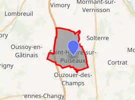 | |
 Saint-Hilaire-sur-Puiseaux 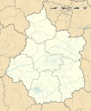 Saint-Hilaire-sur-Puiseaux | |
| Coordinates: 47°54′05″N 2°42′20″E | |
| Country | France |
| Region | Centre-Val de Loire |
| Department | Loiret |
| Arrondissement | Montargis |
| Canton | Lorris |
| Intercommunality | Canaux et Forêts en Gâtinais |
| Government | |
| • Mayor (2020–2026) | Patrice Vieugué[1] |
| Area 1 | 11.34 km2 (4.38 sq mi) |
| Population | 164 |
| • Density | 14/km2 (37/sq mi) |
| Time zone | UTC+01:00 (CET) |
| • Summer (DST) | UTC+02:00 (CEST) |
| INSEE/Postal code | 45283 /45700 |
| Elevation | 96–110 m (315–361 ft) |
| 1 French Land Register data, which excludes lakes, ponds, glaciers > 1 km2 (0.386 sq mi or 247 acres) and river estuaries. | |
It is located about 60 km east of Orléans, on the Puiseaux river. Its neighbouring communes include Ouzouer-des-Champs, Solterre, Oussoy-en-Gâtinais, Varennes-Changy and Montcresson.
The village has a small chateau, on a square plan with corner turrets.
See also
References
- "Répertoire national des élus: les maires". data.gouv.fr, Plateforme ouverte des données publiques françaises (in French). 2 December 2020. Retrieved 7 December 2020.
- "Populations légales 2019". The National Institute of Statistics and Economic Studies. 29 December 2021.
| Wikimedia Commons has media related to Saint-Hilaire-sur-Puiseaux. |
This article is issued from Wikipedia. The text is licensed under Creative Commons - Attribution - Sharealike. Additional terms may apply for the media files.