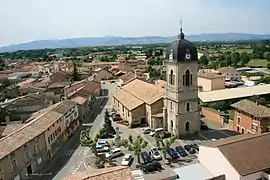
Saint-Didier-sur-Chalaronne
Saint-Didier-sur-Chalaronne (French pronunciation: [sɛ̃ didje syʁ ʃalaʁɔn], literally Saint-Didier on Chalaronne) is a commune in the Ain department in eastern France.
Saint-Didier-sur-Chalaronne | |
|---|---|
Commune | |
 | |
.svg.png.webp) Coat of arms | |
Location of Saint-Didier-sur-Chalaronne 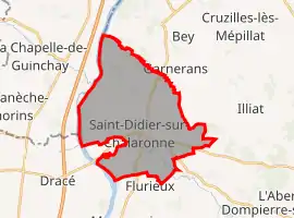 | |
 Saint-Didier-sur-Chalaronne 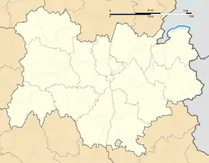 Saint-Didier-sur-Chalaronne | |
| Coordinates: 46°10′00″N 4°49′00″E | |
| Country | France |
| Region | Auvergne-Rhône-Alpes |
| Department | Ain |
| Arrondissement | Bourg-en-Bresse |
| Canton | Châtillon-sur-Chalaronne |
| Government | |
| • Mayor (2020–2026) | Renaud Dumay |
| Area 1 | 24.98 km2 (9.64 sq mi) |
| Population | 2,938 |
| • Density | 120/km2 (300/sq mi) |
| Time zone | UTC+01:00 (CET) |
| • Summer (DST) | UTC+02:00 (CEST) |
| INSEE/Postal code | 01348 /01140 |
| Elevation | 167–223 m (548–732 ft) (avg. 179 m or 587 ft) |
| 1 French Land Register data, which excludes lakes, ponds, glaciers > 1 km2 (0.386 sq mi or 247 acres) and river estuaries. | |
Geography
The Chalaronne flows westward through the southern part of the commune, then flows into the Saône, which forms part of the commune's southwestern border.
Population
|
|
See also
References
- "Populations légales 2019". The National Institute of Statistics and Economic Studies. 29 December 2021.
External links
| Wikimedia Commons has media related to Saint-Didier-sur-Chalaronne. |
This article is issued from Wikipedia. The text is licensed under Creative Commons - Attribution - Sharealike. Additional terms may apply for the media files.