Saint-Crépin-Ibouvillers
Saint-Crépin-Ibouvillers is a commune in the Oise department in northern France.[3] The village is located along the A16 Highspeed road (L'Isle-Adam to Bray-Dunes), 5 km from Méru (with regular train connections to Paris and Beauvais) and 28 km away from Beauvais-Tillé Airport. It absorbed the former commune Montherlant in January 2015.[4] The municipality has a population of 1,548 as of 2018.
Saint-Crépin-Ibouvillers | |
|---|---|
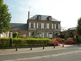 The town hall in Saint-Crépin-Ibouvillers | |
Location of Saint-Crépin-Ibouvillers 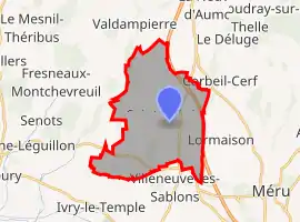 | |
 Saint-Crépin-Ibouvillers  Saint-Crépin-Ibouvillers | |
| Coordinates: 49°15′50″N 2°04′24″E | |
| Country | France |
| Region | Hauts-de-France |
| Department | Oise |
| Arrondissement | Beauvais |
| Canton | Chaumont-en-Vexin |
| Intercommunality | Sablons |
| Government | |
| • Mayor (2020–2026) | Alain Letellier[1] |
| Area 1 | 14.43 km2 (5.57 sq mi) |
| Population | 1,563 |
| • Density | 110/km2 (280/sq mi) |
| Time zone | UTC+01:00 (CET) |
| • Summer (DST) | UTC+02:00 (CEST) |
| INSEE/Postal code | 60570 /60149 |
| Elevation | 97–168 m (318–551 ft) (avg. 106 m or 348 ft) |
| 1 French Land Register data, which excludes lakes, ponds, glaciers > 1 km2 (0.386 sq mi or 247 acres) and river estuaries. | |
Saint-Crépin-Ibouvillers is known for its 13th-century church, a listed monument since 1932.[5][6]
See also
References
- "Répertoire national des élus: les maires". data.gouv.fr, Plateforme ouverte des données publiques françaises (in French). 2 December 2020. Retrieved 7 December 2020.
- "Populations légales 2019". The National Institute of Statistics and Economic Studies. 29 December 2021.
- Commune de Saint-Crépin-Ibouvillers (60570), INSEE
- Arrêté préfectoral 30 September 2014 (in French)
- Duhamel, Bernhard (1988). Guide des églises du Vexin français. Editions du Valhermeil. pp. 278–280. ISBN 2-905684-23-2.
- Base Mérimée: Eglise Saint-Crépin et Saint-Crépinien, Ministère français de la Culture. (in French)
| Wikimedia Commons has media related to Saint-Crépin-Ibouvillers. |
This article is issued from Wikipedia. The text is licensed under Creative Commons - Attribution - Sharealike. Additional terms may apply for the media files.