Rosebud, Montana
Rosebud is an unincorporated community and census-designated place in Rosebud County, Montana, United States.[1] It is a river town located on the south bank of the Yellowstone River, approximately 1.5 miles east of the intersection of the Yellowstone River and Rosebud Creek. Interstate 94 passes south of the town.[2]
Rosebud | |
|---|---|
| Coordinates: 46°16′28″N 106°26′41″W | |
| Country | United States |
| State | Montana |
| County | Rosebud County |
| Elevation | 2,485 ft (757 m) |
| Area code(s) | 406 |
| Website | http://www.rosebudmontana.com |
History
In 1878, Rosebud began as a small post office referred to as Beeman, on the Fort Keogh–Bozeman Stage Line. In 1882 the Northern Pacific Railroad and named the town Rosebud.[3]
Demographics
Events
Notable person
- Captain William Clark led part of the Lewis and Clark Expedition through this area on the Yellowstone River in 1806
Education
The Rosebud High School is the highest level of education offered for the town. Enrollment is 31 with a student teacher ratio of 4:1.[4] The team name is the Wranglers.[5]
References
- "Rosebud, Montana". Geographic Names Information System. United States Geological Survey.
- Rosebud, Montana, 7.5 Minute Topographic Quadrangle, USGS, 1968 (1972 rev.)
- "Rosebud". Montana Place Names Companion. Montana Historical Society. Retrieved 9 April 2021.
- "Montana State GEMS School Database". Retrieved October 16, 2015.
- "Member Schools". Montana High School Association. Retrieved 19 April 2021.
Municipalities and communities of Rosebud County, Montana, United States | ||
|---|---|---|
| Cities | 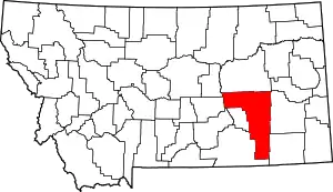 Rosebud County map | |
| CDPs | ||
| Other communities | ||
| Indian reservation | ||
| Ghost town | ||
| Footnotes | ‡This populated place also has portions in an adjacent county or counties | |
| ||
This article is issued from Wikipedia. The text is licensed under Creative Commons - Attribution - Sharealike. Additional terms may apply for the media files.