Road signs in Malaysia
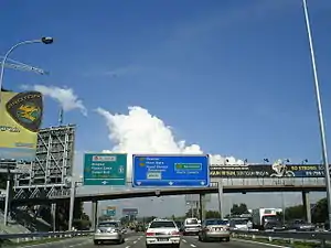
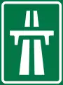
Road signs in Malaysia are standardised road signs similar to those used in Europe but with certain distinctions. Until the early 1980s, Malaysia closely followed Australian, Irish and Japanese practice in road sign design, with diamond-shaped warning signs and circular restrictive signs to regulate traffic. Signs usually use the FHWA Series fonts (Highway Gothic) typeface also used in the United States, Canada, and Australia, as well as New Zealand, although some signs on recently completed expressways use Transport Heavy (cf. the second image shown to the right). However, the new format signs use a font specially designed for the Malaysian Highway Authority (LLM). The font is called LLM Lettering. It has two type of typefaces, LLM Narrow and LLM Normal.
Malaysian traffic signs use Bahasa Malaysia (Malay), the official and national language in Malaysia. However, English is also used for important public places such as tourist attractions, airports, railway stations and immigration checkpoints. Both Malay and English are used in the road signs that are located along the Pengerang Highway (Federal Route ![]() ), which links Kota Tinggi to Sungai Rengit in Johor state and Genting Sempah-Genting Highlands Highway which links Genting Sempah to Genting Highlands, which also have Chinese and Tamil on signs.
), which links Kota Tinggi to Sungai Rengit in Johor state and Genting Sempah-Genting Highlands Highway which links Genting Sempah to Genting Highlands, which also have Chinese and Tamil on signs.
There are four major types of road signs in Malaysia. First is Warning Signs (Tanda Amaran), second is Prohibition Signs (Tanda Larangan), third is Mandatory Signs (Tanda Wajib) and fourth is Information Signs (Tanda Maklumat).[1]
According to the road category under 333 Act, the Malaysian Road Transport Act 1987, chapter 67, blue traffic signs are used for federal, state and municipal roads. Green signs are used for toll expressways or highways only.
Route numbers
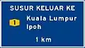
Expressway
Expressways use letters E-- (Example: ![]() )
)
| Examples | Information | Number digits |
|---|---|---|
| Expressway route numbers | E01 – E99 | |
| EXIT 253 EXIT 1108 | Expressway exit numbers | EXIT 201 – EXIT 299 EXIT 1101 – 1199 |
Federal
Federal Roads only use numbers and digits, for example Federal Route 1 (Example: ![]() ). However, federal road numbers can also be added with the FT— prefix before the route number, which is normally used by the Malaysian Public Works Department (JKR) and the Royal Malaysia Police. For example, Federal Route 1 can also be written as Federal Route FT1.[2] There are also service roads off of main federal roads that use letters after its main route (Example:
). However, federal road numbers can also be added with the FT— prefix before the route number, which is normally used by the Malaysian Public Works Department (JKR) and the Royal Malaysia Police. For example, Federal Route 1 can also be written as Federal Route FT1.[2] There are also service roads off of main federal roads that use letters after its main route (Example: ![]() ).
).
| Examples | Information | Number digits |
|---|---|---|
| Main federal route numbers | 001–249 | |
| Institutional facilities federal roads | 250–479 | |
| EXIT 1 EXIT 226 | Federal road exit numbers | EXIT 1 – EXIT 99 EXIT 201 – 299 |
| Main federal route numbers (Sarawak) | 1-1 – 1–59 4-1 – 4–99 1000 – 9999 | |
| Main federal route numbers (Sabah) | A01 – A99 | |
| Main federal route numbers (Labuan) | 700–799 | |
| FELDA/FELCRA federal route numbers | 1000 – 1999 2000 – 2999 | |
| Industrial federal route numbers | 3000 – 3999 | |
| Service road numbers | --A – --Z |
State
State roads use letters that correspond to each state. (refer here for state letter codes/plate numbers)
| Examples | Information | Number digits |
|---|---|---|
| Johor state route numbers | J001 – J999 | |
| Selangor state route numbers | B001 – B999 | |
| Negeri Sembilan state route numbers | N001 – N999 | |
| Sabah state route numbers | SA001 – SA999 | |
| Perak state route numbers | A001 - A999 | |
| Pahang state route numbers | C001 - C999 | |
| Kelantan state route numbers | D001 - D999 | |
| Kedah state route numbers | K001 - K999 | |
| Melaka state route numbers | M001 - M999 | |
| Pulau Pinang state route numbers | P001 - P999 | |
| Terengganu state route numbers | T001 - T999 | |
| Perlis state route numbers | P001 - P999 | |
| Sarawak state route numbers | Q001 - Q999
Q1000 - Q9999 |
 Federal roads route code shield
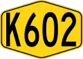 State roads route code shield
 Expressway (toll road) route code shield
 Service road route code shield
 Local authority route code shield
Road signs
Prohibitory signs
Malaysian prohibitory signs are round with white backgrounds, red borders, and black pictograms. The exceptions are the stop sign and the give way sign.
 Stop sign
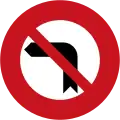 Left turn not allowed
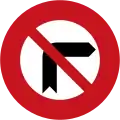 Right turn not allowed
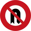 U-turn turn not allowed
 No entry
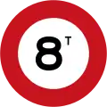 Vehicles exceeding 8 tonnes prohibited
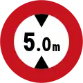 Height limit 5 metres
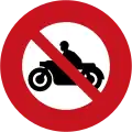 No motorbikes allowed
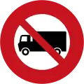 No trucks allowed
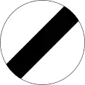 Speed limit ends
 No parking or waiting
 Stopping not allowed
 No use of the vehicle horn
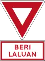 Give way
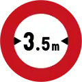 Width limit 3.5 metres
 Mandatory stop, children crossing
 No slow moving vehicles
 No overtaking
 No overtaking for heavy vehicles
 Heavy vehicles prohibited in the right lane
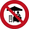 No hawking
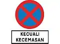 No Stopping except in an emergency
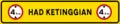 Height limit gantry
Mandatory signs
Mandatory instruction signs are round with blue backgrounds and white pictogram.
 Follow arrow direction (left)
 Follow arrow direction (right)
 Follow arrow direction (go straight)
 Follow arrow direction (go straight or turn left)
 Follow arrow direction (go straight or turn right)
 Bicycle lane
 Tricycle lane
 Motorbike lane
 Pass onto the left
 Pass onto the right
 Pass onto either side
 Motorbike lane on the left
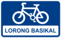 Bicycle lane (Rectangular)[3]
Speed limit signs
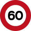 Speed limit
- Speed limit ends
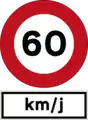 Speed limit
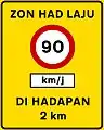 Speed limit zone
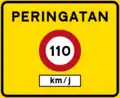 Speed limit reminder
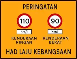 National speed limit reminder
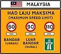 Malaysia speed limit at border crossing (Type 1)
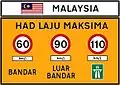 Malaysia speed limit at border crossing (Type 2)
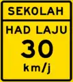 School zone speed limit
Warning signs
Malaysian warning signs are diamond-shaped and are yellow and black in colour.
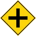 Crossroad, 4-way junction ahead
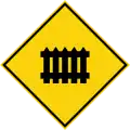 Railroad crossing ahead with barrier
 Steep descend
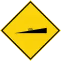 Steep climb
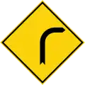 Bend to the right
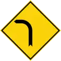 Bend to the left
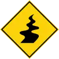 Winding road
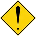 Danger ahead
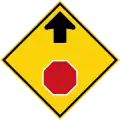 Stop ahead
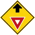 Give way sign ahead
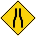 Road narrows on both sides ahead
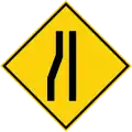 Road narrows ahead from the left
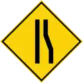 Road narrows ahead from the right
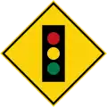 Traffic light ahead
 Obstruction
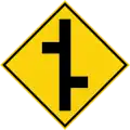 Staggered junctions ahead, first on the right
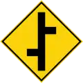 Staggered junctions ahead, first on the left
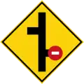 Staggered junctions ahead, no entry on first right junction
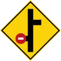 Staggered junctions ahead, no entry on first left junction
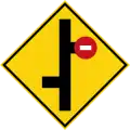 Staggered junctions ahead, no entry on second right junction
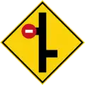 Staggered junctions ahead, no entry on second left junction
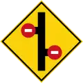 Staggered junctions ahead, first on the right
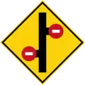 Staggered junctions ahead, no entry
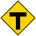 T-junction ahead
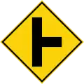 Side road junction ahead on the right
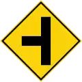 Side road junction ahead on the left
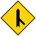 Merging traffic ahead on the right
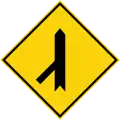 Merging traffic ahead on the left
 Danger of falling rocks or landslides ahead
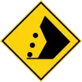 Danger of falling rocks or landslides ahead
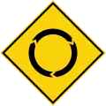 Roundabout ahead
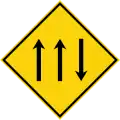 Climbling lane
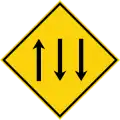 Climbing lane on opposite direction
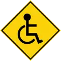 Disabled pedestrian crossing ahead
 Narrow bridge ahead
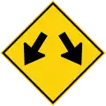 Diverge
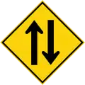 Two-way traffic ahead
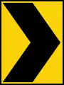 Chevron to the left
 Chevron to the right
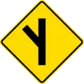 Exit to the left
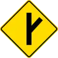 Exit to the right
 Y-shaped road intersection
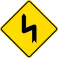 Double bend To the Left
 Double bend To the Right
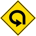 Spiral loop
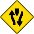 Divided road begins
 Divided road ends
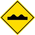 Uneven road
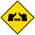 Drawbridge
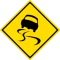 Slippery road
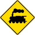 Level crossing without barrier ahead
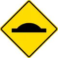 Road hump
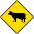 Animals crossing area
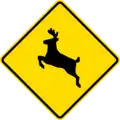 Wild animal crossing area
 Crosswind area
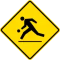 Playground area
 Pedestrian crossing for blind people ahead
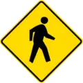 Pedestrian crossing
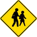 School pedestrian crossing
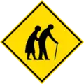 Elderly pedestrian crossing ahead
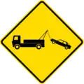 Towing zone
 Obstacles
 Junction sign, turn right or left
 Caution! Accident Area sign
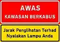 Fog area warning sign, limited visibility - switch on headlamps sign
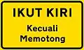 Use left lane unless overtaking
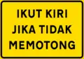 Use left lane if not overtaking
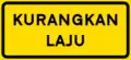 Reduce speed
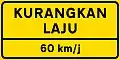 Reduce speed sign, with speed limit
 Heavy vehicles use left lane
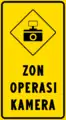 Speed trap camera (AES) enforcement zone
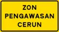 Slope supervision zone
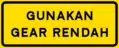 Use low gear
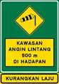 Crosswind area 500 meters ahead
.png.webp) High voltage area ahead (Option 1, used for electrical substation)
High voltage area ahead (Option 1, used for electrical substation).png.webp) High voltage lines ahead (Option 2, used for electrified level crossing, with maximum height limit plate)
High voltage lines ahead (Option 2, used for electrified level crossing, with maximum height limit plate)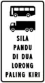 Heavy vehicles, please use two leftmost lanes
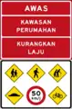 Residential area warning sign (usually found in Klang Valley)
Construction/Temporary signs
The construction signs in Malaysia are diamond-shaped and are orange and black in colour.
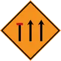 Left lane closed ahead
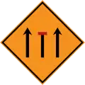 Centre lane closed ahead
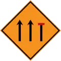 Right lane closed ahead
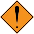 Danger ahead
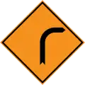 Bend to the left
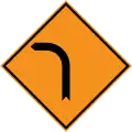 Bend to the Right
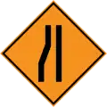 Road narrows ahead from the left
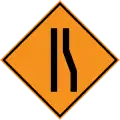 Road narrows ahead from the right
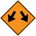 Diverge
 Chevron to the left
 Chevron to the Right
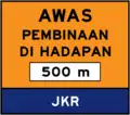 Construction Ahead sign within 500 m
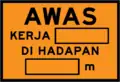 Caution works ahead
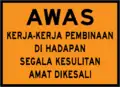 Caution construction works ahead
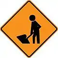 Roadworks Ahead
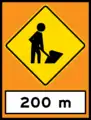 Road Work sign with 200m
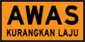 Caution, Reduce Speed
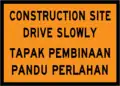 Construction site drive slowly
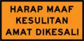 Sorry for inconvenience caused
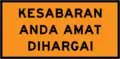 Your cooperation and patience is very appreciated
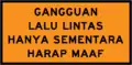 Traffic blockage is only temporary
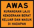 Caution heavy vehicles entering and exiting construction zone ahead
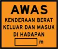 Caution heavy vehicles entering and exiting construction zone ahead, with distance
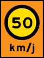 Temporary speed limit sign
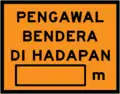 Flagman ahead
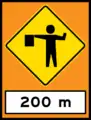 Flagman sign with 200m
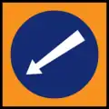 Pass onto the left
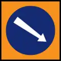 Pass onto the right
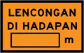 Detour ahead
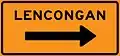 Detour, follow arrow
 Detour to the left sign
 Detour to the right sign
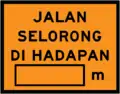 One lane road ahead
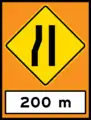 Temporary narrow roads on the left sign
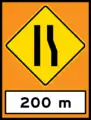 Temporary narrow roads on the right sign
 Right lane closed
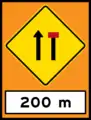 Right lane closed sign
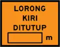 Left lane closed
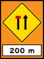 Left lane closed sign
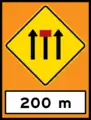 Centre lane closed sign
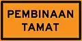 End of construction
Guide signs
Malaysian information signs are blue.
 First aid/hospital sign (Option 1)
 Hospital sign (Option 2)
 Dead end road
 U-turn
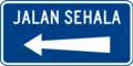 One way street
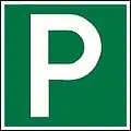 Layby logo
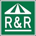 Rest and Service Area (found at toll expressways)
 Rest and Service Area (found at no-tolled highways/major trunk roads)
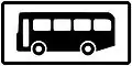 Bus Stop
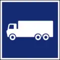 Truck stop
.jpg.webp) Restaurant
Restaurant Fruit stall
.jpg.webp) Disabled (OKU) parking
Disabled (OKU) parking.svg.png.webp) Toilet
Toilet.jpg.webp) Petrol Station
Petrol Station.jpg.webp) Surau / Mosque
Surau / Mosque.jpg.webp) Jetty
Jetty Pier
Pier.jpg.webp) Emergency Telephone
Emergency Telephone.jpg.webp) Parking
Parking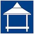 Wakaf (hut)
.jpg.webp) Information Centre
Information Centre.jpg.webp) Repair shop
Repair shop.jpg.webp) ATM
ATM.png.webp) Touch 'n Go purchase and reload facilities
Touch 'n Go purchase and reload facilities Money Changer
 Wi-Fi Hotspot
.jpg.webp) Airport
Airport
Old format
- First aid
.jpg.webp) Hospital
Hospital Old rest and service area logo (usually found at major trunk roads)
 Old rest and service area logo (usually found at majortrunk roads)
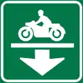
Motorcycle lane
Malaysian motorcycle lane signs are blue.
- Motorcycle lane entrance
 Motorcycle lane gantry sign
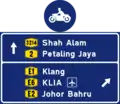 Motorcycle lane directions sign
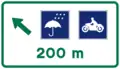 Rain shelter for motorcycles, 200 meters ahead
 Rain shelter for motorcycles pull-in
Tolled Expressway and Highway signs
Malaysian toll expressway and highway signs are green and are only suitable for toll expressways and highways managed by Malaysian Highway Authority (LLM).
- JKR hexagon-shaped highway shield with expressway/highway code signs are black and yellow.
- Green with white signs for major destinations.
 Symbol of the Malaysian Expressways
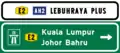 Direction to expressway with expressway name
 Direction to expressway
 To expressway direction
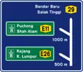 Entrance to the toll expressway from non-tolled highway
 White with black letters signs for expressway names of closed toll systems
 Yellow with black letters signs for expressway names of opened toll systems
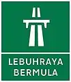 Start of Expressway
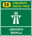 Start of expressway with name of expressway
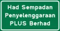 Expressway maintenance border limit (Option 1)
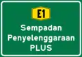 Expressway maintenance border limit (Option 2)
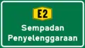 Expressway maintenance border limit (Option 3)
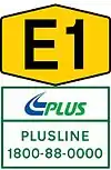 Malaysian expressway shield with highway concessionaire logo and highway hotline number
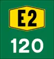 Driver location signs kilometer markers
 Driver location signs hectometer markers
 Driver location signs interchange hectometer markers
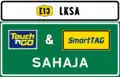 This expressway accepts electronic toll collections (ETC) only
.png.webp) This toll plaza accepts Electronic Toll Collections (ETC) only (Note: Batu Tiga Toll Plaza was demolished in 2017)
This toll plaza accepts Electronic Toll Collections (ETC) only (Note: Batu Tiga Toll Plaza was demolished in 2017)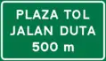 Toll plaza ahead in 500 meters with its name
 Keep your lane
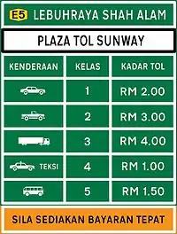 Toll fare rates list
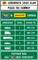 Toll rates rates list (electronic toll collection (ETC) only)
- Motocycle entry lane on expressway signs
 Touch 'n Go lane
 Touch 'n Go reload lane
 SmartTAG lane
 RFID sign
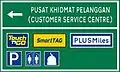 Customer Service Centre sign, usually found at toll plaza
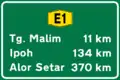 Expressway distance sign
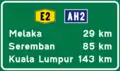 Expressway distance sign with Asian Highway route shield
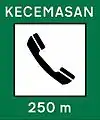 Emergency signs with SOS logo
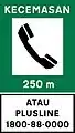 Emergency SOS sign with highway hotline number
 SOS nearby signs, usually found at road barrier
- Shelter for motorcycles, 200 meters away
- Shelter for motorcycles on the left
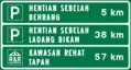 Layby and Rest and Service Area distance sign
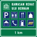 Rest and Service area 1 kilometer away
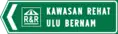 R&R entry
 Overhead Bridge Restaurant (OBR) entry sign
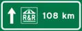 Next R&R signs, usually found after R&R
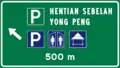 Layby sign
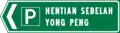 Layby entry
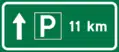 Next layby signs, usually found after Layby
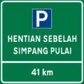 Next Layby/R&R signs, usually found near the entrance of Layby/R&R.
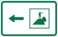 Direction to Vista Point
 Vista Point sign
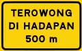 Tunnel 500 meters ahead
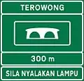 Tunnel ahead, please turn on headlights
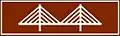 Penang Bridge logo
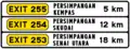 Next interchange exit sign
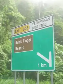
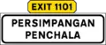 Name of interchange including exit signs (Usually found on expressways in urban areas)
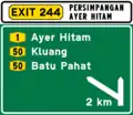 Exit 2 kilometers away
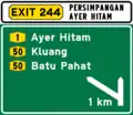 Exit 1 kilometer away
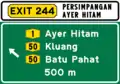 Exit 500 meters away
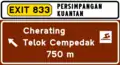 Expressway tourist exit sign
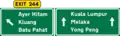 Gantry signs:- Exit approaching
 Exit to the left sign
 Gantry sign:- Expressway interchange 2 kilometers away
 Gantry sign:- Expressway interchange 1 kilometer away
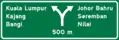 Gantry sign:- Expressway interchange 500 meters away
 Gantry sign:- Expressway interchange 250 meters away
 Gantry exit signs
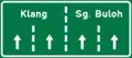 Direction lanes
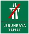 End of Expressway
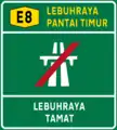 End of expressway with name of expressway
Old format
 Old interchange sign
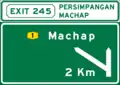 Old interchange sign with exit number
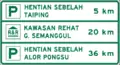 Old next parking and rest and service area signs
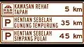 Old next parking and rest service area signs (Note: Gua Tempurung between Sungai Perak & Simpang Pulai Lay-By did not exist anymore because it was destroyed in 1996 after a landslide incident)
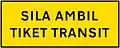 Please take a transit ticket sign (Note: transit ticket systems are no longer used on closed toll expressways)
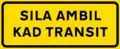 Please take a transit card sign (Note: transit ticket systems are no longer used on closed toll expressways)
Non-tolled Federal, State and Municipal Roads
Malaysian road signs are blue and used for federal, state and municipal roads.
- Blue with white letters signs for major destinations
- Maroon with white letters signs for recreational places/tourist spot
- Blue with yellow letters signs for street names
- White with green letters signs for spesific places/buildings
- Green with yellow letters signs for government buildings/institution
- White with blue letters signs for residential area
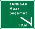
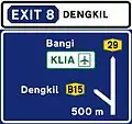 Highway interchange directional sign with exit number
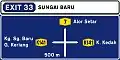 4-way intersection directional sign with exit number
 3-way intersection directional signs ahead
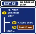 3-way intersection directional sign with exit number (1000 metres)
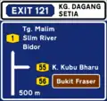 3-way intersection directional sign with exit number (500 metres)
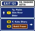 3-way intersection directional sign with exit number (100 metres)
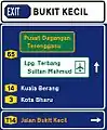 3-way intersection directional sign including institution facilities with exit number (100 metres)
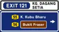 3-way intersection exit sign
 Route number direction sign
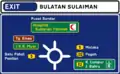 4-way roundabout directional sign with exit number
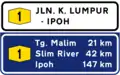 Federal Road distance sign with road name
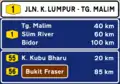 Federal Road distance sign with road name and other major road
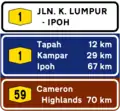 Federal Road distance sign with road name and tourist destination
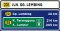 Federal Road distance sign with road name and route to expressway
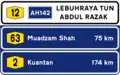 Federal Road distance sign with road name and Asian Highway route shield
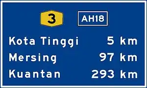 Federal Road distance sign with Asian Highway route shield
 Primary milestones
 Secondary milestones
 Name of roads - gantry sign
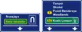 Federal Route gantry sign
 Airport gantry sign
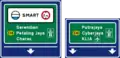 Gantry sign towards SMART tunnel
 4-way intersection directions to town centre
 White with Black letters for exit signs
 Road name signs with route shield (local authority)
 Road name signs with route shield (JKR federal routes)
 Kilometre markers for federal roads, usually found on non-tolled highways
 Hectometre markers for federal roads, usually found on non-tolled highways
.png.webp) Emergency phone in 250 metres sign on federal roads, mostly found on non-tolled highways and main roads
Emergency phone in 250 metres sign on federal roads, mostly found on non-tolled highways and main roads
Old format
 Exit to next destinations (usually for highways)
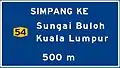 Intersection to next destinations (usually for trunk roads)
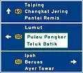 4-way intersection directions
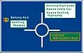 4-way roundabout directions
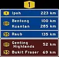 Places distance
Asian Highway route signs
As part of the Asian Highway Network.
.jpg.webp) Asian Highway route shield
Asian Highway route shield- Expressway distance sign with Asian Highway route shield
- Federal Road distance sign with Asian Highway route shield
- Federal Road distance sign with road name and Asian Highway route shield
Border signs
Border signs in Malaysia are green for international and state and blue for district.
International border signs
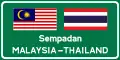 International border signboard
State border signs
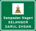 Selangor state border signboard
 Federal Territory of Kuala Lumpur border signboard
District border signs
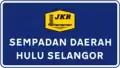 Hulu Selangor district border signboard with JKR logo
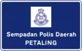 Petaling police district border signboard with Royal Malaysia Police logo.
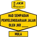 Malaysian Public Works Department (JKR) Maintenance Border Limit (Starts here)
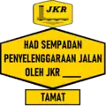 Malaysian Public Works Department (JKR) Maintenance Border Limit (Ends here)
Important signs
These are other important signs in Malaysia such as government institutions and tourist destinations.
- White with black letters for towns and other settlements.
- Green with orange letters for government institutions.
- White with green letters and Maroon with white letters for tourist destinations.
 Entering town and settlements signs
 Government institutions (option 1)
 Government institutions (option 2)
 Tourist destinations (option 1)
 Tourist destinations (option 2)
 Industrial area direction sign
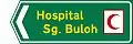 Hospital direction sign
 Hotel direction sign
 Commercial centre direction sign
 University direction sign
 Golf course direction sign
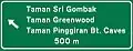 Townships direction sign
 Housing estate/neighbourhood sign
 Public transportation name signs
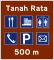 Tourist spot by 500 m signs
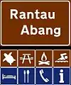 Tourist spot signs
Tourist spot signs
Malaysian tourist spot signs are maroon.
.jpg.webp)
.jpg.webp)
.jpg.webp)


Weighing bridge signs
There is also a signs for weighing bridge.
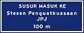 Entry to Weighing bridge
 Malaysian Road Transport Department (JPJ) Enforcement Station entry sign
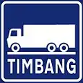 Weighing bridge symbol
Road name sign
Road name sign in Malaysia have many different colours and styles according the local authority to design with them.
 Blue with orange letters for road names. This signs usually found at Kuala Lumpur.
 Blue with orange letters for road names with highway shield.
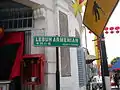 A bilingual (Malay/Chinese) road sign in George Town, Penang which is under the authority of the Penang Island City Council (MBPP).
 A dual language (Malay/Chinese) road sign in Kuching, Sarawak under the authority of the Kuching South City Council (MBKS).
Road markings
Road markings in Malaysia primarily use thermoplastic and are white. Yellow markings are usually for road shoulders, construction or temporary markings and parking.[4]
Construction/temporary road markings are similar but in yellow.
Centre lines
Centre lines divide the road into either direction.
 Standard road centre line on urban and residential roads.
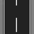 Standard road centre line on federal roads.
 Strictly no overtaking center line.
 Overtaking is allowed with caution centre line, opposite direction cannot overtake.
 Overtaking not allowed, only opposite direction can overtake centre line.
Edge lines
Edge lines are located at the edges of a road, whether there is a median or pavement or not.
 Standard roadside edge line.
 No parking on roadside edge line.
 Opening on roadside edge line (building entrances, etc.)
 Strictly no parking or stopping on roadside edge line
Lane dividers
Lane dividers divide road into lanes according to its designated width.
_and_urban_or_residential_roads.png.webp) Standard lane divider on highways (JKR R5) and urban/residential roads.
Standard lane divider on highways (JKR R5) and urban/residential roads._and_federal_roads.png.webp) Standard lane divider on highways (JKR R6) and federal roads.
Standard lane divider on highways (JKR R6) and federal roads.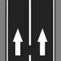 Overtaking and changing lanes not encouraged lane divider.
Directional markings
Directional marking consists of arrows and lettering on the road.
 Straight arrow
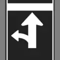 Straight or turn left arrow
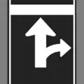 Straight or turn right arrow
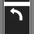 Turn left arrow
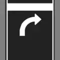 Turn right arrow
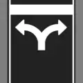 Turn left or right arrow
 Straight or turn left or right arrow
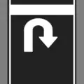 U-Turn arrow
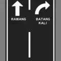 Junction direction lettering with arrow (Option 1)
 Junction direction lettering with arrow and route code (Option 2)
Other type road markings
_lettering.png.webp) AWAS (Caution) lettering
AWAS (Caution) lettering_lettering.png.webp) PERLAHAN (slow down) lettering
PERLAHAN (slow down) lettering Bus lane divider
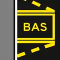 Bus stop
 Taxi stand
 Give way
 Transverse rumble strip (usually placed before junctions, toll plaza or high density areas)
 Shoulder rumble strips (usually placed on highways at very hazardous areas)
 Touch n Go marker (at toll plazas)
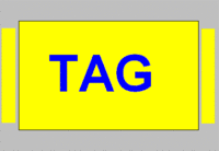 SmartTAG marker (at toll plazas)
 RFIDTag (also known as MyRFID) marker (at toll plazas)
Miscellaneous
Bridge-related signs
These signs usually found at the bridge.
 Bridge numbers.
River signs
These signs usually found at the bridge.
 River sign with Department of Irrigation and Drainage (Jabatan Pengairan Dan Saliran) logo
 River sign (option 1)
 River sign (option 2)
Highway concessionaires border limit
Many expressways/highways has a border limit.
Traffic Light codes
Many traffic lights have codes in them.
Kuala Lumpur
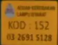 A normal traffic light code in Kuala Lumpur.
 An old traffic light code in Kuala Lumpur.
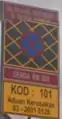 An old criss-cross section with traffic lights that is no longer used.
Gallery
 Malaysian expressway exit signs.
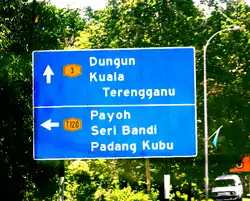 A direction signboard on Federal Route 3 in Terengganu.
 A typical road sign in Kuala Lumpur, with yellow letters for major thoroughfares and green letters on white background for parks and locations of interests. Smaller signs below it show directions for pedestrians and tourists.
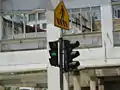 A typical crosswalk traffic signal in Kuala Lumpur with a countdown display and a crosswalk sign above it.
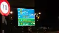 A road sign near Jalan Yam Tuan, Seremban with yellow letters for major roads and green letters on green signs for hospitals and white on green signs for expressways.
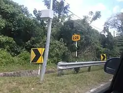 A Federal Route code sign, placed at pole along the road.
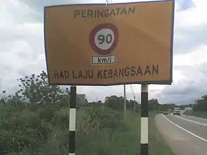 National Speed Limit signboard on Malaysian federal roads.
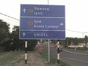 Common state road signboard which is similar to the signboards on federal roads.
 Some road signs in Malaysia are in English, such as this one near Jalan Beringin in Damansara Town Centre, Kuala Lumpur.
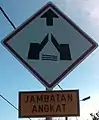 Drawbridge sign in Terengganu
 MyRFID toll booth lane at Gombak Toll Plaza
 A bunch of Malaysian road signs on
 Seremban–Bukit Nenas Highway
See also
References
- Drive in Malaysia
- Maklumat Mengenai Papan Tanda Arah, Destinasi dan Nombor Laluan Jalan Raya Malaysia Archived 19 March 2009 at the Wayback Machine. Jabatan Kerja Raya Malaysia. Retrieved on 23 August 2008.
- "Jalan Ampang, Kuala Lumpur, Federal Territory of Kuala Lumpur". July 2018.
- "JKR Road Marking & Delineation". dokumen.tips. Retrieved 18 March 2022.
External links
| Wikimedia Commons has media related to Road signs in Malaysia. |
Road signs in Asia | |
|---|---|
| Sovereign states |
|
| States with limited recognition |
|
| Dependencies and other territories |
|
| |