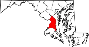
Queensland, Maryland
Queensland is a census-designated place near Upper Marlboro in Prince George's County, Maryland, United States. The population of the CDP was 2,191 at the 2020 census.[2] It was formerly known as Queenland until 2014 when its name was changed to Queensland[3][4] and a small portion of its geography was transferred to Upper Marlboro.[5][6]
Queenland, Maryland | |
|---|---|
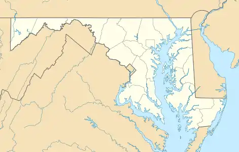 Queenland, Maryland Location within the state of Maryland  Queenland, Maryland Queenland, Maryland (the United States) | |
| Coordinates: 38°48′18″N 76°47′28″W | |
| Country | |
| State | |
| County | |
| Area | |
| • Total | 4.74 sq mi (12.27 km2) |
| • Land | 4.73 sq mi (12.25 km2) |
| • Water | 0.01 sq mi (0.02 km2) |
| Elevation | 120 ft (40 m) |
| Population (2020) | |
| • Total | 2,191 |
| • Density | 463.21/sq mi (178.86/km2) |
| Time zone | UTC−5 (Eastern (EST)) |
| • Summer (DST) | UTC−4 (EDT) |
| Area code(s) | 301, 240 |
| FIPS code | 24-64568 |
Geography
According to the U.S. Census Bureau as of 2010, Queenland has a total area of 4.9 square miles (12.6 km2), of which 0.012 square miles (0.03 km2), or 0.26%, is water.[7]
The CDP is bordered to the north by Maryland Route 4, to the south and east by U.S. Route 301, and to the west by Marlboro Pike and South Osborne Road. The CDPs of Westphalia, Marlboro Village, and Brock Hall border Queensland to the north, Croom is to the southeast, Marlton is to the south, and Rosaryville is to the southwest.
Demographics
| Historical population | |||
|---|---|---|---|
| Census | Pop. | %± | |
| 2010 | 1,929 | — | |
| 2020 | 2,191 | 13.6% | |
| U.S. Decennial Census[8] 2020[9] The CDP was known as Queenland at the 2010 Census | |||
2020 census
| Race / Ethnicity | Pop 2020[9] | % 2020 |
|---|---|---|
| White alone (NH) | 296 | 13.51% |
| Black or African American alone (NH) | 1,593 | 72.71% |
| Native American or Alaska Native alone (NH) | 13 | 0.59% |
| Asian alone (NH) | 27 | 1.23% |
| Pacific Islander alone (NH) | 0 | 0.00% |
| Some Other Race alone (NH) | 22 | 1.00% |
| Mixed Race/Multi-Racial (NH) | 95 | 4.34% |
| Hispanic or Latino (any race) | 145 | 6.62% |
| Total | 2,191 | 100.00% |
Note: the US Census treats Hispanic/Latino as an ethnic category. This table excludes Latinos from the racial categories and assigns them to a separate category. Hispanics/Latinos can be of any race.
Education
Prince George's County Public Schools operates public schools serving the census-designated place. Most of the CDP is zoned to Marlton Elementary School, with a section instead zoned to Melwood Elementary School.[10]
Residents are zoned to James Madison Middle School,[11] and Dr. Henry A Wise, Jr. High School.[12]
References
- "2020 U.S. Gazetteer Files". United States Census Bureau. Retrieved April 26, 2022.
- "Queensland CDP, Maryland". United States Census Bureau. Retrieved March 13, 2022.
- "B03002 HISPANIC OR LATINO ORIGIN BY RACE - Queensland CDP, Maryland - 2014 American Community Survey 5-Year Estimates". U.S. Census Bureau. July 1, 2014.
- "B03002 HISPANIC OR LATINO ORIGIN BY RACE - Queenland CDP, Maryland - 2013 American Community Survey 5-Year Estimates". U.S. Census Bureau. July 1, 2013.
- "2010 CENSUS - CENSUS BLOCK MAP: Queenland CDP, MD." U.S. Census Bureau
- "2020 CENSUS - CENSUS BLOCK MAP: Queensland CDP, MD." U.S. Census Bureau
- "Geographic Identifiers: 2010 Demographic Profile Data (G001): Queenland CDP, Maryland". United States Census Bureau. Retrieved December 16, 2011.
- "Decennial Census of Population and Housing by Decades". US Census Bureau.
- "P2 HISPANIC OR LATINO, AND NOT HISPANIC OR LATINO BY RACE - 2020: DEC Redistricting Data (PL 94-171) - Queensland CDP, Maryland". United States Census Bureau.
- "NEIGHBORHOOD ELEMENTARY SCHOOLS AND BOUNDARIES SCHOOL YEAR 2018-2019." Prince George's County Public Schools. Retrieved on August 26, 2018.
- "NEIGHBORHOOD MIDDLE SCHOOLS AND BOUNDARIES SCHOOL YEAR 2018-2019." Prince George's County Public Schools. Retrieved on August 26, 2018.
- "NEIGHBORHOOD HIGH SCHOOLS AND BOUNDARIES SCHOOL YEAR 2018-2019." Prince George's County Public Schools. Retrieved on August 26, 2018.
| Wikimedia Commons has media related to Queenland, Maryland. |