Py Point
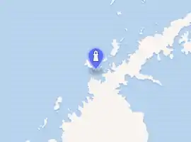
Py Point (64°53′S 63°37′W) is a point forming the south extremity of Doumer Island, in the Palmer Archipelago. Discovered by the French Antarctic Expedition, 1903–05, and named by Charcot for Monsieur Py, president of the French Chamber of Commerce in Buenos Aires at that time.
 | |
| Location | Doumer Island, Palmer Archipelago |
|---|---|
| Coordinates | 64°52′33″S 63°35′02″W |
| Tower | |
| Foundation | concrete base |
| Construction | metal skeletal tower |
| Height | 11 m (36 ft) |
| Shape | square pyramidal tower[1][2] |
| Markings | red |
| Power source | solar power |
| Operator | Instituto Antártico Chileno |
| Light | |
| Focal height | 71 m (233 ft) |
| Range | 5 nmi (9.3 km; 5.8 mi) |
| Characteristic | Fl W 5s |
See also
References
- List of Lights, Pub. 111: The West Coasts of North and South America (Excluding Continental U.S.A. and Hawaii), Australia, Tasmania, New Zealand, and the Islands of the North and South Pacific Oceans (PDF). List of Lights. United States National Geospatial-Intelligence Agency. 2017.
- Rowlett, Russ. "Lighthouses of Antarctica". The Lighthouse Directory. University of North Carolina at Chapel Hill. Retrieved 24 May 2017.
![]() This article incorporates public domain material from the United States Geological Survey document: "Py Point". (content from the Geographic Names Information System)
This article incorporates public domain material from the United States Geological Survey document: "Py Point". (content from the Geographic Names Information System)
This article is issued from Wikipedia. The text is licensed under Creative Commons - Attribution - Sharealike. Additional terms may apply for the media files.