Purbalingga Regency
Purbalingga Regency (Javanese: ꦥꦸꦂꦧꦭꦶꦁꦒ) is an inland regency (Indonesian: kabupaten) in the southwestern part of Central Java province in Indonesia. Purbalingga Regency has an area of 777.64 km² and population of 848,952 at the 2010 Census[2] and 998,561 at the 2020 Census, comprising 505,281 male and 493,280 female inhabitants.[3] The administrative capital is the town of Purbalingga
Purbalingga | |
|---|---|
| Purbalingga Regency Kabupaten Purbalingga | |
| Other transcription(s) | |
| • Javanese | ꦥꦸꦂꦧꦭꦶꦁꦒ |
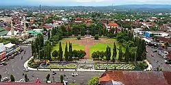 Alun-alun Purbalingga | |
 Coat of arms | |
| Nickname(s): Kota Perwira | |
| Motto(s): Prasetyaning Nayaka Amangun Praja | |
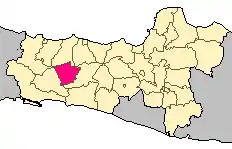 Location of Purbalingga Regency in Central Java | |
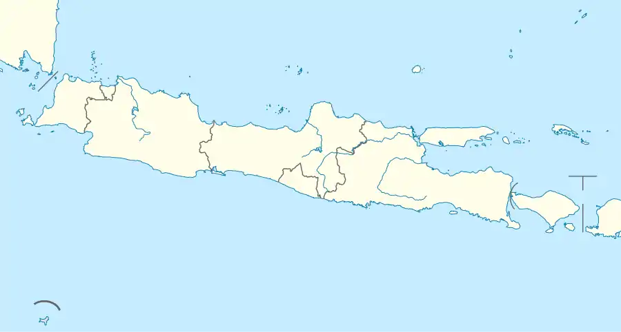 Purbalingga Location in Java 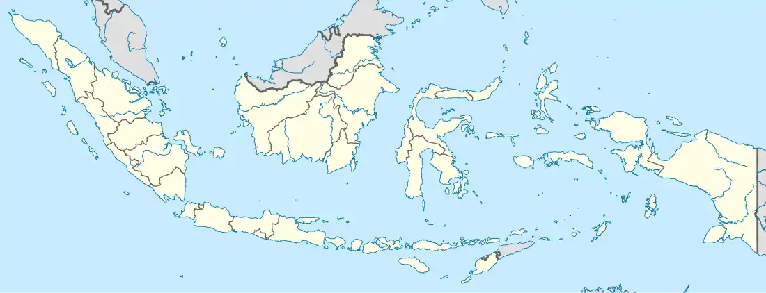 Purbalingga Location in Indonesia | |
| Coordinates: 7°17′0″S 109°21′0″E | |
| Country | Indonesia |
| Province | Central Java |
| Capital | Purbalingga |
| Government | |
| • Regent | Dyah Hayuning Pratiwi SE, B.Econ |
| • Vice Regent | Sudono |
| Area | |
| • Total | 777.64 km2 (300.25 sq mi) |
| Population (2020 Census)[1] | |
| • Total | 998,561 |
| • Density | 1,300/km2 (3,300/sq mi) |
| Time zone | UTC+7 (WIB) |
| Area code(s) | +62 281 |
| Website | purbalinggakab.go.id |
Etymology
The term Purbalinga comes from the Sanskrit root words of Hindu origin, purba (east) and linga (an abstract representation of Hindu deity Lord Shiva), thus meaning the Lord Shiva of East. This reflects the historic origin of the place that the Srivijaya-era or earlier founders of the place had built a Hindu temple of the Lord Shiva here in whose honor the place was named by the founder ruling dynasty.
History
Purbalingga is steeped in the ancient history of the Hindu empires of the Srivijaya and Majapahit era, with several following extant ancient Hindu temples scattered in and around the regency:[4]
- in Tegal Regency
- Pura Caraka Dewa, Margo Padang, Tarub, Tegal.
- Pura Segara Suci, Jalan Timor Timur, Martologo, Tegal.
- Nearby in Cirebon Regency
- Pura Agung Jati Permana, Jalan Bali, No. 4, Cirebon.
- Pura Jati Permana, Desa Larangan, Rt 3/4, Harjomukti, Cirebon.
- Pura Jati Pramana, Jalan Ciremai Raya, Cirebon.
Administrative districts
Purbalingga Regency comprises eighteen districts (kecamatan), tabulated below with their areas and their populations at the 2010 Census[5] and the 2020 Census.[6] The table also includes the number of administrative villages (rural desa and urban kelurahan) in each district and its post code.
| District | Area in km2 | Population 2010 Census | Population 2020 Census | Number of Villages | Post code |
|---|---|---|---|---|---|
| Kemangkon | 45.13 | 52,260 | 63,622 | 19 | 53381 |
| Bukateja | 42.40 | 65,381 | 78,114 | 14 | 53382 |
| Kejobong | 39.99 | 42,237 | 50,738 | 13 | 53392 (a) |
| Pengadegan | 41.75 | 33,249 | 41,046 | 9 | 53393 |
| Kaligondang | 50.54 | 55,343 | 65,548 | 18 | 53391 (b) |
| Purbalingga (town) | 14.72 | 55,615 | 57,580 | 13 | 53311 -53319 |
| Kalimanah | 22.51 | 49,347 | 57,667 | 17 | 53371 (c) |
| Padamara | 17.27 | 38,698 | 46,533 | 14 | 53372 |
| Kutasari | 52.90 | 54,280 | 65,235 | 14 | 53361 |
| Bojongsari | 29.25 | 54,874 | 63,095 | 13 | 53362 |
| Mrebet | 47.89 | 65,042 | 77,869 | 19 | 53352 |
| Bobotsari | 32.28 | 46,593 | 53,319 | 16 | 53353 |
| Karangreja | 74.49 | 39,092 | 46,640 | 7 | 53358 |
| Karangjambu | 46.09 | 23,422 | 28,078 | 6 | 53357 |
| Karanganyar | 30.55 | 34,171 | 40,091 | 13 | 53354 |
| Kertanegara | 38.02 | 30,177 | 36,926 | 11 | 53351 |
| Karangmoncol | 60.27 | 49,790 | 58,543 | 11 | 53355 |
| Rembang | 91.59 | 57,385 | 67,917 | 12 | 53356 |
| Totals | 777.64 | 848,952 | 998,561 | 239 |
Notes: (a) except the village of Timbang, which has a post code of 53314.
(b) except the village of Penaruban, which has a post code of 53331.
(c) except the village of Kalikabong, which has a post code of 53321.
Climate
Purbalingga Regency has a tropical rainforest climate (Af) with moderate rainfall from July to September and heavy to very heavy rainfall from October to June. The following climate data is for the town of Purbalingga.
| Climate data for Purbalingga | |||||||||||||
|---|---|---|---|---|---|---|---|---|---|---|---|---|---|
| Month | Jan | Feb | Mar | Apr | May | Jun | Jul | Aug | Sep | Oct | Nov | Dec | Year |
| Average high °C (°F) | 30.9 (87.6) |
31.1 (88.0) |
31.3 (88.3) |
31.4 (88.5) |
31.1 (88.0) |
30.6 (87.1) |
30.1 (86.2) |
30.4 (86.7) |
30.9 (87.6) |
31.4 (88.5) |
31.0 (87.8) |
30.9 (87.6) |
30.9 (87.7) |
| Daily mean °C (°F) | 26.6 (79.9) |
26.7 (80.1) |
26.9 (80.4) |
27.1 (80.8) |
26.8 (80.2) |
25.9 (78.6) |
25.2 (77.4) |
25.4 (77.7) |
26.0 (78.8) |
26.6 (79.9) |
26.7 (80.1) |
26.7 (80.1) |
26.4 (79.5) |
| Average low °C (°F) | 22.3 (72.1) |
22.4 (72.3) |
22.6 (72.7) |
22.8 (73.0) |
22.5 (72.5) |
21.3 (70.3) |
20.4 (68.7) |
20.5 (68.9) |
21.1 (70.0) |
21.8 (71.2) |
22.5 (72.5) |
22.5 (72.5) |
21.9 (71.4) |
| Average rainfall mm (inches) | 389 (15.3) |
341 (13.4) |
406 (16.0) |
297 (11.7) |
230 (9.1) |
139 (5.5) |
81 (3.2) |
83 (3.3) |
124 (4.9) |
319 (12.6) |
402 (15.8) |
427 (16.8) |
3,238 (127.6) |
| Source: Climate-Data.org[7] | |||||||||||||
Famous people
- Sudirman, General of the Army and the first commander-in-chief of the Indonesian Armed Forces - one of the most prominent national heroes of Indonesia - was born in Bodas Karangjati village, in the district of Rembang, Purbalingga Regency, on 24 January 1916.
- Indro (Warkop), (born 1958), Indonesian comedian and a member of the Indonesian legendary comedy group Warkop.
References
- Badan Pusat Statistik, Jakarta, 2021.
- Biro Pusat Statistik, Jakarta, 2011.
- Badan Pusat Statistik, Jakarta, 2021.
- 2004, "Raditya, Issues 79-83", Manikgeni Dharma Sastra Foundation, p. 21.
- Biro Pusat Statistik, Jakarta, 2011.
- Badan Pusat Statistik, Jakarta, 2021.
- "Climate: Purbalingga". Climate-Data.org. Retrieved 13 November 2020.
External links
| Wikivoyage has a travel guide for Purbalingga. |
- (in Indonesian) Official site of Local Government of Purbalingga Regency
| Wikimedia Commons has media related to Purbalingga Regency. |
Regencies and cities of Central Java | ||
|---|---|---|
Capital: Semarang | ||
| Regencies |  | |
| Cities | ||