Longlands, New Zealand
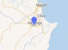
Longlands is a rural community in the Hastings District and Hawke's Bay Region of New Zealand's North Island. The area is on the southern and western outskirts of Hastings city.
Longlands | |
|---|---|
Rural community | |
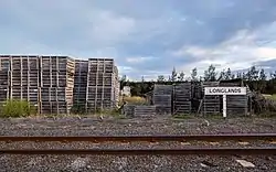 Apple boxes at Longlands | |
 | |
| Coordinates: 39.660°S 176.834°E | |
| Country | New Zealand |
| Region | Hawke's Bay Region |
| Territorial authority | Hastings District |
| Ward | Heretaunga |
| Population (2018)[1] | |
| • Total | 2,253 |
| Postcode(s) | 4172, 4174, 4175, 4178 |
The Longlands Estate occupied much of the land around 1880,[2] but was broken up into smaller farms and a freezing works in the early 20th century.[3][4][5]
The area is a centre for growing fruit and vegetables.[6]
Demographics
| Year | Pop. | ±% p.a. |
|---|---|---|
| 2006 | 2,091 | — |
| 2013 | 2,049 | −0.29% |
| 2018 | 2,253 | +1.92% |
| Source: [1] | ||
Longlands, comprising the statistical areas of Irongate and Longlands-Pukahu, which cover 40 square kilometres and also include Pakipaki, had a population of 2,253 at the 2018 New Zealand census, an increase of 204 people (10.0%) since the 2013 census, and an increase of 162 people (7.7%) since the 2006 census. There were 762 households. There were 1,182 males and 1,074 females, giving a sex ratio of 1.1 males per female, with 426 people (18.9%) aged under 15 years, 366 (16.2%) aged 15 to 29, 1,071 (47.5%) aged 30 to 64, and 396 (17.6%) aged 65 or older.
Ethnicities were 82.3% European/Pākehā, 20.1% Māori, 5.9% Pacific peoples, 2.9% Asian, and 2.3% other ethnicities (totals add to more than 100% since people could identify with multiple ethnicities).
The proportion of people born overseas was 16.6%, compared with 27.1% nationally.
Although some people objected to giving their religion, 46.5% had no religion, 43.8% were Christian, 0.3% were Hindu, 0.1% were Muslim, 0.3% were Buddhist and 3.3% had other religions.
Of those at least 15 years old, 345 (18.9%) people had a bachelor or higher degree, and 309 (16.9%) people had no formal qualifications. The employment status of those at least 15 was that 1,008 (55.2%) people were employed full-time, 318 (17.4%) were part-time, and 39 (2.1%) were unemployed.[1]
| Name | Population | Households | Median age | Median income |
|---|---|---|---|---|
| Irongate | 345 | 93 | 36.9 years | $28,100[7] |
| Longlands-Pukahu | 1,908 | 669 | 46 years | $33,700[8] |
| New Zealand | 37.4 years | $31,800 |
Railway station
Longlands flag station on the Palmerston North–Gisborne Line opened in 1912, after a deputation met the Minister of Railways,[9] following the opening of a sheep and cattle yard in 1911.[10][11] The line through Longlands, from Hastings to Paki Paki, had opened on 1 January 1875,[12] the last works being to complete the bridge over the nearby Irongate Stream, formerly the Ngaruroro River.[13][14] The piles of that bridge sank soon after construction.[15] A shelter shed was built at Longlands in 1905,[11] to the south of Longlands Road.[16] In 1936 Longlands was a main centre for railing cattle.[17] In 1947 frame levers at Longlands tablet locked siding were fitted with chains, staples, and a points lock.[11] The station closed to all traffic on 18 May 1980, but a service siding was retained for about a decade.[12]
References
- "Statistical area 1 dataset for 2018 Census". Statistics New Zealand. March 2020. Irongate (209300) and Longlands-Pukahu (210200).
- "Untitled". Hawke's Bay Herald. 6 September 1880. p. 2.
- "The Meat Industry - A New Freezing Works". Marlborough Express. 2 January 1904. p. 1.
- Fowler, Michael (22 October 2020). "Historic Hawke's Bay: The butcher who owned a freezing works". Hawke's Bay Today.
- "Volume 6. Taranaki, Hawke's Bay and Wellington Provincial Districts". The Cyclopedia of New Zealand. 1908. pp. 474–5.
- Gary Andrews, Heidi Andrews (1996). "Hawke's Bay". Seasonal Work in New Zealand. p. 145. ISBN 9780473032210.
{{cite book}}: CS1 maint: uses authors parameter (link) - 2018 Census place summary: Irongate
- 2018 Census place summary: Longlands-Pukahu
- "FLAG STATION AT LONGLANDS. HASTINGS STANDARD". paperspast.natlib.govt.nz. 7 August 1912. Retrieved 19 July 2021.
{{cite web}}: CS1 maint: url-status (link) - "RAILWAY SIDING AT LONGLANDS. HASTINGS STANDARD". paperspast.natlib.govt.nz. 8 February 1911. Retrieved 19 July 2021.
{{cite web}}: CS1 maint: url-status (link) - "Station Archive". NZR Rolling Stock Lists. Retrieved 10 August 2020.
{{cite web}}: CS1 maint: url-status (link) - Scoble, Juliet (2010). "Names & Opening & Closing Dates of Railway Stations" (PDF). Rail Heritage Trust of New Zealand.
{{cite web}}: CS1 maint: url-status (link) - "Interprovincial News. NEW ZEALAND MAIL". paperspast.natlib.govt.nz. 19 December 1874. Retrieved 19 July 2021.
{{cite web}}: CS1 maint: url-status (link) - "Te Karamū Stream". www.hastingsdc.govt.nz. Retrieved 19 July 2021.
{{cite web}}: CS1 maint: url-status (link) - "NAPIER. AUCKLAND STAR". paperspast.natlib.govt.nz. 20 April 1875. Retrieved 19 July 2021.
{{cite web}}: CS1 maint: url-status (link) - "1:63360 map Sheet: N134 Napier and Hastings". www.mapspast.org.nz. 1943. Retrieved 19 July 2021.
{{cite web}}: CS1 maint: url-status (link) - "HAWKE'S BAY CATTLE. NEW ZEALAND HERALD". paperspast.natlib.govt.nz. 1 October 1936. Retrieved 19 July 2021.
{{cite web}}: CS1 maint: url-status (link) - Yonge, John Roger; Company, Quail Map (1993). New Zealand Railway and Tramway Atlas. Quail Map Company. ISBN 9780900609923.