Port Blandford
Port Blandford is a town in eastern Newfoundland, Newfoundland and Labrador, Canada. It is in Division No. 7 on Clode Sound. The population in 1940 was 539, and increased to 631 by 1956.
Port Blandford | |
|---|---|
Town | |
 Seal | |
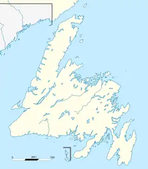 Port Blandford Location of Port Blandford in Newfoundland | |
| Coordinates: 48°21′N 54°10′W | |
| Country | |
| Province | |
| Census division | 7 |
| Area | |
| • Total | 50.56 km2 (19.52 sq mi) |
| Elevation | 39.5 m (129.6 ft) |
| Population (2016) | |
| • Total | 601 |
| • Density | 11.9/km2 (31/sq mi) |
| [1] | |
| Time zone | UTC-3:30 (Newfoundland Time) |
| • Summer (DST) | UTC-2:30 (Newfoundland Daylight) |
| Postal code span | |
| Area code(s) | 709 |
| Highways | |
| Website | www |
Climate
Port Blandford has a humid continental climate typical of the island of Newfoundland. It is wet, snowy, highly seasonal and retains warm summers and cold winter nights coupled with relatively mild winter days.
| Climate data for Port Blandford | |||||||||||||
|---|---|---|---|---|---|---|---|---|---|---|---|---|---|
| Month | Jan | Feb | Mar | Apr | May | Jun | Jul | Aug | Sep | Oct | Nov | Dec | Year |
| Record high °C (°F) | 15.0 (59.0) |
15.5 (59.9) |
19.0 (66.2) |
24.0 (75.2) |
29.5 (85.1) |
32.0 (89.6) |
33.0 (91.4) |
33.0 (91.4) |
32.5 (90.5) |
24.0 (75.2) |
17.5 (63.5) |
14.0 (57.2) |
33.0 (91.4) |
| Average high °C (°F) | −1.8 (28.8) |
−1.1 (30.0) |
2.5 (36.5) |
7.7 (45.9) |
13.9 (57.0) |
18.9 (66.0) |
23.2 (73.8) |
23.2 (73.8) |
18.5 (65.3) |
12.3 (54.1) |
6.6 (43.9) |
1.2 (34.2) |
10.4 (50.8) |
| Daily mean °C (°F) | −7.0 (19.4) |
−6.5 (20.3) |
−2.8 (27.0) |
2.9 (37.2) |
7.8 (46.0) |
12.3 (54.1) |
17.0 (62.6) |
17.1 (62.8) |
12.7 (54.9) |
7.4 (45.3) |
2.3 (36.1) |
−3.1 (26.4) |
5.0 (41.0) |
| Average low °C (°F) | −12.1 (10.2) |
−11.9 (10.6) |
−8.0 (17.6) |
−1.9 (28.6) |
1.8 (35.2) |
5.7 (42.3) |
10.8 (51.4) |
10.8 (51.4) |
6.9 (44.4) |
2.5 (36.5) |
−2.0 (28.4) |
−7.5 (18.5) |
−0.4 (31.3) |
| Record low °C (°F) | −30.0 (−22.0) |
−30.0 (−22.0) |
−28.0 (−18.4) |
−21.5 (−6.7) |
−8.5 (16.7) |
−4.0 (24.8) |
−1.0 (30.2) |
−2.0 (28.4) |
−4.0 (24.8) |
−8.0 (17.6) |
−17.0 (1.4) |
−25.0 (−13.0) |
−30.0 (−22.0) |
| Average precipitation mm (inches) | 92.1 (3.63) |
87.2 (3.43) |
77.9 (3.07) |
76.6 (3.02) |
70.8 (2.79) |
81.7 (3.22) |
73.2 (2.88) |
78.1 (3.07) |
88.8 (3.50) |
93.1 (3.67) |
80.9 (3.19) |
87.9 (3.46) |
988.3 (38.93) |
| Average rainfall mm (inches) | 35.7 (1.41) |
41.9 (1.65) |
40.4 (1.59) |
61.4 (2.42) |
69.7 (2.74) |
81.7 (3.22) |
73.2 (2.88) |
78.1 (3.07) |
88.8 (3.50) |
92.3 (3.63) |
66.9 (2.63) |
48.5 (1.91) |
778.6 (30.65) |
| Average snowfall cm (inches) | 56.4 (22.2) |
45.3 (17.8) |
37.5 (14.8) |
15.2 (6.0) |
1.1 (0.4) |
0.0 (0.0) |
0.0 (0.0) |
0.0 (0.0) |
0.0 (0.0) |
0.8 (0.3) |
14.0 (5.5) |
39.4 (15.5) |
209.7 (82.5) |
| Source: Environment Canada[2] | |||||||||||||
Demographics
In the 2021 Census of Population conducted by Statistics Canada, Port Blandford had a population of 513 living in 258 of its 398 total private dwellings, a change of 5.1% from its 2016 population of 488. With a land area of 51 km2 (20 sq mi), it had a population density of 10.1/km2 (26.1/sq mi) in 2021.[3]
References
- "Port Blandford Census Profile". Statistics Canada. Statistics Canada. Retrieved 1 September 2015.
- "Port Blandford". Canadian Climate Normals 1981–2010 (in English and French). Environment Canada. Retrieved September 1, 2015.
- "Population and dwelling counts: Canada, provinces and territories, census divisions and census subdivisions (municipalities), Newfoundland and Labrador". Statistics Canada. February 9, 2022. Retrieved March 15, 2022.
External links
- Official site of Port Blandford
- Port Blandford - Encyclopedia of Newfoundland and Labrador, vol. 4, p. 388-389.
Places adjacent to Port Blandford | |
|---|---|
This article is issued from Wikipedia. The text is licensed under Creative Commons - Attribution - Sharealike. Additional terms may apply for the media files.