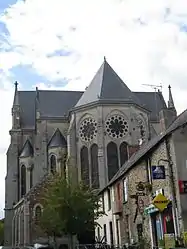
Rougé
Rougé (French pronunciation: [ʁuʒe] (![]() listen); Breton: Ruzieg) is a commune in the Loire-Atlantique department in western France, near Rennes.
listen); Breton: Ruzieg) is a commune in the Loire-Atlantique department in western France, near Rennes.
Rougé | |
|---|---|
Commune | |
 | |
.svg.png.webp) Coat of arms | |
Location of Rougé 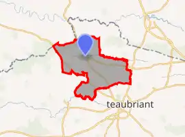 | |
 Rougé 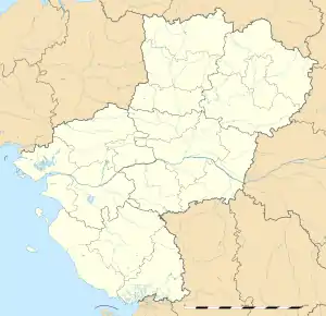 Rougé | |
| Coordinates: 47°47′01″N 1°26′49″W | |
| Country | France |
| Region | Pays de la Loire |
| Department | Loire-Atlantique |
| Arrondissement | Châteaubriant-Ancenis |
| Canton | Châteaubriant |
| Intercommunality | Châteaubriant-Derval |
| Government | |
| • Mayor (2020–2026) | Jean-Michel Duclos |
| Area 1 | 56.32 km2 (21.75 sq mi) |
| Population | 2,185 |
| • Density | 39/km2 (100/sq mi) |
| Time zone | UTC+01:00 (CET) |
| • Summer (DST) | UTC+02:00 (CEST) |
| INSEE/Postal code | 44146 /44660 |
| Elevation | 39–109 m (128–358 ft) |
| 1 French Land Register data, which excludes lakes, ponds, glaciers > 1 km2 (0.386 sq mi or 247 acres) and river estuaries. | |
The name "Rougé" comes from the Latin "Rubiacus", means the red place, in reference to the high iron-composition of the ground.
Geography
The river Chère forms small part of the commune's southern border.
Population
|
|
References
- "Populations légales 2019". The National Institute of Statistics and Economic Studies. 29 December 2021.
See also
| Wikimedia Commons has media related to Rougé. |
This article is issued from Wikipedia. The text is licensed under Creative Commons - Attribution - Sharealike. Additional terms may apply for the media files.