List of places in Colorado
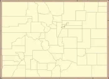
This is a list of more than 4,000 places in the U.S. State of Colorado.[1][2]

For additional information, please see the following:
- 210 census-designated places – List of census-designated places in Colorado[3]
- 64 counties – List of counties in Colorado[4]
- 64 county seats – List of county seats in Colorado[4][1][2]
- more than 36 forts – List of forts in Colorado[1][2]
- more than 1,500 ghost towns – List of ghost towns in Colorado[1][2]
- more than 1,500 historic places – List of National Register of Historic Places in Colorado[5][1][2]
- 8 military bases – List of military installations in Colorado[1][2]
- more than 340 mountain passes – List of mountain passes of Colorado[1]
- more than 2,800 mountain peaks – List of mountain peaks of Colorado[1]
- 272 municipalities – List of municipalities in Colorado[6][7][1][2]
- 2 Native American reservations – List of Native American reservations in Colorado[1][2]
- more than 400 post offices – List of post offices in Colorado[8][1][2]
- more than 600 protected areas – List of protected areas of Colorado[1][2]
|
Colorado places: A B C D E F G H I J K L M N O P Q R S T U V W X Y Z |
A
B
C
D
E
F
See also
- Colorado
- Colorado statistical areas
- Geography of Colorado
- History of Colorado
- List of counties in Colorado
- List of places in Colorado
- List of protected areas of Colorado
Notes
- This pass crosses the Continental Divide of the Americas.
- Arapahoe City was the original seat of Jefferson County, Jefferson Territory.
- Aurora was originally incorporated in 1903 as the Town of Fletcher.
- Autobees Plaza was the original seat of Huerfano County, Colorado Territory, although it now lies in Pueblo County.
- The Beulah post office serves Beulah Valley.
- Bill Williams Peak is the highest summit of the Williams Mountains.
- Bison Peak is the highest summit of the Tarryall Mountains.
- Black Hawk is the least populous home rule city in Colorado.
- Blair Mountain is the highest summit of the White River Plateau.
- Blanca Peak is the highest summit of the Sangre de Cristo Mountains.
- Boulder City was the seat of Jackson County, Jefferson Territory and then Boulder County, Colorado Territory.
- Breckenridge was founded in 1859 and named for prospector Thomas Breckenridge. In 1860, the town changed the spelling of its name to Breckinridge in honor of U.S. Vice President John Cabell Breckinridge. When John Breckinridge accepted a commission as a brigadier general in the Confederate States Army in 1861, the town promptly changed its name back to the original Breckenridge.
- Breckinridge was the seat of Saratoga County, Jefferson Territory.
- As a consolidated city and county, the City and County of Broomfield is its own county seat.
- Castle Peak is the highest summit of the Elk Mountains.
- Castle Rock is the most populous home rule town in Colorado.
- Central City was the seat of Mountain County, Jefferson Territory and then Gilpin County, Colorado Territory.
- Clark Peak is the highest summit of the Medicine Bow Mountains.
- Colorado City was the original seat of El Paso County, Jefferson Territory and then El Paso County, Colorado Territory.
- Colorado City served as the capital of the Territory of Colorado from July 7 to August 14, 1862.
- Colorado Springs is the most populous home rule city in Colorado.
- Denver's official elevation of 5,280 feet (1,609.344 m) is measured on the west steps of the Colorado State Capitol. Historically, this elevation measurement has moved up and down the steps based upon elevation adjustments made by the U.S. National Geodetic Survey.
- Mount Elbert is the highest summit of the Rocky Mountains of North America and the State of Colorado at an elevation of 14,440 feet (4,401.2 m).
- The point where the Arikaree River flows out of Yuma County is the lowest point in the State of Colorado at an elevation of 3,317 feet (1,011 m). This low point is higher than the high elevation points of 18 states and the District of Columbia.
- Conejos is the only unincorporated county seat remaining in the State of Colorado.
- Crater Peak is the highest summit of Grand Mesa.
- Crestone Peak is the highest summit of the Crestones.
- Culebra Peak is the highest summit of the Culebra Range.
- The Provisional Government of the Territory of Jefferson granted a charter to the consolidated City of Denver, Auraria, and Highland on December 3, 1859. The Territory of Colorado reincorporated the city as the City of Denver City on November 7, 1861. Denver City shortened its name to the Denver in 1866. The City and County of Denver was consolidated on November 15, 1902.
- Denver has served as the capital of Colorado since December 9, 1867.
- As a consolidated city and county, the City and County of Denver is its own county seat.
- Denver City was the original seat of Arrappahoe County, Jefferson Territory and then Arapahoe County, Colorado Territory.
- Denver City served as the first capital of the Provisional Government of the Territory of Jefferson from August 24, 1859 to November 13, 1860, and the first capital of the Territory of Colorado from February 28, 1861 to July 7, 1862.
- The 105th meridian west, the central meridian for the Mountain Time Zone, passes directly through Denver Union Station.
- Interstate Highway 70 passes under the Continental Divide of the Americas through the Eisenhower Tunnel. The high point of the Eisenhower Tunnel, located just inside the west portal at 11,158 feet (3,401 m), is the highest point on the Interstate Highway System and the highest vehicular tunnel in North America.
- Fishers Peak is the highest summit of the Raton Mesas and the easternmost summit of its elevation in the United States.
- Flat Top Mountain is the highest summit of the Flat Tops range.
- Frankstown was the original seat of Douglas County.
- Fulford is the least populous census-designated place in Colorado.
References
- "GNIS Colorado query". United States Department of the Interior, United States Geological Survey. Retrieved August 20, 2021.
- Elliott, Donald R.; Elliott, Doris L. Salmen (1999). "Place Names of Colorado" (PDF). Colorado Council of Genealogical Societies, Inc. Retrieved August 20, 2021.
- "State of Colorado Census Designated Places - BAS20 - Data as of January 1, 2020". United States Census Bureau. January 1, 2020. Retrieved August 20, 2021.
- "Colorado Counties". State of Colorado, Department of Local Affairs, Division of Local Government. Retrieved August 20, 2021.
- "National Register of Historic Places". United States Department of the Interior, National Park Service. Retrieved August 20, 2021.
- "Active Colorado Municipalities". State of Colorado, Department of Local Affairs, Division of Local Government. Retrieved August 20, 2021.
- "State of Colorado Incorporated Places - Current/TAB20 - Data as of January 1, 2020". United States Census Bureau. January 1, 2020. Retrieved August 20, 2021.
- "Colorado Post Offices". United States Postal Service. Retrieved August 20, 2021.
- "Arapaho National Recreation Area". United States Department of Agriculture, United States Forest Service. Retrieved July 19, 2021.
- Scott, Glenn R. (1995). "Historic trail map of the Lamar 1 degree by 2 degrees Quadrangle, Colorado and Kansas". United States Department of the Interior, United States Geological Survey. Retrieved July 19, 2021.
- "Bent's Old Fort National Historic Site". United States Department of the Interior, National Park Service. Retrieved July 19, 2021.
- "Black Canyon of the Gunnison National Park". United States Department of the Interior, National Park Service. Retrieved July 19, 2021.
- "Browns Canyon National Monument". United States Department of the Interior, Bureau of Land Management. Retrieved July 19, 2021.
- "California National Historic Trail". United States Department of the Interior, National Park Service. Retrieved July 19, 2021.
- Scott, Glenn R. (1989). "Historic trail maps of the Sterling 1 degree by 2 degrees Quadrangle, northeastern Colorado". United States Department of the Interior, United States Geological Survey. Retrieved July 19, 2021.
- "Canyons of the Ancients National Monument". United States Department of the Interior, Bureau of Land Management. Retrieved July 19, 2021.
- "Chimney Rock National Monument". United States Department of Agriculture, United States Forest Service. Retrieved July 19, 2021.
- "Colorado National Monument". United States Department of the Interior, National Park Service. Retrieved July 19, 2021.
- "Colorado State Capitol". State of Colorado. Retrieved July 19, 2021.
- "Continental Divide National Scenic Trail". United States Department of Agriculture, United States Forest Service. Retrieved July 19, 2021.
- "Curecanti National Recreation Area". United States Department of the Interior, National Park Service. Retrieved July 19, 2021.
- Scott, Glenn R. (1976). "Historic trail map of the Greater Denver area, Colorado". United States Department of the Interior, United States Geological Survey. Retrieved July 23, 2021.
- Scott, Glenn R. (1999). "Historic trail map of the Denver 1 degree by 2 degrees Quadrangle, central Colorado". United States Department of the Interior, United States Geological Survey. Retrieved July 23, 2021.
- "Dinosaur National Monument". United States Department of the Interior, National Park Service. Retrieved July 19, 2021.
- "Florissant Fossil Beds National Monument". United States Department of the Interior, National Park Service. Retrieved July 19, 2021.
- Scott, Glenn R. (1975). "Historic trail map of the Pueblo 1 degree x 2 degrees Quadrangle, Colorado". United States Department of the Interior, United States Geological Survey. Retrieved July 19, 2021.
- Scott, Glenn R.; Shwayder, Carol Rein (1993). "Historic trail map of the Greeley 1 degree by 2 degrees Quadrangle, Colorado and Wyoming". United States Department of the Interior, United States Geological Survey. Retrieved July 19, 2021.
- Scott, Glenn R. (2001). "Historic trail map of the Trinidad 1 degree by 2 degrees quadrangle, southern Colorado". United States Department of the Interior, United States Geological Survey. Retrieved July 19, 2021.
External links
- Colorado state government website
- Colorado tourism website
- History Colorado website
- United States Geological Survey GNIS query
References
This article is issued from Wikipedia. The text is licensed under Creative Commons - Attribution - Sharealike. Additional terms may apply for the media files.
