Pléchâtel
Pléchâtel (French pronunciation: [pleʃatɛl]; Breton: Plegastell) is a commune in the Ille-et-Vilaine department of Brittany in northwestern France.
Pléchâtel
Plegastell | |
|---|---|
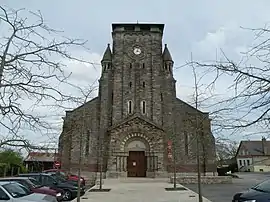 The church of Pléchâtel | |
Location of Pléchâtel 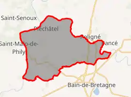 | |
 Pléchâtel  Pléchâtel | |
| Coordinates: 47°53′43″N 1°44′50″W | |
| Country | France |
| Region | Brittany |
| Department | Ille-et-Vilaine |
| Arrondissement | Redon |
| Canton | Bain-de-Bretagne |
| Government | |
| • Mayor (2020–2026) | Éric Bourasseau[1] |
| Area 1 | 36.32 km2 (14.02 sq mi) |
| Population | 2,780 |
| • Density | 77/km2 (200/sq mi) |
| Time zone | UTC+01:00 (CET) |
| • Summer (DST) | UTC+02:00 (CEST) |
| INSEE/Postal code | 35221 /35470 |
| Elevation | 7–116 m (23–381 ft) |
| 1 French Land Register data, which excludes lakes, ponds, glaciers > 1 km2 (0.386 sq mi or 247 acres) and river estuaries. | |
Geography
The river Semnon forms all of the commune's northern border, then flows into the Vilaine, which forms all of its western border.
Population
Inhabitants of Pléchâtel are called Pléchâtellois in French.
| Year | Pop. | ±% |
|---|---|---|
| 1962 | 1,503 | — |
| 1968 | 1,512 | +0.6% |
| 1975 | 1,559 | +3.1% |
| 1982 | 1,780 | +14.2% |
| 1990 | 1,834 | +3.0% |
| 1999 | 1,946 | +6.1% |
| 2008 | 2,685 | +38.0% |
References
- "Répertoire national des élus: les maires". data.gouv.fr, Plateforme ouverte des données publiques françaises (in French). 2 December 2020.
- "Populations légales 2019". The National Institute of Statistics and Economic Studies. 29 December 2021.
External links
| Wikimedia Commons has media related to Pléchâtel. |
- Base Mérimée: Search for heritage in the commune, Ministère français de la Culture. (in French)
- Mayors of Ille-et-Vilaine Association (in French)
This article is issued from Wikipedia. The text is licensed under Creative Commons - Attribution - Sharealike. Additional terms may apply for the media files.