Pinrang Regency
Pinrang Regency is one of the twenty-one regencies in South Sulawesi Province of Indonesia. Pinrang town is the administrative capital of Pinrang Regency. The regency covers 1,961.77 km2 and had a population of 351,161 at the 2010 Census[2] and 403,994 at the 2020 Census.[3]
Pinrang Regency
Kabupaten Pinrang | |
|---|---|
|
Coat of arms | |
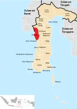 Location within South Sulawesi | |
| Country | Indonesia |
| Province | South Sulawesi |
| Capital | Pinrang |
| Area | |
| • Total | 1,961.77 km2 (757.44 sq mi) |
| Population (2020 Census)[1] | |
| • Total | 403,994 |
| • Density | 210/km2 (530/sq mi) |
| Time zone | UTC+8 (WITA) |
| Area code(s) | +62 421 |
Administrative districts
Pinrang Regency in 2020 comprised twelve administrative Districts (Kecamatan), tabulated below with their areas and their populations at the 2010 Census[4] and the 2020 Census.[5] The table also includes the location of the district administrative centres, and the number of administrative villages (69 rural desa and 40 urban kelurahan) in each district.
| Name Area in km2 | Population Census 2010 | Population Census 2020 | Admin centre | No. of villages | |
|---|---|---|---|---|---|
| Suppa | 74.20 | 30,504 | 34,434 | Majennang | 10 |
| Mattiro Sompe | 96.99 | 27,441 | 30,155 | Langnga | 9 |
| Lanrisang | 73.01 | 17,131 | 19,713 | Jampue | 7 |
| Mattiro Bulu | 132.49 | 26,847 | 31,524 | Bua | 9 |
| Watang Sawitto | 58.97 | 51,093 | 56,570 | Sawitto | 8 |
| Paleteang | 37.29 | 36,699 | 42,630 | Laleng Bata | 6 |
| Tiroang | 77.73 | 20,856 | 23,409 | Tiroang | 6 |
| Patampanua | 136.85 | 31,533 | 37,577 | Teppo | 11 |
| Cempa | 90.30 | 17,217 | 19,543 | Cempa | 7 |
| Duampanua | 291.86 | 43,877 | 50,226 | Lampa | 15 |
| Batulappa | 158.99 | 9,652 | 11,281 | Bilajeng | 5 |
| Lembang | 733.09 | 38,268 | 46,932 | Tuppa | 16 |
| Totals | 1,961.77 | 351,161 | 403,994 | Pinrang | 109 |
Climate
Pinrang has a tropical rainforest climate (Af) with moderate to heavy rainfall year-round. The following climate data is for the town of Pinrang.
| Climate data for Pinrang | |||||||||||||
|---|---|---|---|---|---|---|---|---|---|---|---|---|---|
| Month | Jan | Feb | Mar | Apr | May | Jun | Jul | Aug | Sep | Oct | Nov | Dec | Year |
| Average high °C (°F) | 30.0 (86.0) |
30.1 (86.2) |
30.4 (86.7) |
30.9 (87.6) |
31.0 (87.8) |
30.6 (87.1) |
30.4 (86.7) |
31.2 (88.2) |
31.5 (88.7) |
32.1 (89.8) |
31.4 (88.5) |
30.3 (86.5) |
30.8 (87.5) |
| Daily mean °C (°F) | 26.5 (79.7) |
26.7 (80.1) |
26.7 (80.1) |
27.0 (80.6) |
27.1 (80.8) |
26.6 (79.9) |
26.0 (78.8) |
26.4 (79.5) |
26.6 (79.9) |
27.3 (81.1) |
27.3 (81.1) |
26.7 (80.1) |
26.7 (80.1) |
| Average low °C (°F) | 23.1 (73.6) |
23.3 (73.9) |
23.1 (73.6) |
23.2 (73.8) |
23.3 (73.9) |
22.6 (72.7) |
21.6 (70.9) |
21.6 (70.9) |
21.8 (71.2) |
22.6 (72.7) |
23.2 (73.8) |
23.2 (73.8) |
22.7 (72.9) |
| Average rainfall mm (inches) | 287 (11.3) |
185 (7.3) |
187 (7.4) |
225 (8.9) |
196 (7.7) |
134 (5.3) |
104 (4.1) |
82 (3.2) |
112 (4.4) |
125 (4.9) |
177 (7.0) |
266 (10.5) |
2,080 (82) |
| Source: Climate-Data.org[6] | |||||||||||||
References
- Badan Pusat Statistik, Jakarta, 2021.
- Biro Pusat Statistik, Jakarta, 2011.
- Badan Pusat Statistik, Jakarta, 2021.
- Biro Pusat Statistik, Jakarta, 2011.
- Badan Pusat Statistik, Jakarta, 2021.
- "Climate: Pinrang". Climate-Data.org. Retrieved 18 November 2020.