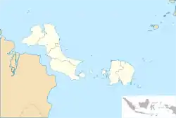
Payung, South Bangka
Payung is a district of South Bangka Regency, Bangka-Belitung Islands. It is located in the northern part of the regency, bordering the Central Bangka Regency.
Payung | |
|---|---|
 Payung Location of Payung in Bangka-Belitung | |
| Coordinates: 2°36′S 106°8′E | |
| Country | |
| Province | Bangka Belitung Islands |
| Regency | South Bangka Regency |
| Area | |
| • Total | 372.95 km2 (144.00 sq mi) |
| Population (2020)[1] | |
| • Total | 22,473 |
| • Density | 60/km2 (160/sq mi) |
| Time zone | UTC+7 (Western Indonesia Time) |
| Area code(s) | +62718 |
Administrative divisions
The district is subdivided into nine villages. The administrative center is located at Payung village.[2]
| Village | Area (km2) | Population |
|---|---|---|
| Bedengung | 65.321 | 2,275 |
| Irat | 32.438 | 1,308 |
| Sengir | 30.75 | 1,503 |
| Payung | 50.466 | 4,222 |
| Nadung | 17.898 | 1,407 |
| Ranggung | 46.602 | 3,279 |
| Pangkal Buluh | 38.653 | 2,520 |
| Malik | 59.653 | 1,321 |
| Paku | 31.17 | 2,154 |
Economy
The economy of the district is largely agricultural, with the labor force nearly entirely engaged in agriculture.[2]: 42
References
- "Luas Wilayah Menurut Kecamatan (km2), Jumlah Penduduk Menurut Kecamatan dan Jenis Kelamin (jiwa), Kepadatan Penduduk (jiwa/km2), dan Rasio Jenis Kelamin Kabupaten Bangka Selatan Menurut Kecamatan, 2020". Badan Pusat Statistik Kabupaten Bangka Selatan (in Indonesian). Statistics Indonesia. Retrieved 16 May 2021.
- "Kecamatan Payung Dalam Angka 2020" (in Indonesian). Statistics Indonesia. Retrieved 18 May 2021.
This article is issued from Wikipedia. The text is licensed under Creative Commons - Attribution - Sharealike. Additional terms may apply for the media files.