Oratia Stream
The Oratia Stream is a stream of the Auckland Region of New Zealand's North Island. It flows north-east from its source at the township of Waiatarua in the Waitākere Ranges, before entering into the Te Wai-o-Pareira / Henderson Creek, which flows into the western the Waitematā Harbour. After beginning at Waiatarua, the stream passes through the rural locality of Oratia and the West Auckland suburbs of Sunnyvale and Henderson. Since the mid-2000s has been forested with native flora.
| Oratia Stream | |
|---|---|
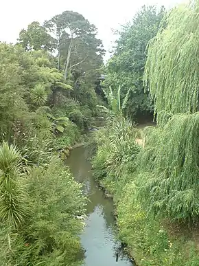 The Oratia Stream near WestCity Waitakere | |
| Location | |
| Country | New Zealand |
| Physical characteristics | |
| Source | |
| • location | Waiatarua |
| Mouth | |
• location | Te Wai-o-Pareira / Henderson Creek |
| Length | 9 km (6 mi) |
Description
The stream begins south of the Waiatarua, flowing north-east through the rural locality of Oratia.[1] At Glen Eden, the stream changes course, flowing north-west towards Parrs Park.[1] The stream meets the Waikumete Stream ad the Millbrook Esplanade in the suburb of Sunnyvale, and continues to flow north, adjacent to the WestCity Waitakere shopping centre in Henderson. At Te Kōpua (modern-day Falls Park / Tui Glen Reserve), the stream becomes Te Wai-o-Pareira / Henderson Creek, an estuarine arm of the Waitematā Harbour.
The stream has six tributaries. Five of these, the Potter Stream,[2] Bendall Creek,[3] Cantys Stream,[4] Cochran Stream[5] and Kaurimu Stream,[6] flow in rural Oratia, while one the Waikumete Stream, flows north from Titirangi through Glen Eden.[7]
The stream is a location where a population of the freshwater crab Amarinus lacustris is found.[8][9]
History
The stream is in the traditional rohe of Te Kawerau ā Maki,[10] Radiocarbon evidence shows occupation of the Oratia Stream from at least the 16th century.[11] The name is taken from the pā which existed on the western banks of the stream in modern-day Oratia/Sunnyvale, near Holdens Road.[10] Oratia is the traditional name for areas of the middle and lower catchments of the stream, while the upper catchment near Waiatarua was known as Waihorotiu, due to the landslips which often occurred there.[12] The end of the Oratia Stream, Te Kōpua (modern-day Falls Park / Tui Glen Reserve), was the location of a strategic Te Kawerau ā Maki pā, as this was the end point where Te Wai-o-Pareira / Henderson Creek could be navigated by canoe.[12]
The Oratia Stream was first milled for kauri timber in 1841 by early settler Thomas Canty,[13] who obtained logging rights in the area in 1843.[14] In the mid-19th century, European settlers used the stream to drive logs downstream to Henderson.[10] During early colonial days, the stream was known by the name Cantys Creek,[15] a name now used for one of the steam's tributaries.
Between the mid-2000s and the 2020s, large-scale riparian planting was undertaken along the Oratia Stream as a part of Project Twin Streams.[10]
See also
References
- "Oratia Stream". New Zealand Gazetteer. Land Information New Zealand. Retrieved 1 May 2022.
- "Potter Stream". New Zealand Gazetteer. Land Information New Zealand. Retrieved 1 May 2022.
- "Bendall Creek". New Zealand Gazetteer. Land Information New Zealand. Retrieved 1 May 2022.
- "Cantys Stream". New Zealand Gazetteer. Land Information New Zealand. Retrieved 1 May 2022.
- "Cochran Stream". New Zealand Gazetteer. Land Information New Zealand. Retrieved 1 May 2022.
- "Kaurimu Stream". New Zealand Gazetteer. Land Information New Zealand. Retrieved 1 May 2022.
- "Waikumete Stream". New Zealand Gazetteer. Land Information New Zealand. Retrieved 1 May 2022.
- Clint McCullough. "Freshwater Crab (Hymenosomatidae: Amarinus lacustris)". New Zealand Native Freshwater Life. Archived from the original on November 16, 2010. Retrieved June 4, 2010.
- McQueen, Stella (2010). The New Zealand Native Freshwater Aquarium. New Zealand: Wet Sock Publications. pp. 105–106. ISBN 9780473179359.
- "Oratia Stream" (PDF). Project Twin Streams. Auckland Council. 2012. Retrieved 1 May 2022.
- Hayward, B. W.; Diamond, J. T. (1980). "Radiocarbon dates from the Waitakere Ranges, West Auckland". New Zealand Archaeological Association Newsletter. 23: 226–231. Retrieved 1 May 2022.
- Te Kawerau ā Maki; The Trustees of Te Kawerau Iwi Settlement Trust; The Crown (12 December 2013). "Deed of Settlement Schedule: Documents" (PDF). Retrieved 26 April 2022.
- Hayward, B. W.; Diamond, J. T. (1975). "Kauri Dam Sites in the Waitakere Ranges" (PDF). Tane. 6: 105–120. Retrieved 3 May 2022.
- "Cantys Stream". New Zealand Gazetteer. Land Information New Zealand. Retrieved 27 April 2022.
- "Oratia". New Zealand Gazetteer. Land Information New Zealand. Retrieved 27 April 2022.