Okeechobee County, Florida
Okeechobee County (US: /oʊkiˈtʃoʊbi/[1]) is a county located in the Florida Heartland region of the state of Florida. As of the 2010 census, the population was 39,996.[2] The county seat is Okeechobee.[3]
Okeechobee County | |
|---|---|
County | |
| County of Okeechobee | |
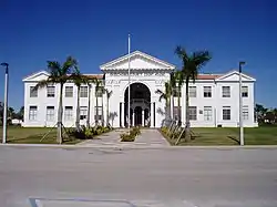
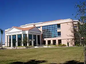 The Okeechobee County Judicial Center, in Okeechobee | |
 Seal | |
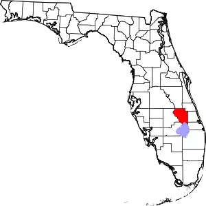 Location within the U.S. state of Florida | |
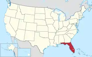 Florida's location within the U.S. | |
| Coordinates: 27°23′N 80°53′W | |
| Country | |
| State | |
| Founded | May 8, 1917 |
| Named for | Lake Okeechobee |
| Seat | Okeechobee |
| Largest city | Okeechobee |
| Area | |
| • Total | 892 sq mi (2,310 km2) |
| • Land | 769 sq mi (1,990 km2) |
| • Water | 123 sq mi (320 km2) 13.8%% |
| Population | |
| • Estimate (2019) | 42,168 |
| • Density | 52/sq mi (20/km2) |
| Time zone | UTC−5 (Eastern) |
| • Summer (DST) | UTC−4 (EDT) |
| ZIP Codes | 34972, 34973, 34974 |
| Area code | 863 |
| Congressional district | 17th |
| Website | www |
Okeechobee County comprises the Okeechobee, FL Micropolitan Statistical Area, which is included in the Miami-Fort Lauderdale-Port St. Lucie, FL Combined Statistical Area.
History
Okeechobee County was incorporated in 1917. It was named for Lake Okeechobee, which was itself named for the Seminole Indian[4] words okee (water) and chobee (big).
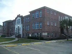
Historic buildings
Historic buildings in Okeechobee County include:
Geography
According to the U.S. Census Bureau, the county has a total area of 892 square miles (2,310 km2), of which 769 square miles (1,990 km2) is land and 123 square miles (320 km2) (13.8%) is water.[5]
Adjacent counties
- Indian River County - northeast
- Martin County - east
- St. Lucie County - east
- Glades County - southwest
- Hendry County - southwest
- Highlands County - west
- Polk County - northwest
- Osceola County - northwest
Points of interest
The Lake Okeechobee Scenic Trail, part of the Florida National Scenic Trail, runs along the Herbert Hoover Dike around the Lake.
Transportation
Airports
Demographics
| Historical population | |||
|---|---|---|---|
| Census | Pop. | %± | |
| 1920 | 2,132 | — | |
| 1930 | 4,129 | 93.7% | |
| 1940 | 3,000 | −27.3% | |
| 1950 | 3,454 | 15.1% | |
| 1960 | 6,424 | 86.0% | |
| 1970 | 11,233 | 74.9% | |
| 1980 | 20,264 | 80.4% | |
| 1990 | 29,627 | 46.2% | |
| 2000 | 35,910 | 21.2% | |
| 2010 | 39,996 | 11.4% | |
| 2019 (est.) | 42,168 | [6] | 5.4% |
| U.S. Decennial Census[7] 1790-1960[8] 1900-1990[9] 1990-2000[10] 2010-2019[2] | |||
As of the census of 2010, there were 39,996 people, 13,857 households, and 9,016 families residing in the county. The population density was 46 people per square mile (18/km2). There were 15,504 housing units at an average density of 52 per square mile (8/km2). The racial makeup of the county was 87.9% White, 8.6% Black or African American, 1.3% Native American, 0.9% Asian, 0.1% Pacific Islander, and 1.2% from two or more races. 24.5% of the population were Hispanic or Latino of any race.
In 2005 68.5% of the county population was White non-Hispanic, 21.6% of the population was Latino, 8.0% was African-American and both Native Americans and Asians constituted 0.9% of the population.[11]
In 2000 there were 12,593 households, out of which 30.40% had children under the age of 18 living with them, 55.50% were married couples living together, 10.70% had a female householder with no husband present, and 28.40% were non-families. 21.50% of all households were made up of individuals, and 10.10% had someone living alone who was 65 years of age or older. The average household size was 2.69 and the average family size was 3.07.
In the county in 2000 the population was spread out, with 25.20% under the age of 18, 9.50% from 18 to 24, 27.10% from 25 to 44, 21.90% from 45 to 64, and 16.30% who were 65 years of age or older. The median age was 37 years. For every 100 females, there were 115.50 males. For every 100 females age 18 and over, there were 115.20 males.
In 2010 the median income for a household in the county was $36,929, and the median income for a family was $35,163. Males had a median income of $25,574 versus $20,160 for females. The per capita income for the county was $14,553. About 11.80% of families and 16.00% of the population were below the poverty line, including 19.90% of those under age 18 and 10.30% of those age 65 or over.
Libraries
Okeechobee County is part of the Heartland Library Cooperative which serves Okeechobee County and some of the surrounding counties, including Glades, Highlands, Hardee, and DeSoto. The seven-branch library system has one branch in the city of Okeechobee.
Communities
City
Census-designated places
Other unincorporated communities
- Ancient Oaks
- Barber Quarters
- Basinger
- Basswood Estates
- Country Hills Estates
- Deans Court
- Dixie Ranch Acres
- Duberry Gardens
- Echo Estates
- Everglades
- Fort Drum
- Four Seasons
- Hilolo
- Mildred
- Oak Park
- Okeechobee Little Farms
- Quail Acres
- Rookerville
- Sherman
- Taylor Creek Isle
- Treasure Island
- Viking Estates[12][13]
- Upthegrove Beach
- Whispering Pines
Politics
| Year | Republican | Democratic | Third party | |||
|---|---|---|---|---|---|---|
| No. | % | No. | % | No. | % | |
| 2020 | 11,470 | 71.76% | 4,390 | 27.46% | 124 | 0.78% |
| 2016 | 9,356 | 67.99% | 3,959 | 28.77% | 446 | 3.24% |
| 2012 | 7,328 | 59.25% | 4,856 | 39.27% | 183 | 1.48% |
| 2008 | 7,561 | 58.89% | 5,108 | 39.79% | 170 | 1.32% |
| 2004 | 6,978 | 57.24% | 5,153 | 42.27% | 59 | 0.48% |
| 2000 | 5,057 | 51.32% | 4,589 | 46.57% | 208 | 2.11% |
| 1996 | 3,418 | 34.38% | 4,826 | 48.55% | 1,697 | 17.07% |
| 1992 | 3,298 | 35.20% | 3,418 | 36.48% | 2,654 | 28.32% |
| 1988 | 4,736 | 60.79% | 3,007 | 38.60% | 48 | 0.62% |
| 1984 | 4,449 | 66.65% | 2,226 | 33.35% | 0 | 0.00% |
| 1980 | 2,783 | 44.81% | 3,228 | 51.98% | 199 | 3.20% |
| 1976 | 1,598 | 33.12% | 3,184 | 65.99% | 43 | 0.89% |
| 1972 | 2,581 | 80.58% | 621 | 19.39% | 1 | 0.03% |
| 1968 | 862 | 28.66% | 542 | 18.02% | 1,604 | 53.32% |
| 1964 | 1,316 | 56.43% | 1,016 | 43.57% | 0 | 0.00% |
| 1960 | 631 | 35.93% | 1,125 | 64.07% | 0 | 0.00% |
| 1956 | 575 | 40.78% | 835 | 59.22% | 0 | 0.00% |
| 1952 | 539 | 37.96% | 881 | 62.04% | 0 | 0.00% |
| 1948 | 179 | 17.08% | 784 | 74.81% | 85 | 8.11% |
| 1944 | 119 | 13.65% | 753 | 86.35% | 0 | 0.00% |
| 1940 | 122 | 12.92% | 822 | 87.08% | 0 | 0.00% |
| 1936 | 186 | 22.12% | 655 | 77.88% | 0 | 0.00% |
| 1932 | 90 | 10.09% | 802 | 89.91% | 0 | 0.00% |
| 1928 | 657 | 68.87% | 287 | 30.08% | 10 | 1.05% |
| 1924 | 57 | 20.96% | 182 | 66.91% | 33 | 12.13% |
| 1920 | 58 | 15.93% | 237 | 65.11% | 69 | 18.96% |
See also
External links
| Wikimedia Commons has media related to Okeechobee County, Florida. |
Governmental
- Board of County Commissioners
- Constitutional Officers
- School district
- Countywide District
- Multi-county Districts
- Judicial
Non-governmental
- Okeechobee Official Discussion Forum
- D.R. Wilson Land Company
- Okeechobee County Tourist Development Council
- Okeechobee County Guide
- Okeechobee News local newspaper for Okeechobee County, Florida fully and openly available in the Florida Digital Newspaper Library
References
- "Okeechobee". Collins Dictionary. n.d. Retrieved September 24, 2014.
- "State & County QuickFacts". United States Census Bureau. Retrieved February 14, 2014.
- "Find a County". National Association of Counties. Archived from the original on May 31, 2011. Retrieved June 7, 2011.
- Harper, Debra Kay. English/Seminole Vocabulary (PDF). p. 47. Archived from the original (PDF) on December 11, 2013. Retrieved December 10, 2020.
- "US Gazetteer files: 2010, 2000, and 1990". United States Census Bureau. February 12, 2011. Retrieved April 23, 2011.
- "Population and Housing Unit Estimates". Retrieved May 21, 2020.
- "U.S. Decennial Census". United States Census Bureau. Archived from the original on April 26, 2015. Retrieved June 16, 2014.
- "Historical Census Browser". University of Virginia Library. Retrieved June 16, 2014.
- "Population of Counties by Decennial Census: 1900 to 1990". United States Census Bureau. Retrieved June 16, 2014.
- "Census 2000 PHC-T-4. Ranking Tables for Counties: 1990 and 2000" (PDF). United States Census Bureau. Retrieved June 16, 2014.
- Okeechobee County QuickFacts from the US Census Bureau Archived 2011-06-07 at the Wayback Machine
- "Southeast District | Florida Department of Environmental Protection".
- "Archived copy". Archived from the original on March 3, 2016. Retrieved March 7, 2020.
{{cite web}}: CS1 maint: archived copy as title (link) - Leip, David. "Dave Leip's Atlas of U.S. Presidential Elections". uselectionatlas.org. Retrieved June 15, 2018.
Places adjacent to Okeechobee County, Florida | ||||||||||||||||
|---|---|---|---|---|---|---|---|---|---|---|---|---|---|---|---|---|
| ||||||||||||||||
Municipalities and communities of Okeechobee County, Florida, United States | ||
|---|---|---|
| City | | |
| CDPs | ||
| Unincorporated communities | ||
| Ghost town | ||
| ||