Norris Reef
Norris Reef (54°25′S 3°20′E) is a reef lying close off the western shore of the island of Bouvetøya, 0.5 nautical miles (0.9 km) southwest of Cape Circoncision. First charted in 1898 by a German expedition under carl Chun. Recharted in December 1927 by a Norwegian expedition under Captain Harald Horntvedt. Named by the Norwegians after British sealer Captain George Norris who, commanding the sealers Sprightly and Lively, visited Bouvetoya in 1825.[1][2]
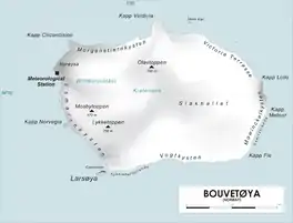
Map of Bouvetøya
References
- "Norris Reef: Antarctica". Geographic Names. Retrieved October 1, 2016.
- "Prof. Dr. phil., Dr. med. h. c. Carl Chun". University of Leipzig. Retrieved October 1, 2016.
Other sources
- Simpson-Housley, Paul (2002) Antarctica: Exploration, Perception and Metaphor (Routledge) ISBN 9781134891214
![]() This article incorporates public domain material from the United States Geological Survey document: "Norris Reef". (content from the Geographic Names Information System)
This article incorporates public domain material from the United States Geological Survey document: "Norris Reef". (content from the Geographic Names Information System)
This article is issued from Wikipedia. The text is licensed under Creative Commons - Attribution - Sharealike. Additional terms may apply for the media files.