Nankoku, Kōchi
Nankoku (南国市, Nankoku-shi) is a city located in Kōchi Prefecture, Japan. Strong in the fishing industry and the market industry, Nankoku-shi supplies most of Kochi's agricultural needs, because of the amount of fields and plantations. Kōchi Ryōma Airport, which serves the city of Kochi, is located southeast of Nankoku-shi. The city was formally named on October 1, 1959. As of 1 February 2021, the city has an estimated population of 47‚776, with 21‚952 households[1] and a population density of 380 persons per km². The total area is 125.35 km².
Nankoku
南国市 | |
|---|---|
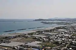 View of Tosa Bay and Pacific Ocean from Zenjibu Temple | |
 Flag  Seal | |
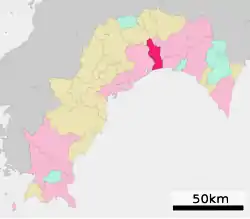 Location of Nankoku in Kōchi Prefecture | |
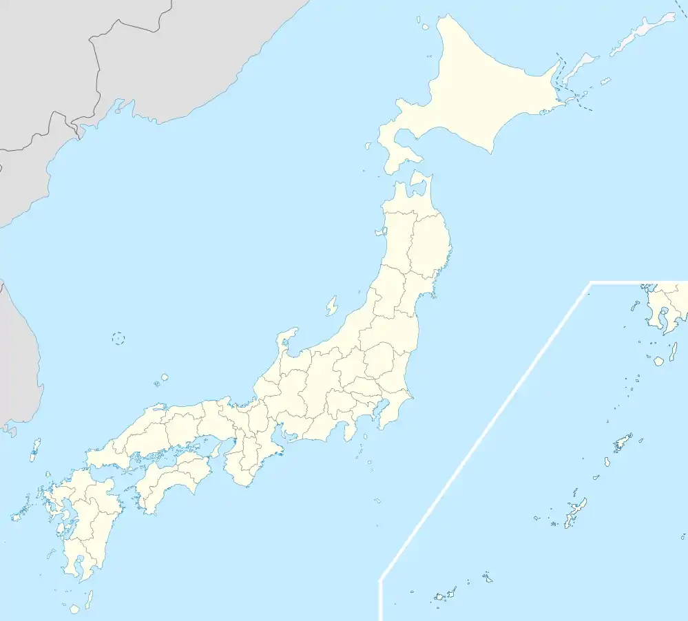 Nankoku Location in Japan | |
| Coordinates: 33°35′N 133°38′E | |
| Country | Japan |
| Region | Shikoku |
| Prefecture | Kōchi Prefecture |
| Government | |
| • Mayor | Toshihito Hashizume |
| Area | |
| • Total | 125.35 km2 (48.40 sq mi) |
| Population (1 February 2021) | |
| • Total | 47,776 |
| • Density | 380/km2 (990/sq mi) |
| Time zone | UTC+09:00 (JST) |
| City hall address | 2301 Ōsone Kō, Nankoku-shi, Kōchi-ken 783-8501 |
| Climate | Cfa |
| Website | www |
| Symbols | |
| Bird | Onagadori (Long tail chicken) |
| Flower | Tachibana (Citrus tachibana) |
| Tree | Yamamomo |
Geography
Climate
Nankoku has a humid subtropical climate (Köppen climate classification Cfa) with hot, humid summers and cool winters. There is significant precipitation throughout the year, especially during June and July. The average annual temperature in Nankoku is 16.6 °C (61.9 °F). The average annual rainfall is 2,359.1 mm (92.88 in) with September as the wettest month. The temperatures are highest on average in August, at around 27.2 °C (81.0 °F), and lowest in January, at around 6.0 °C (42.8 °F).[2] The highest temperature ever recorded in Nankoku was 36.9 °C (98.4 °F) on 30 July 2004; the coldest temperature ever recorded was −7.9 °C (17.8 °F) on 8 February 1984.[3]
| Climate data for Gomen, Nankoku (1991−2020 normals, extremes 1978−present) | |||||||||||||
|---|---|---|---|---|---|---|---|---|---|---|---|---|---|
| Month | Jan | Feb | Mar | Apr | May | Jun | Jul | Aug | Sep | Oct | Nov | Dec | Year |
| Record high °C (°F) | 21.9 (71.4) |
23.0 (73.4) |
24.7 (76.5) |
28.4 (83.1) |
30.1 (86.2) |
32.9 (91.2) |
35.9 (96.6) |
36.9 (98.4) |
36.3 (97.3) |
30.9 (87.6) |
26.2 (79.2) |
22.8 (73.0) |
36.9 (98.4) |
| Average high °C (°F) | 11.5 (52.7) |
12.5 (54.5) |
15.5 (59.9) |
20.0 (68.0) |
23.9 (75.0) |
26.2 (79.2) |
29.9 (85.8) |
31.5 (88.7) |
28.9 (84.0) |
24.4 (75.9) |
19.0 (66.2) |
13.8 (56.8) |
21.4 (70.6) |
| Daily mean °C (°F) | 6.0 (42.8) |
7.1 (44.8) |
10.5 (50.9) |
15.2 (59.4) |
19.4 (66.9) |
22.5 (72.5) |
26.2 (79.2) |
27.2 (81.0) |
24.4 (75.9) |
19.3 (66.7) |
13.5 (56.3) |
8.1 (46.6) |
16.6 (61.9) |
| Average low °C (°F) | 0.8 (33.4) |
2.0 (35.6) |
5.4 (41.7) |
10.3 (50.5) |
14.8 (58.6) |
19.0 (66.2) |
23.0 (73.4) |
23.6 (74.5) |
20.6 (69.1) |
14.6 (58.3) |
8.5 (47.3) |
2.9 (37.2) |
12.1 (53.8) |
| Record low °C (°F) | −7.1 (19.2) |
−7.9 (17.8) |
−4.6 (23.7) |
0.1 (32.2) |
5.9 (42.6) |
10.6 (51.1) |
14.4 (57.9) |
16.6 (61.9) |
9.2 (48.6) |
2.9 (37.2) |
−1.4 (29.5) |
−5.7 (21.7) |
−7.9 (17.8) |
| Average precipitation mm (inches) | 51.7 (2.04) |
95.1 (3.74) |
153.5 (6.04) |
195.6 (7.70) |
239.3 (9.42) |
316.1 (12.44) |
319.2 (12.57) |
277.8 (10.94) |
335.9 (13.22) |
180.4 (7.10) |
117.2 (4.61) |
77.3 (3.04) |
2,359.1 (92.88) |
| Average precipitation days (≥ 1.0 mm) | 5.5 | 7.0 | 9.7 | 9.8 | 10.1 | 14.1 | 12.5 | 11.5 | 12.2 | 8.7 | 6.8 | 5.8 | 113.7 |
| Mean monthly sunshine hours | 183.2 | 171.4 | 191.9 | 201.0 | 201.8 | 137.0 | 176.6 | 208.4 | 166.4 | 180.8 | 165.7 | 178.0 | 2,167.8 |
| Source: Japan Meteorological Agency[3][2] | |||||||||||||
| Climate data for Kōchi Airport, Nankoku (2003−2020 normals, extremes 2003−present) | |||||||||||||
|---|---|---|---|---|---|---|---|---|---|---|---|---|---|
| Month | Jan | Feb | Mar | Apr | May | Jun | Jul | Aug | Sep | Oct | Nov | Dec | Year |
| Record high °C (°F) | 18.9 (66.0) |
24.7 (76.5) |
24.2 (75.6) |
27.4 (81.3) |
31.2 (88.2) |
31.8 (89.2) |
38.3 (100.9) |
36.6 (97.9) |
35.5 (95.9) |
31.1 (88.0) |
26.4 (79.5) |
22.9 (73.2) |
38.3 (100.9) |
| Average high °C (°F) | 11.9 (53.4) |
13.0 (55.4) |
15.7 (60.3) |
19.9 (67.8) |
23.6 (74.5) |
25.9 (78.6) |
29.3 (84.7) |
31.0 (87.8) |
28.7 (83.7) |
24.6 (76.3) |
19.4 (66.9) |
14.0 (57.2) |
21.4 (70.6) |
| Daily mean °C (°F) | 6.4 (43.5) |
7.9 (46.2) |
10.8 (51.4) |
15.4 (59.7) |
19.5 (67.1) |
22.6 (72.7) |
26.1 (79.0) |
27.3 (81.1) |
24.7 (76.5) |
19.8 (67.6) |
14.3 (57.7) |
8.5 (47.3) |
16.9 (62.5) |
| Average low °C (°F) | 1.0 (33.8) |
2.9 (37.2) |
5.8 (42.4) |
10.6 (51.1) |
15.2 (59.4) |
19.4 (66.9) |
23.4 (74.1) |
24.1 (75.4) |
21.3 (70.3) |
15.6 (60.1) |
9.6 (49.3) |
3.2 (37.8) |
12.7 (54.8) |
| Record low °C (°F) | −7.9 (17.8) |
−7.1 (19.2) |
−3.8 (25.2) |
1.1 (34.0) |
7.3 (45.1) |
12.5 (54.5) |
17.9 (64.2) |
17.5 (63.5) |
13.1 (55.6) |
7.1 (44.8) |
−1.3 (29.7) |
−4.9 (23.2) |
−7.9 (17.8) |
| Average precipitation mm (inches) | 50.4 (1.98) |
106.2 (4.18) |
138.1 (5.44) |
184.4 (7.26) |
199.9 (7.87) |
288.6 (11.36) |
299.9 (11.81) |
255.3 (10.05) |
314.9 (12.40) |
201.6 (7.94) |
111.1 (4.37) |
88.0 (3.46) |
2,238.3 (88.12) |
| Average precipitation days (≥ 1.0 mm) | 5.3 | 7.7 | 9.6 | 9.1 | 8.9 | 12.8 | 11.8 | 10.4 | 11.3 | 8.8 | 7.0 | 5.3 | 108 |
| Source: Japan Meteorological Agency[4][5] | |||||||||||||
Demographics
Per Japanese census data, the population of Nankoku in 2020 is 46,664 people.[6] Nankoku has been conducting censuses since 1960.
| Year | Pop. | ±% |
|---|---|---|
| 1960 | 41,798 | — |
| 1965 | 41,237 | −1.3% |
| 1970 | 41,096 | −0.3% |
| 1975 | 42,832 | +4.2% |
| 1980 | 44,866 | +4.7% |
| 1985 | 47,554 | +6.0% |
| 1990 | 46,823 | −1.5% |
| 1995 | 48,192 | +2.9% |
| 2000 | 49,965 | +3.7% |
| 2005 | 50,758 | +1.6% |
| 2010 | 49,497 | −2.5% |
| 2015 | 47,982 | −3.1% |
| 2020 | 46,664 | −2.7% |
| Nankoku population statistics[6] | ||
Transport

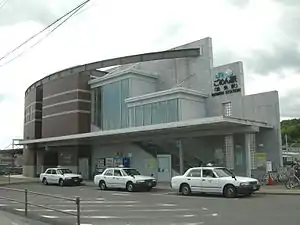
Airport
Tourism
- Kōchi Prefectural Museum of History
- Okō Castle : Chōsokabe clan's prime castle
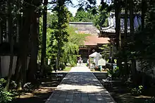
- Tosa Kokubunji
- Zenjibuji
Notable people from Nankoku
- Hiroshi Miyama, enka singer
- Yuji Okabayashi, professional wrestler
References
- "Official website of Nankoku City" (in Japanese). Japan: Nankoku City. Retrieved 1 May 2017.
- 気象庁 / 平年値(年・月ごとの値). JMA. Retrieved April 17, 2022.
- 観測史上1~10位の値(年間を通じての値). JMA. Retrieved April 17, 2022.
- 観測史上1~10位の値(年間を通じての値). JMA. Retrieved April 17, 2022.
- 気象庁 / 平年値(年・月ごとの値). JMA. Retrieved April 17, 2022.
- Nankoku population statistics
External links
| Wikimedia Commons has media related to Nankoku, Kochi. |
- Nankoku City official website (in Japanese)
- Kitaro Shikoku Peace Bell Project
 Geographic data related to Nankoku, Kōchi at OpenStreetMap
 Nankoku travel guide from Wikivoyage
| Core city | ||
|---|---|---|
| Cities | ||
| Districts | ||