Nána, Slovakia
Nána (Hungarian: Nána) is a village and municipality in the Nové Zámky District in the Nitra Region of south-west Slovakia, near the border with Hungary.
Nána | |
|---|---|
Municipality | |
 Statue of Saint Wendelin | |
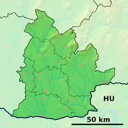 Nána Location of Nána in the Nitra Region 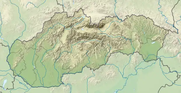 Nána Location of Nána in Slovakia | |
| Coordinates: 47°49′N 18°43′E | |
| Country | Slovakia |
| Region | Nitra |
| District | Nové Zámky |
| First mentioned | 1157 |
| Government | |
| • Mayor | Dezider Molnár[1] |
| Area | |
| • Total | 17.94[2] km2 (6.93[2] sq mi) |
| Elevation | 108[3] m (354[3] ft) |
| Population (2021) | |
| • Total | 1,204[4] |
| Postal code | 943 60[3] |
| Area code(s) | +421 36[3] |
| Car plate | NZ |
History
In historical records the village was first mentioned in 1157.[5] It was the ancient estate of the Nánabeszter kindred in the 13th-century Hungary.
Geography
The municipality lies at an elevation of 110 metres (360 ft) and covers an area of 17.947 km² (6.929 mi²).[6]
Demographics
In 2011, the municipality had a population of 1223 people.[7] 70% of the population identified as Hungarian and 24% as Slovak. It has a small Romani minority.
Facilities
The village has a small public library and a football pitch.
References
- "Voľby do orgánov samosprávy obcí 2018 - OSO 2018".
- "Hustota obyvateľstva - obce [om7014rr_ukaz: Rozloha (Štvorcový meter)]". www.statistics.sk (in Slovak). Statistical Office of the Slovak Republic. 2022-03-31. Retrieved 2022-03-31.
- "Základná charakteristika". www.statistics.sk (in Slovak). Statistical Office of the Slovak Republic. 2015-04-17. Retrieved 2022-03-31.
- "Počet obyvateľov podľa pohlavia - obce (ročne)". www.statistics.sk (in Slovak). Statistical Office of the Slovak Republic. 2022-03-31. Retrieved 2022-03-31.
- https://www.obecnana.sk/
- "Úrad geodézie, kartografie a katastra Slovenskej republiky - Registre obnovenej evidencie pozemkov".
- "Obce Sr".
External links
This article is issued from Wikipedia. The text is licensed under Creative Commons - Attribution - Sharealike. Additional terms may apply for the media files.