Mkinga District
Mkinga District is one of the eleven districts of Tanga Region in Tanzania. It split from Muheza District in 2007. The administrative capital of the district is located in a village called Kasera.[1]
Mkinga District
Wilaya ya Mkinga (Swahili) | |
|---|---|
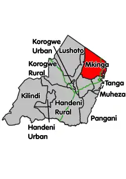 Location within Tanga Region (red) | |
| Country | |
| Zone | Northern |
| Region | Tanga |
| Incorporated District | 1 July 2007 |
| Capital | Parungu Kasera |
| Government | |
| • District Commissioner | Colonel Maulidi Surumbu |
| Area | |
| • Total | 2,711.93 km2 (1,047.08 sq mi) |
| Population (2012) | |
| • Total | 118,065 |
| • Density | 44/km2 (110/sq mi) |
| Time zone | UTC+3 (EAT) |
| Postcode | 215xx |
| Area code(s) | 027 |
| Website | www |
According to the 2012 Tanzania National Census, the population of Mkinga District was 118,065.[2]
Administrative subdivisions
Wards
As of 2012, Mkinga District is administratively divided into 22 wards:[2]
- Boma
- Bosha
- Bwiti
- Daluni
- Doda
- Duga
- Gombero
- Kigongoi Magharibi
- Kigongoi Mashariki
- Kwale
- Manza
- Mapatano
- Maramba
- Mayomboni
- Mhinduro
- Mkinga
- Mnyenzani
- Moa
- Mtimbwani
- Mwakijembe
- Parungu Kasera
- Sigaya
References
- "Main Page". Mkinga District Council. Retrieved 8 August 2019.
- "2012 Population and Housing Census" (PDF). Development Partners Group Tanzania. Retrieved 7 August 2019.
- "Tanga Region Roads Network" (PDF). Tanroads. Retrieved 8 August 2019.
This article is issued from Wikipedia. The text is licensed under Creative Commons - Attribution - Sharealike. Additional terms may apply for the media files.