Mexico City Metro Line 8
Mexico City Metro Line 8 is one of the twelve metro lines operating in Mexico City, Mexico. Its distinctive color is green.
| Line 8 / Línea 8 | |
|---|---|
 | |
| Overview | |
| Locale | Mexico City |
| Termini | Garibaldi / Lagunilla Constitución de 1917 |
| Connecting lines |
|
| Stations | 19 |
| Service | |
| Type | Rapid transit |
| System | Mexico City Metro |
| Operator(s) | Sistema de Transporte Colectivo (STC) |
| Rolling stock | Trains NM-79, MP-82 |
| Ridership | 366,084 passengers per day (2019)[1] |
| History | |
| Opened | 20 July 1994[2] |
| Technical | |
| Line length | 17.679 km (11 mi) |
| Track length | 20.078 km (12 mi) |
| Track gauge | 1,435 mm (4 ft 8+1⁄2 in) standard gauge with roll ways along track |
| Electrification | Guide bars |
Opened in 1994, it was the tenth line to be built (despite its name being Line 8). With a length of 20.078 kilometers and 19 stations, Line 8 runs through Mexico City from downtown to the southeastern municipality of Iztapalapa.
History
.jpg.webp)
Line 8 construction started in 1991 and finished in 1994.[3] It was inaugurated on 20 July 1994 by President of Mexico Carlos Salinas de Gortari in its entire stretch going from Garibaldi to Constitución de 1917. The next day, Salinas de Gortari drove the first train.[4]
In 2018, the Sistema de Transporte Colectivo presented its plan projected to 2030, where an expansion of Line 8 was announced. This would extend the line northbound to La Raza, where it would connect with Lines 3 and 5; and southbound to Santa Marta, where it would connect with Line A. The project states that seven new stations would be built: three northwards and four southwards, with a total of 10.21 km for a total track length of 27.89 km.[5]
Rolling stock
Line 8 has had different types of rolling stock throughout the years.
Currently, out of the 390 trains in the Mexico City Metro network, 30 are in service in Line 8.[6]
Station list
| Denotes a partially accessible station | |
| Denotes a fully accessible station | |
| Denotes a metro transfer | |
| Denotes a connection with the Cablebús system | |
| Denotes a connection with the Centro de transferencia modal (CETRAM) system | |
| Denotes a connection with the Ecobici system | |
| Denotes a connection with the Metrobús system | |
| Denotes a connection with the public bus system | |
| Denotes a connection with the Red de Transporte de Pasajeros (RTP) system | |
| Denotes a connection with the Trolleybus system |
| No. | Station | Date opened | Level | Distance (km) | Connection | Location | |
|---|---|---|---|---|---|---|---|
| Between stations |
Total | ||||||
| 01 | Garibaldi / Lagunilla |
July 20, 1994 | Underground trench |
- | 0.0 |
|
Cuauhtémoc |
| 02 | Bellas Artes |
0.8 | 0.8 |
| |||
| 03 | San Juan de Letrán | 0.6 | 1.4 |
| |||
| 04 | Salto del Agua |
0.4 | 1.8 |
| |||
| 05 | Doctores | 0.7 | 2.5 |
| |||
| 06 | Obrera | 0.9 | 3.4 |
| |||
| 07 | Chabacano |
1.3 | 4.7 |
| |||
| 08 | La Viga | 1.0 | 5.7 |
|
Venustiano Carranza | ||
| 09 | Santa Anita | 0.8 | 6.5 |
|
Iztacalco | ||
| 10 | Coyuya |
Grade-level, overground access | 1.1 | 7.6 |
| ||
| 11 | Iztacalco |
1.1 | 8.7 |
| |||
| 12 | Apatlaco | 1.1 | 9.8 |
|
Iztapalapa | ||
| 13 | Aculco | 0.7 | 10.5 |
| |||
| 14 | Escuadrón 201 | Underground trench |
0.9 | 11.4 |
| ||
| 15 | Atlalilco |
1.9 | 13.3 |
| |||
| 16 | Iztapalapa | 0.9 | 14.2 |
| |||
| 17 | Cerro de la Estrella | 0.9 | 15.1 |
| |||
| 18 | UAM-I | 1.3 | 16.4 |
| |||
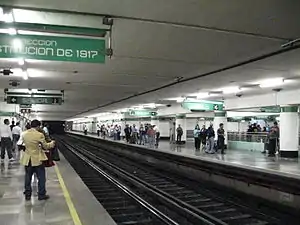
| 19 | Constitución de 1917 |
Grade-level, overground access | 1.3 | 17.7 |
| ||
Renamed stations
| Date | Old name | New name |
|---|---|---|
| 1995 | La Purísima | UAM-I |
| 2009 | Garibaldi | Garibaldi / Lagunilla |
Ridership
The following table shows each of Line 8 stations total and average daily ridership during 2019.[1]
| † | Transfer station |
| ‡ | Terminal |
| †‡ | Transfer station and terminal |
| Rank | Station | Total ridership | Average daily |
|---|---|---|---|
| 1 | Constitución de 1917‡ | 32,255,313 | 88,371 |
| 2 | San Juan de Letrán | 9,962,243 | 27,294 |
| 3 | UAM-I | 9,203,724 | 25,216 |
| 4 | Coyuya | 8,501,595 | 23,292 |
| 5 | Escuadrón 201 | 8,047,639 | 22,048 |
| 6 | Iztacalco | 8,002,058 | 21,923 |
| 7 | Bellas Artes† | 7,718,079 | 21,145 |
| 8 | Garibaldi / Lagunilla†‡ | 6,304,770 | 17,273 |
| 9 | Atlalilco† | 5,611,383 | 15,374 |
| 10 | Salto del Agua† | 5,454,216 | 14,943 |
| 11 | Apatlaco | 5,100,848 | 13,975 |
| 12 | Doctores | 4,502,133 | 12,335 |
| 13 | Obrera | 4,452,999 | 12,200 |
| 14 | Iztapalapa | 4,140,807 | 11,345 |
| 15 | Cerro de la Estrella | 4,074,999 | 11,164 |
| 16 | Aculco | 3,524,731 | 9,657 |
| 17 | La Viga | 2,805,291 | 7,686 |
| 18 | Santa Anita† | 2,402,874 | 6,583 |
| 19 | Chabacano† | 1,554,977 | 4,260 |
| Total | 133,620,679 | 366,084 | |
Tourism
Line 8 passes near several places of interest:
- Plaza Garibaldi, a square known as Mexico City's home of mariachi music where mariachi bands can be found playing or soliciting gigs from visitors.
- Palacio de Bellas Artes, Palace of Fine Arts, cultural center.
- Historic center of Mexico City
- Torre Latinoamericana, a skyscraper in downtown Mexico City with an observation deck.
Notes
- The following list was adapted from different websites and official maps.
- Metro (
_version_2019.svg.png.webp) ) connections obtained from the official Mexico City Metro system map.[7]
) connections obtained from the official Mexico City Metro system map.[7] - Accessibility obtained from the Mexico City Metro system map. In some cases, the map omits the accessibility icon as the station(s) are actually partially accessible. However, the respective websites of each station on the official site indicate the respective accessibility methods. Stations with the symbol
 ‡ are fully accessible; stations with the symbol
  † are partially accessible.[7]
 - Cablebús (
_Cableb%C3%BAs_de_la_CDMX.svg.png.webp) ) obtained from their official website.[8]
) obtained from their official website.[8] - Centro de transferencia modal (CETRAM;
_%C3%93rgano_Regulador_de_Transporte_(CETRAM).svg.png.webp) ) obtained from the official website of the Órgano Regulador de Transporte.[9]
) obtained from the official website of the Órgano Regulador de Transporte.[9] - Ecobici (
_EcoBici.svg.png.webp) ) obtained from their official website.[10]
) obtained from their official website.[10] - Metrobús (
_Metrob%C3%BAs_de_la_CDMX.svg.png.webp) ) obtained from the Mexico City Metrobús system map.[11]
) obtained from the Mexico City Metrobús system map.[11] - Public buses network (peseros) (
_Red_de_Autobuses_de_la_CDMX.svg.png.webp) ) obtained from the official website of the Órgano Regulador de Transporte.[12]
) obtained from the official website of the Órgano Regulador de Transporte.[12] - Red de Transporte de Pasajeros (
_Red_de_Transporte_de_Pasajeros.svg.png.webp) ) obtained from their official website.[13]
) obtained from their official website.[13] - Trolleybuses (
_Servicio_de_Transportes_El%C3%A9ctricos_de_la_CDMX.svg.png.webp) ) obtained from their official website.[8]
) obtained from their official website.[8]
- Metro (
See also
References
- "Afluencia de estación por línea 2019" (in Spanish). Metro CDMX. Retrieved 27 April 2020.
- "Línea 8" (in Spanish). Metro CDMX. Retrieved 27 April 2020.
- Connolly, Priscilla. "Evaluación económico financiera del Metro de la ciudad de México 1988-1994" (PDF) (in Spanish). p. 127. Retrieved 10 November 2020.
- "Los Presidentes que impulsaron el Metro". El Universal (in Spanish). 2 September 2019. Retrieved 27 April 2020.
- Sistema de Transporte Colectivo. "Plan Maestro del Metro 2018–2030" (PDF) (in Spanish). p. 49. Retrieved 27 April 2020.
- "Parque vehicular". Metro CDMX. Retrieved 27 April 2020.
- "Mi Mapa Metro 22032021" [My Metro Map 22032021] (PDF) (in Spanish). Sistema Transporte Colectivo Metro. 22 March 2021. Retrieved 30 October 2021.
- "Servicios" [Services] (in Spanish). Servicio de Transportes Eléctricos. Retrieved 30 October 2021.
- "Centros de Transferencia Modal (CETRAM)" [Modal Transfer Centers] (in Spanish). Órgano Regulador de Transporte. Retrieved 30 October 2021.
- "Mapa de disponibilidad" [Disponibility map] (in Spanish). Ecobici. Retrieved 30 October 2021.
- "Mapa del sistema" [System map] (in Spanish). Mexico City Metrobús. Retrieved 30 October 2021.
- "Red de corredores" [Route network] (in Spanish). Retrieved 30 October 2021.
- "Red de Rutas" [Routes network] (in Spanish). Red de Transporte de Pasajeros. Retrieved 30 October 2021.
| Line 1 | |
|---|---|
| Line 2 | |
| Line 3 |
|
| Line 4 | |
| Line 5 | |
| Line 6 | |
| Line 7 | |
| Line 8 | |
| Line 9 | |
| Line A | |
| Line B | |
| Line 12 | |
| Others |
|
|---|---|
| Former | |