List of urban areas in the Nordic countries
This is a list of urban areas in the Nordic countries by population. The population is measured on a national level, independently by each country's statistical bureau. Statistics Sweden uses the term tätort (urban settlement), Statistics Finland also uses tätort in Swedish and taajama in Finnish, Statistics Denmark uses byområde (city), while Statistics Norway uses tettsted (urban settlement).
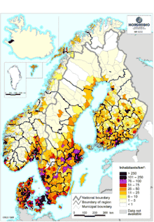
A uniform statistical definition between the Nordic countries was agreed upon in 1960,[1] which defines an urban area as a continuous built-up area whose population is at least 200 inhabitants and where the maximum distance between residences is 200 metres; discounting roads, parking spaces, parks, sports grounds and cemeteries – without regard to the ward, municipal or county boundaries.[1][2] Despite the uniform definition, the various statistical bureaus have different approaches in conducting these measurements, resulting in slight variation between the countries.[lower-alpha 1]
Despite belonging to the Nordic countries, Iceland does not follow the same definition of "urban area" for statistical purposes. The Nordic definition is unique to the four other countries, and should not be confused with the international concepts of metropolitan area or urban areas in general. In 2010, Finland changed its definition (stat.fi). This means that according to official statistics, the land area covered by urban areas is three times larger in Finland than in Norway though the total urban population is roughly the same (ssb.no). It also means that while the population of Danish “byområder” is usually less than half of the population of the “functional urban area” defined by Eurostat, the population of a Finnish “tätort” is usually around 80% of the respective “functional urban area” defined by Eurostat. In 2013, the “functional urban area” of Aarhus thus had a population of 845,971 while the “functional urban area” of Tampere had a population of 364,992. According to official statistics, however, the “tätort” Tampere is larger than the “byområde” Aarhus (eurostat.ec). This suggests that direct comparison between Finland and the other Nordic countries may be problematic.
List
| Rank | City / urban settlement | Urban area | Metropolitan / Eurostat Functional Urban Area | Notes | Image |
|---|---|---|---|---|---|
| 1 | 1,611,776 | 2,417,124[3][4] | Capital of Sweden. Municipality: 978,770. | 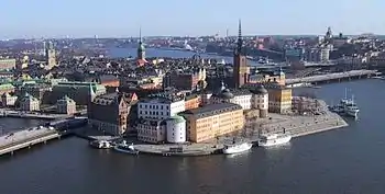 | |
| 2 | 1,320,629[5] | 2,059,453[6] (see notes) | Capital of Denmark. Municipality: 623,404 (2019). | 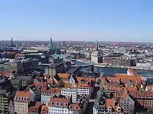 | |
| 3 | 1,305,893[7] | 1,671,000[4] | Capital of Finland. Municipality: 658,864. |  | |
| 4 | 1,036,059[8] | 1,588,457[9][10] 1,278,827 (Eurostat, 2013, latest available)[4] | Capital of Norway. Municipality: 697 028. The Greater Oslo Region (metropolitan) area has a population of 1,546,706. |  | |
| 5 | 582 508 | 1 048 389 [4] | Municipality: 582 508. |  | |
| 6 | 339,313 | 707,120[3]
Eurostat: 658,050, 2017.[4] |
Municipality: 328,494. | 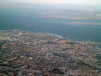 | |
| 7 | 334,112[11] | 440,372 [4] Eurostat: 369,525.[4] |
Municipality: 217,767. Most populous inland city in the Nordic countries. | 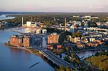 | |
| 8 | 273,077[12] | 845,971[4] | Municipality: 340,421.[13] | 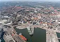 | |
| 9 | 272,230[11] | 315,751[14] | Municipality: 180,546. |  | |
| 10 | 259,958[8] | 420,000395,338 (2013, Eurostat) [4] | Municipality: 285 911. Metropolitan area: 377,116. |  | |
| 11 |
228,231[lower-alpha 2][15] |
Capital of Iceland. Municipality: 128,793. | 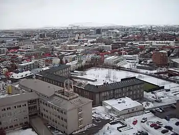 | ||
| 12 | 228,287[8] | 319,822 [4] |
Municipality: 144 223. Metropolitan area: 297,569.
Conurbation includes the neighbouring municipalities Sandnes, Randaberg and Sola. |
 | |
| 13 | 200,400[11] | 258,241 [4] | Municipality: 191,237 |  | |
| 14 | 189,271[8] | 264,396 [4] | Municipality: 208 281. Metropolitan area: 274,958. |  | |
| 15 | 178,210[16] | 485,672 [4] | Municipality: 213,558 |  | |
| 16 | 168,096 | 253,704[17] 288,203 [4] | Municipality: 225,164 | 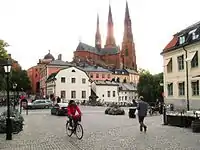 | |
| 17 | 134,672[16] | 580,272 [4] | Includes Nørresundby; Municipality: 205,809 | 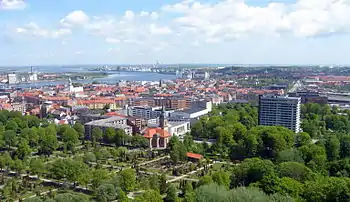 | |
| 18 | 143,420[11] | 212,500[4] | Municipality: 140,812 | 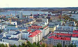 | |
| 19 | 119,068[11] | 191,460 [4] | Municipality: 103,187 | 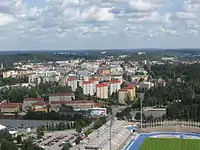 | |
| 20 | 116,373[18] | Fredrikstad: 83 220 Sarpsborg: 57 483 |
 | ||
| 21 | 110,877 | 173,322[17] 195,675 [4] | Municipality: 137,207 |  | |
| 22 | 109,416[8] | Includes parts of Øvre Eiker, Lier and Røyken. |  | ||
| 23 | 107,038 | 208,241[17] | Municipality: 135,460 |  | |
| 24 | 104,232 | 177,308[17] | Municipality: 146,416 |  | |
| 25 | 97,122 | 272,873[17] | Municipality: 129,177 |  | |
| 26 | 92,753[18] | Includes Porsgrunn and Skien and a part of Bamble. |  | ||
| 27 | 89,396 | Municipality: 127,382 |  | ||
| 28 | 88,520[11] | 167,753[17] | Municipality: 105,229 |  | |
| 29 | 87,247 | 183,100[17] | Municipality: 130,050 |  | |
| 30 | 84,190[11] | Municipality: 83,473 |  | ||
| 31 | 82,800 | Municipality: 110,488 |  | ||
| 32 | 79,594 | Municipality: 115,473 |  | ||
| 33 | 72,398 | Municipality: 116,032 |  | ||
| 34 | 71,033 | 184,346[17] | Municipality: 95,055 |  | |
| 35 | 67,811[11] | Municipality: 74,457 |  | ||
| 36 | 67,690[11] | Municipality: 66,401 |  | ||
| 37 | 66,273 | Municipality: 103,294 |  | ||
| 38 | 64,679 | 209,028[17] | Municipality: 96,311 |  | |
| 39 | 64,619 | - | Municipality: 86,246
No independent area, part of Greater Stockholm[17] |
 | |
| 40 | 62,687 | Municipality: 98,265 |  | ||
| 41 | 61,685 | 179,486[17] | Municipality: 85,753 |  | |
| 42 | 112 725 | Municipality: 88,320 |  | ||
| 43 | 60,887 | 156.629[17] | Municipality: 83,005 |  | |
| 44 | 61,272 | - | Municipality: 63,789
No independent area, part of Greater Stockholm |
_2009.jpg.webp) | |
| 45 | 60,508 | Municipality: 92,515 |  | ||
| 46 | 58,577 | 134,156[17] | Municipality: 91,800 |  | |
| 47 | 56,567 | Municipality: 114,140 |  | ||
| 48 | 55,884 | Municipality: 85,662 |  | ||
| 49 | 55,743[11] | Municipality: 72,748 |  | ||
| 50 | 52,753[11] | Municipality: 61,166 |  | ||
| 51 | 51,704[11] | Municipality: 54,845 |  | ||
| 52 | 50,712 | 125,812[17] | Municipality: 96,977 |  |
Note that the population numbers from the countries are from different years, as Statistics Finland, Statistics Norway and Statistics Denmark release the statistic yearly (albeit at different times of the year), Statistics Sweden only release the figures every five years. The Norwegian data is from 2013[18] and 2018,[8] the Danish data is from 2014,[19] the Swedish is from 2010[20] and the Finnish is from 2017.[11]
Also note that some of the statistics have been updated since the first note was made, so some statistics may be from 2018, while others from 2013, etc.
See also
- Urban areas in the Nordic countries
- List of the most populated municipalities in the Nordic countries
- List of metropolitan areas in Sweden
- List of urban areas in Sweden by population
- List of urban areas in Denmark by population
- List of urban areas in Norway by population
- List of urban areas in Finland by population
- List of cities in Iceland
- List of cities in the Baltic states
- List of metropolitan areas by population
Notes
- For example, Statistics Finland utilizes a 62,500 square metres (673,000 sq ft) grid system for analyzing population, resulting in slight measurement differences between it and the other Nordic statistical bureaus.
- Iceland does not adhere to the common Nordic definition for an urban area, so this figure is inaccurate for comparative purposes.
References
- "Nationalencyklopedin - Tätort". Nationalencyklopedin. Retrieved 21 July 2014.
Translation: 'a for the Nordic countries shared statistical definition of built-up area with at least 200 residents, not more than 200 m between each other (without regard to the ward, municipal or county boundaries)'
- "Localities 2010: Population, age and gender" (PDF) (in Swedish and English). Statistics Sweden. Retrieved 21 July 2014.
A densely built area includes any cluster of buildings with at least 200 inhabitants, unless the distance between the houses exceeds 200 metres. However, the distance may exceed 200 metres if the cluster of buildings is situated within the area of influence of a larger locality. [...] Even if the distance between buildings exceeds 200 metres, the locality should not be divided if the area between the buildings is used for public purposes such as roads, parking spaces, parks, sports grounds and cemeteries. The same applies to undeveloped areas such as storage sites, railways and docks.page=21
- "Folkmängden efter region, civilstånd, ålder och kön. År 1968 - 201" (in Swedish). Statistikmyndigheten SCB. Retrieved 22 December 2017.
- http://appsso.eurostat.ec.europa.eu/nui/show.do?dataset=urb_lpop1&lang=en
- "BY1: Population 1. January by urban, rural areas, age and sex". statbank.dk.
- "Statistikbanken". www.statbank.dk. Retrieved 2020-01-09.
- Statistikcentralen, Finland; Tätorter efter folkmängd och folktäthet, 2019 Retrieved 27 november 2020.
- Population and land area in urban settlements, December 2018
- regionaldepartementet, Kommunal- og (2003-05-09). "St.meld. nr. 31 (2002-2003)". Regjeringen.no (in Norwegian). Retrieved 2017-12-22.
- "Folketalet ved nyttår var 5 258 000". ssb.no (in Norwegian Nynorsk). Retrieved 2017-12-22.
- "Urban settlements by population and population density, 31 Dec 2017". Archived from the original on 18 July 2018. Retrieved 11 February 2018.
- "Statistikbanken". www.statbank.dk.
- "Statistikbanken". www.statistikbanken.dk.
- "Seutukuntien ennakkoväkiluku alueittain, elokuu 2013". Tiedote (in Finnish). Statistics Finland (Tilastokeskus). 31 August 2013. Archived from the original on 27 June 2013. Retrieved 2 October 2013.
- "Population by municipalities, sex and age 1 January 1998-2019 - Current municipalities". www.hagstofa.is. Statistics Iceland. 1 January 2019. Retrieved 26 July 2019.
- "Population 1. January by urban, rural areas (DISCONTINUED) - StatBank Denmark - data and statistics". www.statistikbanken.dk.
- "table". www.statistikdatabasen.scb.se. Retrieved 2017-12-22.
- Citypopulation Norway Archived 2012-11-20 at the Wayback Machine
- "Denmark: Regions, Municipalities, Cities and Urban Areas - Population Statistics in Maps and Charts". www.citypopulation.de. Archived from the original on 2012-04-08. Retrieved 2011-09-30.
- "Sweden: Counties, Cities, Municipalities, Settlements and Metropolitan Areas - Population Statistics in Maps and Charts". www.citypopulation.de.
| ||||||||||||||||||||||||||||||||||||||||||||||||||||||||||||||||||||||||||||||||||||||||||||||||