Matador, Texas
Matador is a town in and the county seat of Motley County, Texas, United States.[5] Its population was 607 at the 2010 census. In 1891, it was established by and named for the Matador Ranch. It is located 95 miles east of Lubbock, Texas.
Matador, Texas | |
|---|---|
.jpg.webp) | |
 Location of Matador, Texas | |
 | |
| Coordinates: 34°0′50″N 100°49′18″W | |
| Country | United States |
| State | Texas |
| County | Motley |
| Area | |
| • Total | 1.30 sq mi (3.38 km2) |
| • Land | 1.30 sq mi (3.38 km2) |
| • Water | 0.00 sq mi (0.00 km2) |
| Elevation | 2,382 ft (726 m) |
| Population (2010) | |
| • Total | 607 |
| • Estimate (2019)[2] | 611 |
| • Density | 468.56/sq mi (180.89/km2) |
| Time zone | UTC-6 (Central (CST)) |
| • Summer (DST) | UTC-5 (CDT) |
| ZIP code | 79244 |
| Area code(s) | 806 |
| FIPS code | 48-47004[3] |
| GNIS feature ID | 1362272[4] |
History
The Matador Ranch was consolidated in 1882 by a Scottish syndicate, and a post office opened at Matador in 1886.
At the end of the 19th century, townspeople freed the community from domination by the Matador Ranch, which was liquidated in 1951, by relocating nonranch families there and electing their own slate of officials.
The community was incorporated in 1912 and made the county seat. The state required that a town have at least 20 businesses. Local ranch hands hence established fraudulent, temporary businesses using ranch supplies. The only real business in Matador at the time was a saloon.[6]
Geography
Matador is located at 34°0′50″N 100°49′18″W (34.013996, –100.821646).[7]
According to the United States Census Bureau, the town has a total area of 1.3 square miles (3.4 km2), all of it land.
Matador is at the junction on conjoined US Route 62, U.S. Route 70, and State Highway 70.
Demographics
| Historical population | |||
|---|---|---|---|
| Census | Pop. | %± | |
| 1920 | 692 | — | |
| 1930 | 1,302 | 88.2% | |
| 1940 | 1,376 | 5.7% | |
| 1950 | 1,335 | −3.0% | |
| 1960 | 1,217 | −8.8% | |
| 1970 | 1,091 | −10.4% | |
| 1980 | 1,052 | −3.6% | |
| 1990 | 790 | −24.9% | |
| 2000 | 740 | −6.3% | |
| 2010 | 607 | −18.0% | |
| 2019 (est.) | 611 | [2] | 0.7% |
| U.S. Decennial Census[8] | |||
As of the census[3] of 2000, 740 people, 308 households, and 222 families resided in the town. The population density was 569.5 people/sq mi (219.8/km2). The 395 housing units averaged 304.0/sq mi (117.3/km2). The racial makeup of the town was 83.92% White, 5.68% African American, 1.22% Native American, 0.27% Asian, 0.27% Pacific Islander, 6.76% from other races, and 1.89% from two or more races. Hispanics or Latinos of any race were 13.24% of the population.
Of the 308 households, 30.8% had children under 18 living with them, 58.1% were married couples living together, 11.0% had a female householder with no husband present, and 27.9% were not families; 25.6% of all households were made up of individuals, and 15.3% had someone living alone who was 65 or older. The average household size was 2.40 and the average family size was 2.88.
In the town, the population was distributed as 26.2% under 18, 6.6% from 18 to 24, 21.2% from 25 to 44, 25.0% from 45 to 64, and 20.9% who were 65 years of age or older. The median age was 43 years. For every 100 females, there were 97.3 males. For every 100 females age 18 and over, there were 88.3 males.
The median income for a household in the town was $27,778, and for a family was $32,054. Males had a median income of $26,042 versus $12,639 for females. The per capita income for the town was $17,001. About 16.3% of families and 19.7% of the population were below the poverty line, including 35.4% of those under age 18 and 16.9% of those age 65 or over.
Education
The Town of Matador is served by the Motley County Independent School District and home to the Motley County High School Matadors.
Notable people
- Karen Elliott House, Pulitzer Prize-winning journalist and former executive at Dow Jones International
- Stanley Rose, famous Hollywood bookseller of the 1930s, was born in Matador
Climate
According to the Köppen climate classification, Matador has a semiarid climate, BSk on climate maps.[9]
References
- "2019 U.S. Gazetteer Files". United States Census Bureau. Retrieved August 7, 2020.
- "Population and Housing Unit Estimates". United States Census Bureau. May 24, 2020. Retrieved May 27, 2020.
- "U.S. Census website". United States Census Bureau. Retrieved 2008-01-31.
- "US Board on Geographic Names". United States Geological Survey. 2007-10-25. Retrieved 2008-01-31.
- "Find a County". National Association of Counties. Retrieved 2011-06-07.
- David Jouris, All Over The Map,
- "US Gazetteer files: 2010, 2000, and 1990". United States Census Bureau. 2011-02-12. Retrieved 2011-04-23.
- "Census of Population and Housing". Census.gov. Retrieved June 4, 2015.
- "Matador, Texas Köppen Climate Classification (Weatherbase)". Weatherbase. Retrieved 18 March 2016.
External links
- Motley County ISD – Go Mighty Mats!
- Matador, Texas from the Handbook of Texas Online
- Matador and Motley County
- Matador Ranch Records, Southwest Collection/Special Collections Library, Texas Tech University
Municipalities and communities of Motley County, Texas, United States | ||
|---|---|---|
| Towns | 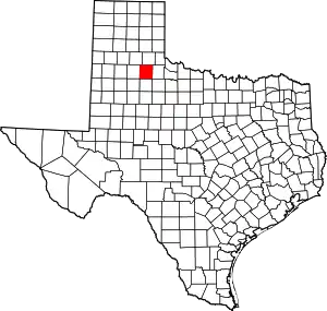 Motley County map | |
| Unincorporated community | ||
| Ghost towns | ||
| ||