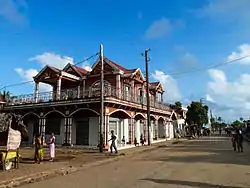
Mananjary
Mananjary is a city located in Vatovavy, Madagascar with a population of 25,222 inhabitants in 2018. It is the chief city of the Mananjary district.
Mananjary | |
|---|---|
 Mananjary | |
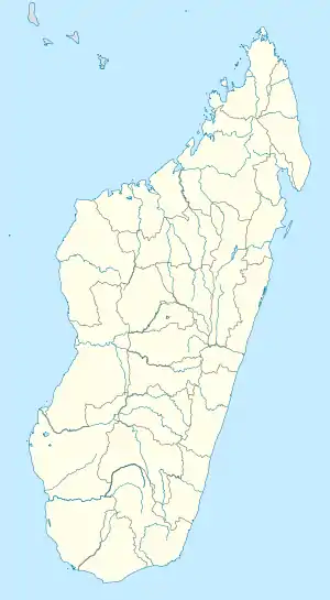 Mananjary Location in Madagascar | |
| Coordinates: 20°14′S 48°21′E | |
| Country | |
| Region | Vatovavy |
| District | Mananjary |
| Elevation | 12 m (39 ft) |
| Population (2018) | |
| • Total | 25,222 |
| Time zone | UTC3 (EAT) |
| Code postal | 317 |
It contains a town of the same name, situated on the southern part of the east coast, where the Mananjary River flows into the Indian Ocean.[2] There's a small port and an airport.
Mananjary is situated at 130 km south of Nosy Varika on the RN 11[3] The Canal des Pangalanes divides the town into two sections.
In 2022 Cyclone Batsirai made landfall at Mananjary, leaving the city destroyed by 90%.[4]
Religion
It is the seat of the Roman Catholic Diocese of Mananjary.
The small Antambahoaka tribe holds a ceremonial mass circumcision rite every seven years in the village, called "Sambatra."[6]
Education
- École primaire française de Mananjary[7]
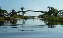
An inoperative bridge on Canal des Pangalanes in Mananjary in 2013, which was damaged by a typhoon. Underneath the bridge, a makeshift bamboo bridge was built, which is removed for passing ships upon payment of a fee.
References
- Estimated based on DEM data from Shuttle Radar Topography Mission
- www.britannica.com
- Atlas Mondial, France Loisir, page 158
- l'Express de Madagascar
- Madagascar & Comoros, pp. 230-31 (Lonely Planet, 2008)
- Bradt, Hilary. Madagascar: The Bradt Travel Guide, p. 298 (2007)
- "École primaire française de Mananjary." AEFE. Retrieved on May 7, 2015.
| Wikimedia Commons has media related to Mananjary. |
Capital: Mananjary | |
| Ifanadiana (14) -312 | |
| Mananjary (25) - 317 |
|
| Nosy Varika (19) - 319 |
|
3 districts; 58 communes | |
This article is issued from Wikipedia. The text is licensed under Creative Commons - Attribution - Sharealike. Additional terms may apply for the media files.