Méry-la-Bataille
Méry-la-Bataille (French pronunciation: [meʁi la bataj]) is a commune in the Oise department in northern France.
Méry-la-Bataille | |
|---|---|
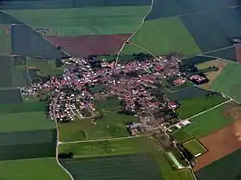 An aerial view of Méry-la-Bataille | |
Location of Méry-la-Bataille  | |
 Méry-la-Bataille  Méry-la-Bataille | |
| Coordinates: 49°32′47″N 2°37′48″E | |
| Country | France |
| Region | Hauts-de-France |
| Department | Oise |
| Arrondissement | Clermont |
| Canton | Estrées-Saint-Denis |
| Intercommunality | Plateau Picard |
| Government | |
| • Mayor (2020–2026) | Isabelle Da Silva-Graczyk[1] |
| Area 1 | 11.26 km2 (4.35 sq mi) |
| Population | 631 |
| • Density | 56/km2 (150/sq mi) |
| Time zone | UTC+01:00 (CET) |
| • Summer (DST) | UTC+02:00 (CEST) |
| INSEE/Postal code | 60396 /60420 |
| Elevation | 72–129 m (236–423 ft) (avg. 134 m or 440 ft) |
| 1 French Land Register data, which excludes lakes, ponds, glaciers > 1 km2 (0.386 sq mi or 247 acres) and river estuaries. | |
History
Méry took the name of Méry-la-Bataille in 1932. The name of Méry is in the statue of the general Mangin which take place at the church St François-Xavier (Place of Président Mithouard at Paris).)
See also
References
- "Répertoire national des élus: les maires". data.gouv.fr, Plateforme ouverte des données publiques françaises (in French). 2 December 2020. Retrieved 7 December 2020.
- "Populations légales 2019". The National Institute of Statistics and Economic Studies. 29 December 2021.
| Wikimedia Commons has media related to Méry-la-Bataille. |
This article is issued from Wikipedia. The text is licensed under Creative Commons - Attribution - Sharealike. Additional terms may apply for the media files.